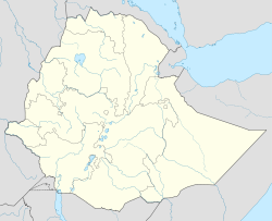
- Debre Zeyit, Benishangul Gumuz
-
Debre Zeyit Location within Ethiopia Coordinates: 10°35′N 35°48′E / 10.583°N 35.8°ECoordinates: 10°35′N 35°48′E / 10.583°N 35.8°E Country Ethiopia Region Benishangul-Gumuz Zone Metekel Zone Elevation 2,097 m (6,880 ft) Population (2005) – Total 4,179 Time zone EAT (UTC+3) Debre Zeyit (also known as Wenbera) is a town in western Ethiopia. Located in the Metekel Zone of the Benishangul-Gumuz Region, Debre Zeit has a latitude and longitude of 10°35′N 35°48′E / 10.583°N 35.8°E with an elevation of 2097 meters above sea level.
The town was visited in 1900 by the American traveller Oscar T. Crosby, who mentions the presence of a market and an Ethiopian military outpost.[1] Crosby knew the settlement as Wenbera, as did the consul R E Cheesman, who stayed there for a few days in April 1927. He described the settlement as "a large village of a few hundred houses and is important chiefly for its market and as a centre for caravan traffic. One set of merchants plies between there and Roseires in the Sudan, and another goes to the Abyssinian main plateau; both carry the famous coffee grown at Kitar in Wanbera district. We had reached an altitude where the Amhara can live, but the population is strongly Galla."[2]
Demographics
Based on figures from the Central Statistical Agency in 2005, Debre Zeyit has an estimated total population of 4,179 of whom 1,936 were males and 2,243 were females.[3] According to the 1994 national census, its total population was 2,429 of whom 1,120 were males and 1,309 were females. It is the largest settlement in Wenbera woreda.
Notes
- ^ Oscar T. Crosby, "Notes on a Journey from Zeila to Khartum", Geographical Journal, 18 (1901), pp. 46-61
- ^ "Local History in Ethiopia" (pdf) The Nordic Africa Institute website (accessed 7 December 2007)
- ^ CSA 2005 National Statistics, Table B.3
Categories:- Populated places in the Benishangul-Gumuz Region
- Ethiopia geography stubs
Wikimedia Foundation. 2010.

