- Magyarcsanád
-
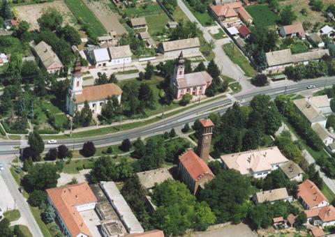
Magyarcsanád The main street of Magyarcsanád on an aerial photo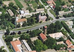
Coat of armsLocation of Magyarcsanád in Hungary
 Magyarcsanád
Coordinates: 46°10′01″N 20°37′01″E / 46.167°N 20.617°E Country Hungary Region Southern Great Plain County Csongrád Subregion Makói Rank Village KSH code 05962[1] Area[1] – Total 48.19 km2 (18.6 sq mi) Population (1 January 2008)[1] – Total 1,538 – Density 31.9/km2 (82.7/sq mi) Time zone CET (UTC+1) – Summer (DST) CEST (UTC+2) Postal code 6932 Area code +36 62 Website www.magyarcsanad.hu Magyarcsanád (Romanian: Cenadul Unguresc; Serbian: Чaнaд / Čanad) a multi-ethnical village located in Csongrád (county), southeast Hungary near the Mureş River (Hungarian: Maros). The Maros is a border-river here between northern Hungary and southern Romania.
The population is mainly Hungarian, but many Romanians, Serbians and Roma people are also living here. Magyarcsanád has four churches: a Romanian Orthodox, a Serbian Orthodox, a Calvinist and a Roman Catholic.
The village has an own outskirt called Bökény directly near the Maros. Here is a tumulus (Hungarian: kunhalom) in which archeological artefacts were found.
Magyarcsanád has a partner-settlement Comloşu Mare (Hungarian: Nagykomlós) in Timiş County (Hungarian: Temes).
An old stone-cross was erected near Magyarcsanád in the Middle Ages. The cross still stands. There is a small isle called in Hungarian "Senki szigete" (in English: Nobody's Isle) some kilometers eastward from Magyarcsanád on the border river Mureş. The isle is inhabitated by Phalacrocoracidae (Phalacrocorax carbo).
References
- ^ a b c Magyarcsanád at the Hungarian Central Statistical Office (Hungarian). 1 January 2008
External links
- Vendégváró (Hungarian)
- (Térképcentrum, Hungarian, with map)
- Gyalogló (Hungarian)
- Hungarian Central Statistical Office about Magyarcsanád (English)
- Csongrád County Government about Magyarcsanád (Hungarian)
- (satellite map, in the centre-right in Google Map)
County seat: SzegedCities and towns Csanádpalota · Csongrád · Hódmezővásárhely · Kistelek · Makó · Mindszent · Mórahalom · Sándorfalva · Szentes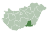
Villages Algyő · Ambrózfalva · Apátfalva · Árpádhalom · Ásotthalom · Baks · Balástya · Bordány · Csanádalberti · Csanytelek · Csengele · Derekegyház · Deszk · Domaszék · Dóc · Eperjes · Fábiánsebestyén · Felgyő · Ferencszállás · Forráskút · Földeák · Királyhegyes · Kiszombor · Klárafalva · Kövegy · Kübekháza · Magyarcsanád · Maroslele · Mártély · Nagyér · Nagylak · Nagymágocs · Nagytőke · Óföldeák · Ópusztaszer · Öttömös · Pitvaros · Pusztamérges · Pusztaszer · Röszke · Ruzsa · Szatymaz · Szegvár · Székkutas · Tiszasziget · Tömörkény · Újszentiván · Üllés · Zákányszék · ZsombóOther topics History · Geography · Government · Economy · Culture · TourismCategories:- Populated places in Csongrád county


Wikimedia Foundation. 2010.