- Anti-Atlas
-
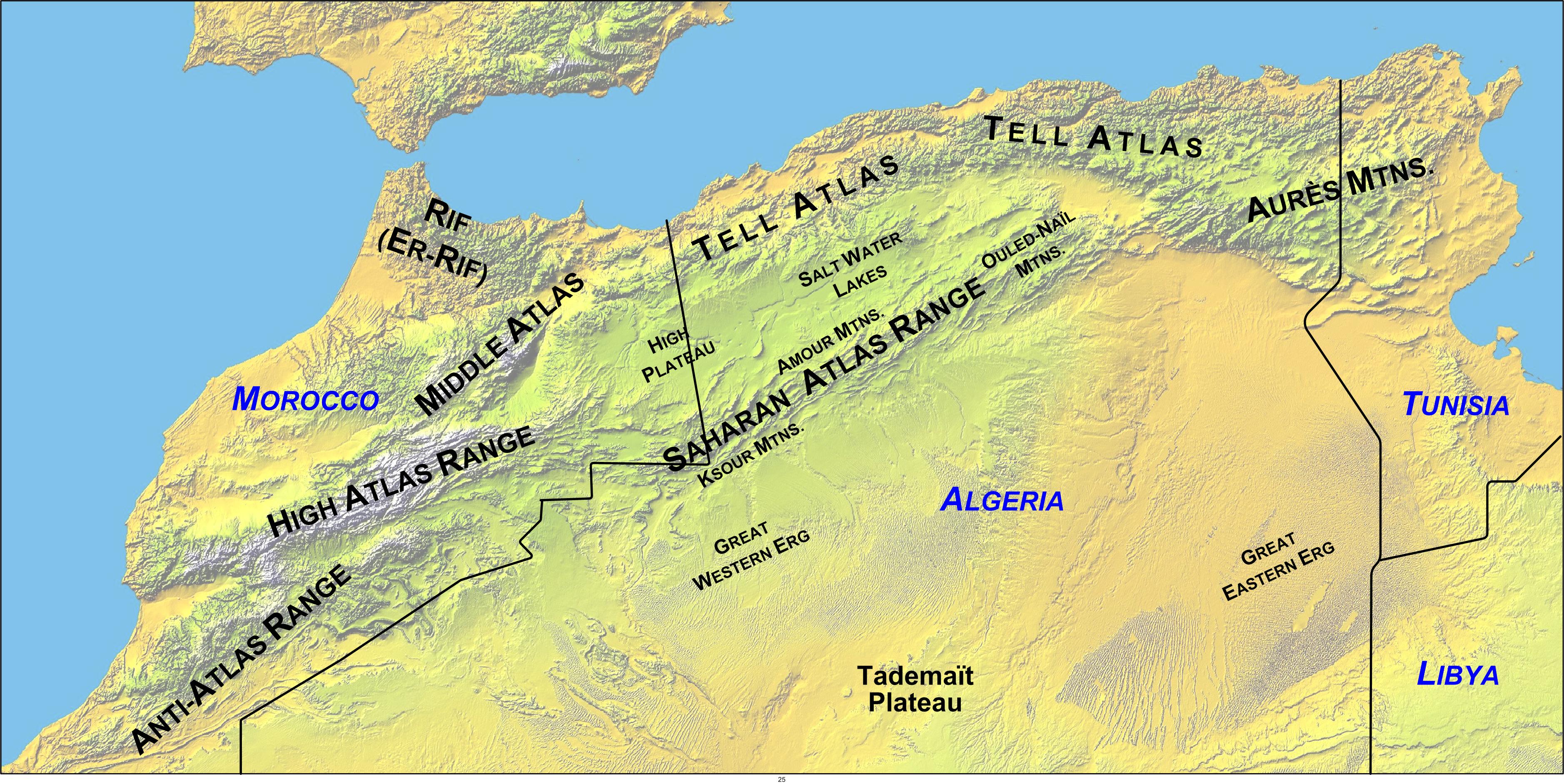
 Map with Anti-Atlas Mountains (lower left) in North Africa.
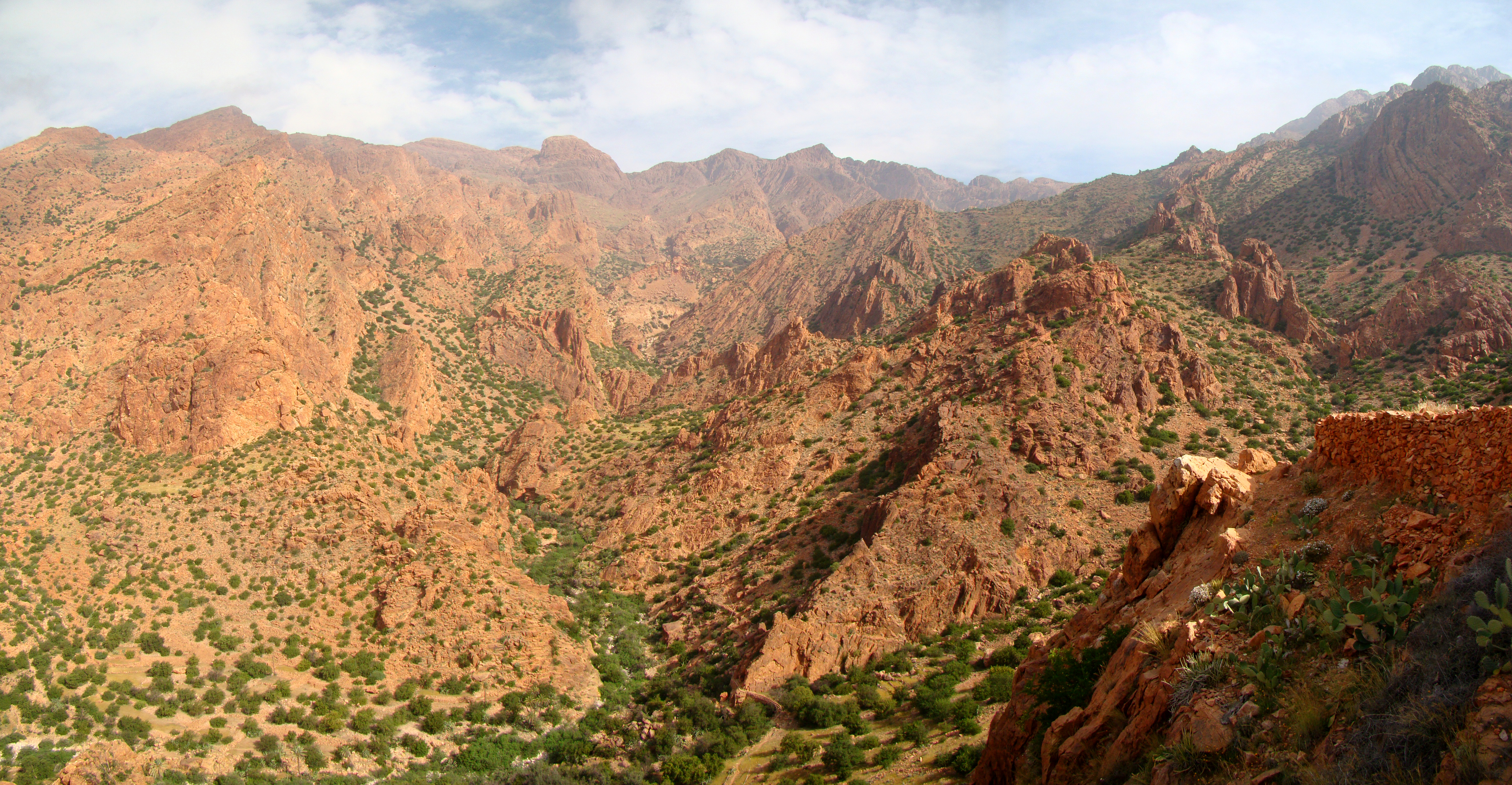
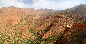 A section of the Anti-Atlas near Tafraout. The peak in the back here is Djebel el Kest.
The Anti-Atlas (Arabic: الأطلس الصغير) or Lesser Atlas or Little Atlas, is a mountain range in Morocco, a part of the Atlas mountains in the northwest of Africa.[1] The Anti-Atlas extends from the Atlantic Ocean in the southwest toward the northeast, to the heights of Ouarzazate and further east to the city of Tafilalt, altogether a distance of approximately 500 km. The range borders on the Sahara to the south.[1]
The easternmost point of the Anti-Atlas is the Djebel Sarhro mountains, and its eastern boundary is set by sections of the High Atlas range. On the heights of Ouarzazate, the massif is cut through by the Draa valley, opening towards the south. In this world of rocks, the contrasts are extreme. Most of the land is dry and barren, but water gathers and runs in some remote places, forming clear basins. Most villages are limited to a few small houses surrounded by palm trees.
Contents
In some contexts,[1] the Anti-Atlas are considered separate from the Atlas mountains, as the term "anti" implies.Creation of the Anti-Atlas Range
The base rock of Africa (the African plate) was formed in the Precambrian (approximately 4,500 to 550 million years ago), and is much older than the Atlas mountains. The Anti-Atlas range developed even later.
The Anti-Atlas range formed in the Paleozoic (~300 million years ago), as a result of continental collisions. North America, Europe and Africa were connected as part of two former continents, Euramerica and Gondwana, which ground against one another to create the former Central Pangean Mountains. Evidence shows that the Anti-Atlas mountains were originally formed as part of the Alleghenian orogeny that also formed the Appalachians, formed when Gondwana (including Africa) and Euramerica (America) collided. There are indications they were once a chain of mountains far higher than the Himalayas are today.
More recently, in the Tertiary period (65 millions to ~1.8 million years ago), the remaining mountain chains that today comprise the Atlas were uplifted as the land masses of Europe and Africa collided at the southern end of the Iberian peninsula. Erosion continued to reduce the Anti-Atlas range so that it is today less massive than the High Atlas range to the north.
Profile and climate
The summits of the Anti-Atlas reach average heights of 2,500-2,700 m (8200–8850 ft), with a few peaks reaching higher. To the north lies a plateau at 1700–1800 m in height. To the south lie the Sahara highlands at approximately 700 m. One peak, Djebel Siroua, of volcanic origin, reaches 3304 m. The range is strongly fissured, particularly in a southerly direction.
In the Anti-Atlas, the precipitation annually is typically below 200 mm, while the climatic conditions on the north and west slopes are locally more wet and agriculturally favorable. Climatically, the mountains are separated from the Mediterranean's influence by the High Atlas to its north, and therefore they belong to the Saharan climate zone.
Flora
In the least dry areas to the west and the north, much of the land is covered with thyme, rosemary and other low-water-demand plants, such as argan. The quilt-like cover is endangered by overgrazing, and in the south little but thorn shrubs remain. The transition to the desert is gradual towards the south.
Settlement and economics
Landscape
The landscape is marked by picturesque kasbah (small castles) in many places in the region. In former times, the kasbah was important as a place of shelter and as a supply depot for kinsmen. Close to these settlements, terraced fields with dry-stone retaining walls cover the landscape. However, increasingly houses are vacated and fields are left uncultivated. With the continued migration from the land, the irrigation systems necessary for agriculture are also decaying.
See also
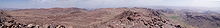 Panorama from Jebel Aklim
Notes
References
- "Anti-Atlas" (or Jebel Saghru), The Encyclopædia Britannica, 1910.
External links
Categories:- Atlas Mountains
- Mountain ranges of Morocco
Wikimedia Foundation. 2010.