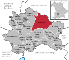
- Maisach
-
Maisach 
Coordinates 48°13′N 11°16′E / 48.21667°N 11.26667°ECoordinates: 48°13′N 11°16′E / 48.21667°N 11.26667°E Administration Country Germany State Bavaria Admin. region Upper Bavaria District Fürstenfeldbruck Local subdivisions 25 Ortsteile Mayor Gerhard Landgraf (FW Maisach) Basic statistics Area 53.45 km2 (20.64 sq mi) Elevation 514 m (1686 ft) Population 12,896 (31 December 2010)[1] - Density 241 /km2 (625 /sq mi) Other information Time zone CET/CEST (UTC+1/+2) Licence plate FFB Postal code 82216 Area codes 08141 / 08142 / 08135 Website www.maisach.de Maisach is a municipality in the district of Fürstenfeldbruck, in Bavaria, Germany. It is the largest municipality in the Fürstenfeldbruck district. It is situated 4 km north of Fürstenfeldbruck, and 25 km northwest of Munich. It is served by an S-Bahn station on the S3
 towards Mammendorf, which lies south of the town center. The tallest building in the town belongs to the eponymously-named local brewery and sports an aircraft warning beacon.
Contents
Geography
The community Maisach lies on the river Maisach.
History
The first documentary record of Maisach comes from the year 806. For the other districts excepting Gernlinden there are also records coming from the second half of the 8th and first half of the 9th century. Gernlinden is first recorded in 1436.
In 1818 the community was established. The settlement Gernlinden was built after the first world war. The current organisation of the districts was carried out in 1978.
Districts
(Districts in bold are primary districts or previously individual communities)
- Maisach (5.193 residents)
- Anzhofen (10 residents)
- Diepoltshofen (71 residents)
- Gernlinden (4.419 residents)
- Gernlinden-Ost (147 residents)
- Überacker (902 residents)
- Fußberg (14 residents)
- Fußbergmoos (23 residents)
- Loderhof (13 residents)
- Pöcklhof (12 residents)
- Thal (22 residents)
- Rottbach (268 residents)
- Deisenhofen (50 residents)
- Kuchenried (6 residents)
- Oberlappach (114 residents)
- Prack (25 residents)
- Unterlappach (17 residents)
- Weiherhaus (13 residents)
- Zötzelhofen (19 residents)
- Germerswang (783 residents)
- Frauenberg (123 residents)
- Stefansberg (124 residents)
- Malching (310 residents)
- Obermalching (19 residents)
- Galgen (22 residents)
Politics
The Gemeinderat in Maisach has 24 members:
CSU SPD Freie Wähler Maisach Die Grünen Einigkeit Gernlinden Bürgerforum Gesamtgemeinde Maisach Total 2002 10 6 3 1 3 1 24 Seats 2008 10 3 6 3 2 0 24 Seats (Status: Kommunalwahl on 2 March 2008 preliminary result)
On 1 May 2008 Hans Seidl (CSU) will take over the role of Bürgermeister
Adelshofen | Alling | Althegnenberg | Egenhofen | Eichenau | Emmering | Fürstenfeldbruck | Germering | Grafrath | Gröbenzell | Hattenhofen | Jesenwang | Kottgeisering | Landsberied | Maisach | Mammendorf | Mittelstetten | Moorenweis | Oberschweinbach | Olching | Puchheim | Schöngeising | Türkenfeld
References
- ^ "Fortschreibung des Bevölkerungsstandes" (in German). Bayerisches Landesamt für Statistik und Datenverarbeitung. 31 December 2010. https://www.statistikdaten.bayern.de/genesis/online?language=de&sequenz=tabelleErgebnis&selectionname=12411-009r&sachmerkmal=QUASTI&sachschluessel=SQUART04&startjahr=2010&endjahr=2010.
Categories:- Municipalities in Bavaria
- Fürstenfeldbruck district
- Upper Bavaria geography stubs
- Maisach (5.193 residents)
Wikimedia Foundation. 2010.


