- Nevada County Air Park
-
Nevada County Air Park
Nevada County Airport
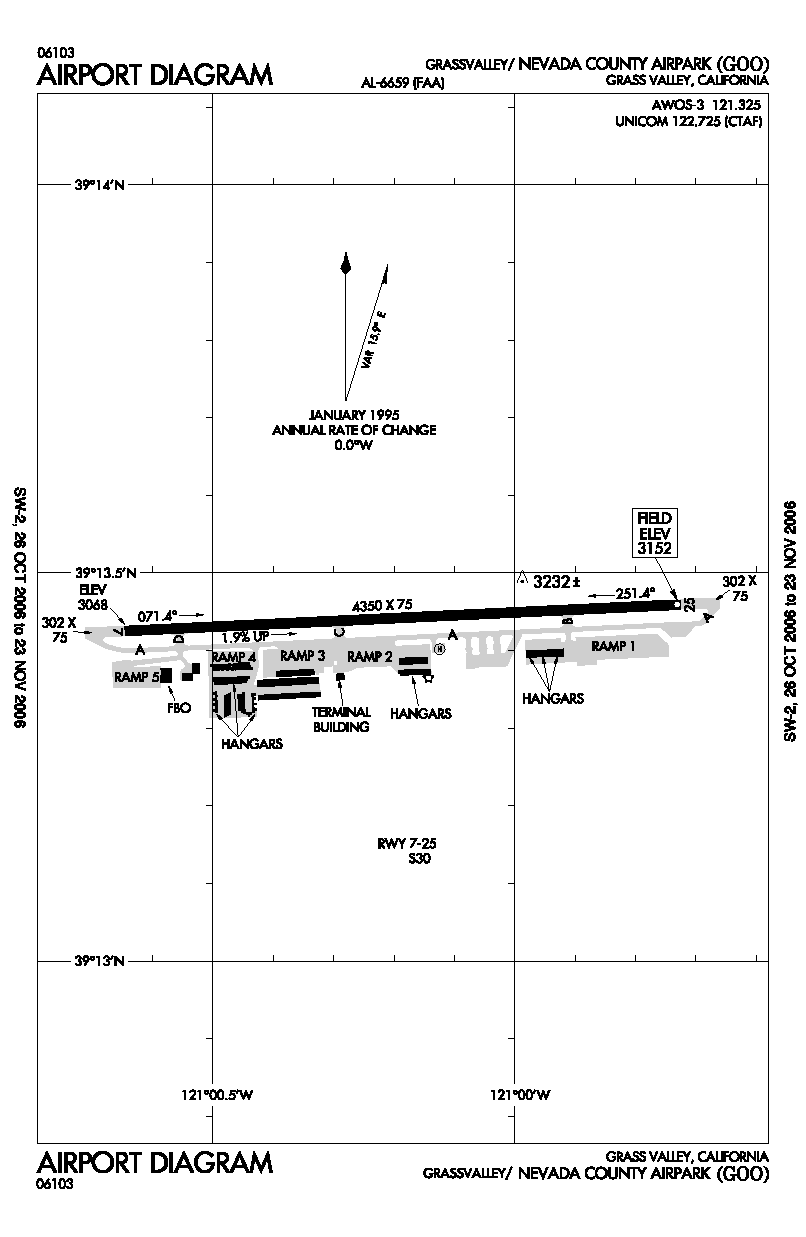
FAA airport diagram IATA: none – ICAO: KGOO – FAA LID: GOO Summary Airport type Public Owner Nevada County Location Grass Valley, California Elevation AMSL 3,152 ft / 961 m Coordinates 39°13′26″N 121°00′11″W / 39.22389°N 121.00306°W Website Runways Direction Length Surface ft m 7/25 4,350 1,326 Asphalt Statistics (2001) Aircraft operations 27,750 Based aircraft 142 Source: FAA[1] and airport website[2] Nevada County Air Park (ICAO: KGOO, FAA LID: GOO, formerly O17) is a county-owned public use airport in Nevada County, California, United States. The airport is located three nautical miles (6 km) east of the central business district of Grass Valley, California.[1] It is also known as Nevada County Airport.[2]
Although most U.S. airports use the same three-letter location identifier for the FAA and IATA, this airport is assigned GOO by the FAA but has no designation from the IATA[3] (which assigned GOO to an airport in Goondiwindi, Queensland, Australia[4]).
Facilities and aircraft
Nevada County Air Park covers an area of 117 acres (47 ha) at an elevation of 3,152 feet (961 m) above mean sea level. It has one asphalt paved runway designated 7/25 which measures 4,350 by 75 feet (1,326 x 23 m).[1]
For the 12-month period ending December 31, 2001, the airport had 27,750 aircraft operations, an average of 76 per day: 96% general aviation and 4% air taxi. At that time there were 142 aircraft based at this airport: 95% single-engine, 4% multi-engine and 1% helicopter.[1]
References
- ^ a b c d FAA Airport Master Record for GOO (Form 5010 PDF), effective 2009-07-02.
- ^ a b Nevada County Airport page at Nevada County website
- ^ Great Circle Mapper: KGOO - Grass Valley, California - Nevada County Air Park
- ^ Aviation Safety Network: GOO / YDGI - Goondiwindi Airport, QLD, Australia
External links
- Aerial photo as of 16 August 1998 from USGS The National Map
- FAA Airport Diagram (PDF), effective 20 October 2011
- FAA Terminal Procedures for GOO, effective 20 October 2011
- Resources for this airport:
- AirNav airport information for GOO
- FlightAware airport information and live flight tracker
- SkyVector aeronautical chart for GOO
Categories:- Airports in Nevada County, California
Wikimedia Foundation. 2010.