Needles (Black Hills)

Needles (Black Hills)
The Needles

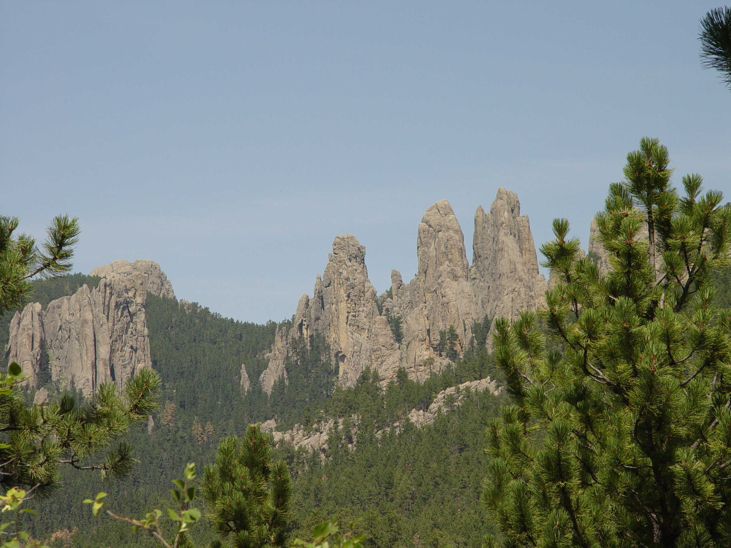
The Needles of the Black Hills of South Dakota are a region of fantastically eroded granite pillars, towers, and spires. Popular with rock climbers and tourists alike, the Needles are accessed from the Needles Highway, which is a part of Sylvan Lake Road (SD 87/89). The Cathedral Spires and Limber Pine Natural Area, a portion of the Needles containing six ridges of pillars as well as a disjunct stand of limber pine, was designated a National Natural Landmark in 1976.

The Needles were the original site proposed for the Mount Rushmore carvings. The location was rejected by the sculptor Gutzon Borglum owing to the poor quality of the granite and the fact that they were too thin to support the sculptures. The Needles attracts approximately 300,000 people annually.

Coordinates: 43°50′13″N 103°32′58″W / 43.83690°N 103.54940°W / 43.83690; -103.54940


Wikimedia Foundation. 2010.

Игры ⚽ Нужна курсовая?

Look at other dictionaries:

  • Needles (Black Hills) — 43° 50′ 13″ N 103° 32′ 58″ W / 43.83690, 103.54940 …   Wikipédia en Français

  • Black Hills — This article is about the region in South Dakota. For other places, see Black Hills (disambiguation). The Black Hills, South Dakot …   Wikipedia

  • Black Hills Playhouse — The Black Hills Playhouse is an American theater located just off the Needles Highway and Iron Mountain Road in Custer State Park in the Black Hills of South Dakota. The playhouse is managed by Black Hills Playhouse Inc. It is one of the oldest… …   Wikipedia

  • Scenic roads in the Black Hills — The Black Hills of South Dakota and Wyoming feature many scenic highways, constructed from the 1920s on to provide routes of interest for tourists. Among these are:* Spearfish Canyon (US 14A) between Cheyenne Crossing, South Dakota and Spearfish …   Wikipedia

  • Needles Highway — Infobox protected area | name = Needles Highway caption = locator x = 111 locator y = 50 location = South Dakota, USA nearest city = Custer, SD lat degrees = 43 lat minutes = 49 lat seconds = 26 lat direction = N long degrees = 103 long minutes …   Wikipedia

  • Black Mesa (western Arizona) — The Black Mesa (western Arizona) of northwestern Arizona is the extreme southern section of the Black Mountains (Arizona).It is a notable mountain section, since the entire Warm Springs Wilderness comprises the entire mesa; it is separated to the …   Wikipedia

  • The Needles (disambiguation) — The Needles is the westernmost point of the Isle of Wight in the United Kingdom.The Needles can also refer to:* Needles, California, a city in the Mojave Desert, United States * Needles (Black Hills), granite pillars located in South Dakota,… …   Wikipedia

  • Black Mountains (Arizona) — Geobox|Range name=Black Mountains image size= image caption= country=United States state=Arizona geology=|orogeny= highest=Mount Wilson highest elevation imperial=5445 map caption=The Black Mountains of Arizona are located in northwest Arizona… …   Wikipedia

  • Needle — may refer to: Contents 1 Crafting 2 Botany 3 Geography 4 …   Wikipedia

  • Mount Rushmore — For the 1960s rock band, see Mount Rushmore (band). Mount Rushmore National Memorial IUCN Category V (Protected Landscape/Seascape) …   Wikipedia

Share the article and excerpts

Direct link
Do a right-click on the link above
and select “Copy Link”