- Mount Pugh
-
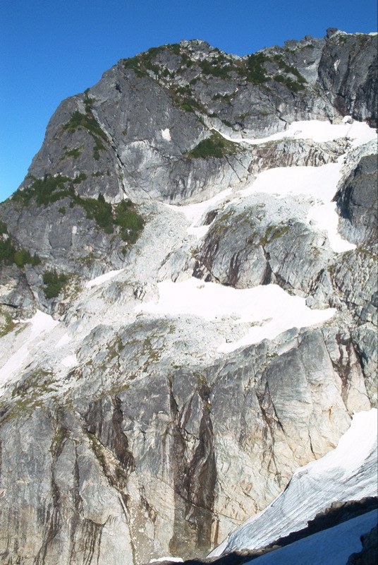
Mount Pugh 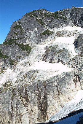
Elevation 7,201 ft (2,195 m) [1] Prominence 2,801 ft (854 m) [1] Location Location Snohomish County, Washington, USA Range Cascade Range Coordinates 48°08′35″N 121°22′28″W / 48.143144181°N 121.374459786°WCoordinates: 48°08′35″N 121°22′28″W / 48.143144181°N 121.374459786°W[2] Topo map USGS Pugh Mountain Climbing First ascent 1916 by Nels Bruseth Easiest route Scramble, class 2-3 Mount Pugh (or Pugh Mountain, or native name Da Klagwats) is a peak near the western edge of the North Cascades, in Washington state. It is located 12.2 miles (19.6 km) west of Glacier Peak, one of the Cascade stratovolcanoes. It rises out of the confluence of the White Chuck River (on the north) and the Sauk River (on the southwest), giving it very low footings. For example, it rises 6,150 feet (1,875 m) above the Sauk River Valley in just over 2 horizontal miles (3.2 km); its rise over the White Chuck River is almost as dramatic. The mountain is named for John Pugh, who settled nearby, in 1891.[3]
According to Fred Beckey, "Nels Bruseth apparently made the first ascent in 1916".[3] Earlier unrecorded ascents, including possibly much earlier Native American ascents, are possibilities, since the easiest ascent route is non-technical.
The trail to the summit easily negotiable most of the way but the last 1.5 miles (2.4 km) is along a razorback ridge with significant exposure.[4] This is the Northwest Ridge, Trail Number 644, which actually starts in the Sauk River Valley on the southwest side of the mountain. The total elevation gain is almost exactly one mile (5,280 ft/1,609 m).
References
- ^ a b "Mount Pugh, Washington". Peakbagger.com. http://www.peakbagger.com/peak.aspx?pid=1974. Retrieved 2008-12-04.
- ^ "Pugh Mtn Lookout House". NGS data sheet. U.S. National Geodetic Survey. http://www.ngs.noaa.gov/cgi-bin/ds_mark.prl?PidBox=TQ0510. Retrieved 2008-12-04.
- ^ a b Beckey, Fred W. (1996). Cascade Alpine Guide, Vol. 2, Stevens Pass to Rainy Pass (2rd ed.). Mountaineers Books. p. 88. ISBN 0-89886-152-7.
- ^ Romano, Craig (2008). Day hiking. North Cascades (1st ed.). Seattle: Mountaineers Books. p. 129. ISBN 1594850488.
External links
- "Mount Pugh". Geographic Names Information System, U.S. Geological Survey. http://geonames.usgs.gov/pls/gnispublic/f?p=gnispq:3:::NO::P3_FID:1528468. Retrieved 2008-12-04.
- Howbert, Jeff. "All Washington Peaks with 2000 Feet of Prominence". The Northwest Peakbaggers Asylum. http://howbert.netherweb.com/mountains/WA_all_2000P/WA_all_2000P_list_Psort.html. Retrieved 2008-12-04.
- "Mount Pugh". SummitPost.org. http://www.summitpost.org/page/150517. Retrieved 2008-12-04.
- "Mount Pugh Trail #644". Washington-Hiking-Advisor.com. http://www.washington-hiking-advisor.com/mount-pugh-644.html.
Categories:- Mountains of Washington (state)
- Landforms of Snohomish County, Washington
- Washington (state) geography stubs
Wikimedia Foundation. 2010.