- Boney Peak
-
Boney Peak 
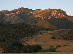
The peak viewed from the trail to the northeast.Elevation 2825+ feet (861+ m) NGVD 29[1] Listing Sierra Club Lower Peaks Committee list [2] Location Location Ventura County, California, USA Range Santa Monica Mountains Coordinates 34°06′59″N 118°56′26″W / 34.116281°N 118.940434°WCoordinates: 34°06′59″N 118°56′26″W / 34.116281°N 118.940434°W[3] Topo map USGS Triunfo Pass Boney Peak, also known as Mount Boney to local residents, is a peak on Boney Mountain in the Santa Monica Mountains National Recreation Area of the National Park Service.[4]
Boney Peak is one of the highest points in the Santa Monica Mountains of southern California.
See also
- Flora of California chaparral and woodlands
- Fauna of the California chaparral and woodlands
- Category: Santa Monica Mountains
External links
- Santa Monica Mountains National Recreation Area: Circle X Ranch trail website
- official Santa Monica Mountains National Recreation Area website
References
- ^ "Boney Peak". Peakbagger.com. http://www.peakbagger.com/peak.aspx?pid=13496. Retrieved 2009-12-17.
- ^ "Lower Peaks Committee List". Angeles Chapter, Sierra Club. http://angeles.sierraclub.org/lpc/lpclist.htm. Retrieved 2009-12-17.
- ^ "Boney Peak". Geographic Names Information System, U.S. Geological Survey. http://geonames.usgs.gov/pls/gnispublic/f?p=gnispq:3:::NO::P3_FID:2628241. Retrieved 2010-05-19.
- ^ "Circle X Ranch". Santa Monica Mountains National Recreation Area. National Park Service. http://www.nps.gov/samo/planyourvisit/upload/CircleX8-08.pdf. Retrieved 2008-12-17.
Categories:- Santa Monica Mountains
- Mountains of Ventura County, California
- Southern California geography stubs
Wikimedia Foundation. 2010.

