- MetVUW
-
MetVUW Weather and Climate service is a meteorological service provided by School of Geography, Geology and Earth Sciences, Victoria University of Wellington, Wellington, New Zealand. The site is run by James McGregor. Much of the weather content and forecast material is available directly from the website, free. A range of different weather information is available, as different pages, under the following headings.
 Marlborough Sounds January 2006
Contents
MetVUW Home
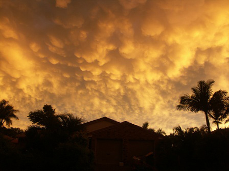
Featuring updates advice about the service, and 'picture of the week', sometimes 'picture of the month'. Many images of quirky and unusual weather related phenomena are to be found, especially clouds of the Mammatus variety.
Satellite Imagery
9 panels of monochrome satellite derived cloud pictures are shown, in 3 hour intervals, ending in current time slot. Images can be enlarged. Data provided by MetService, Image enhancement by MetVUW, MTSAT satellite data courtesy of Japanese Meteorological Agency.
Weather Radar
3 panels each showing 3 locations; Auckland, Wellington and Christchurch, at 3 hour intervals, ending in current time slot. Colour coding is derived from 'reflectivity' (DBz). Images can be enlarged. Data provided by MetService, Image enhancement by MetVUW.
 Mammatus Cloud Christmas Day 2005
Radiosondes (weather balloons) measuring upper air temperatures and winds are routinely launched from five stations around New Zealand. At Whenuapai, Paraparaumu and Invercargill they are launched at 1100 and 2300 NZT. At the Chatham Islands and Raoul Island they are launched daily at 1100 NZT. The upper air data are displayed on tephigrams.
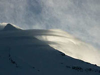 Mount Taranaki 2005
Forecast Charts
A large range of 3 and 7 day forecasts are available. 3 and 7 day thumbnails deliver 12 and 30 images, respectively, spaced at +6 hour intervals, beginning with the forecast time.
These weather forecast charts are generated by software written and maintained by James McGregor of Victoria University of Wellington. The data used is obtained from the United States National Weather Service. These charts are updated approximately every 6 hours and provide forecasts up to 180h ahead of the time they were issued.
Current NZ Weather
Selections are available for temperature, precipitation, pressure and wind. A national map is shown with data at each of many significant locations.
Ocean Weather
Data is available for each of 7 seas/oceans. 3 and 7 day thumbnails deliver 12 and 30 images, respectively, spaced at +6 hour intervals, beginning with the forecast time.
See also
- Victoria University of Wellington
- Meteorological Service of New Zealand Limited
- World Meteorological Organisation
External links
Categories:- Victoria University of Wellington
- Meteorological institutions affiliated with universities
- Wellington City


Wikimedia Foundation. 2010.