- Marias Pass
-
Marias Pass 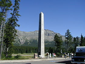
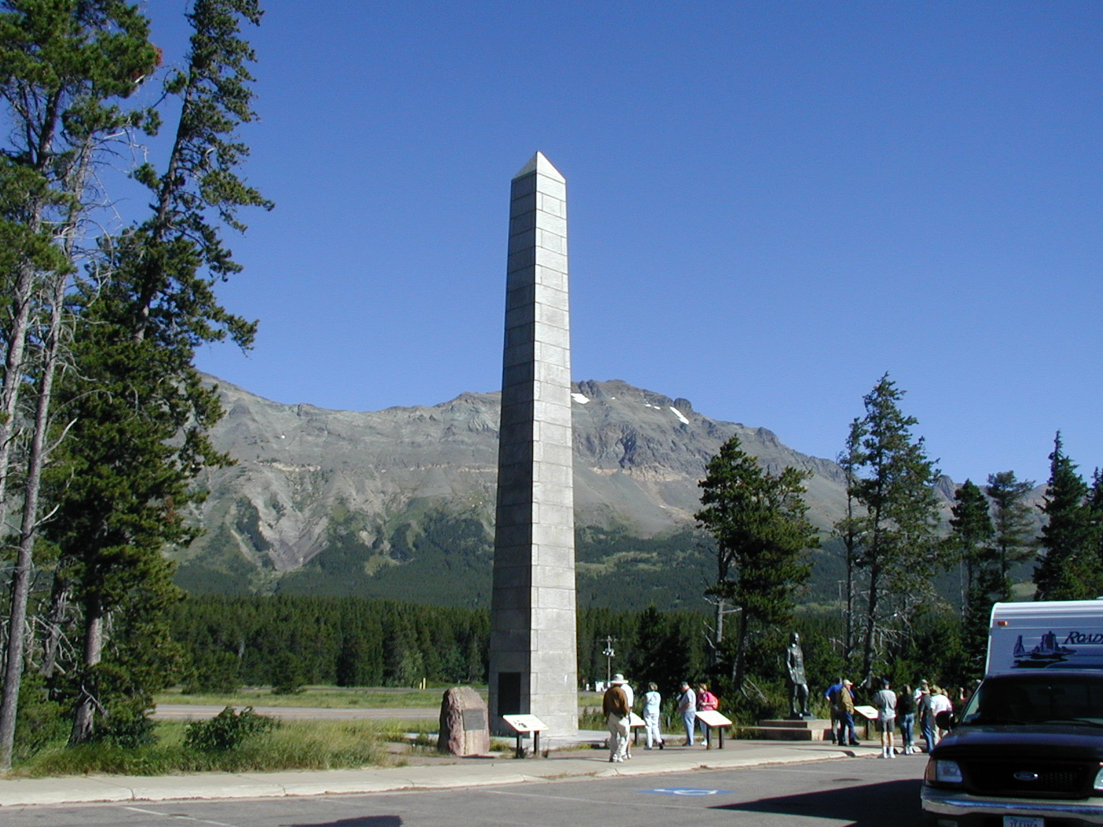
Marias Pass obelisk and statue of John F. Stevens. (The Obelisk was once located between the travel lanes of US 2)Elevation 5,213 ft (1,589 m) Traversed by U.S. Highway 2, BNSF Railway, and Amtrak Empire Builder Location Location Glacier County, Montana,  United States
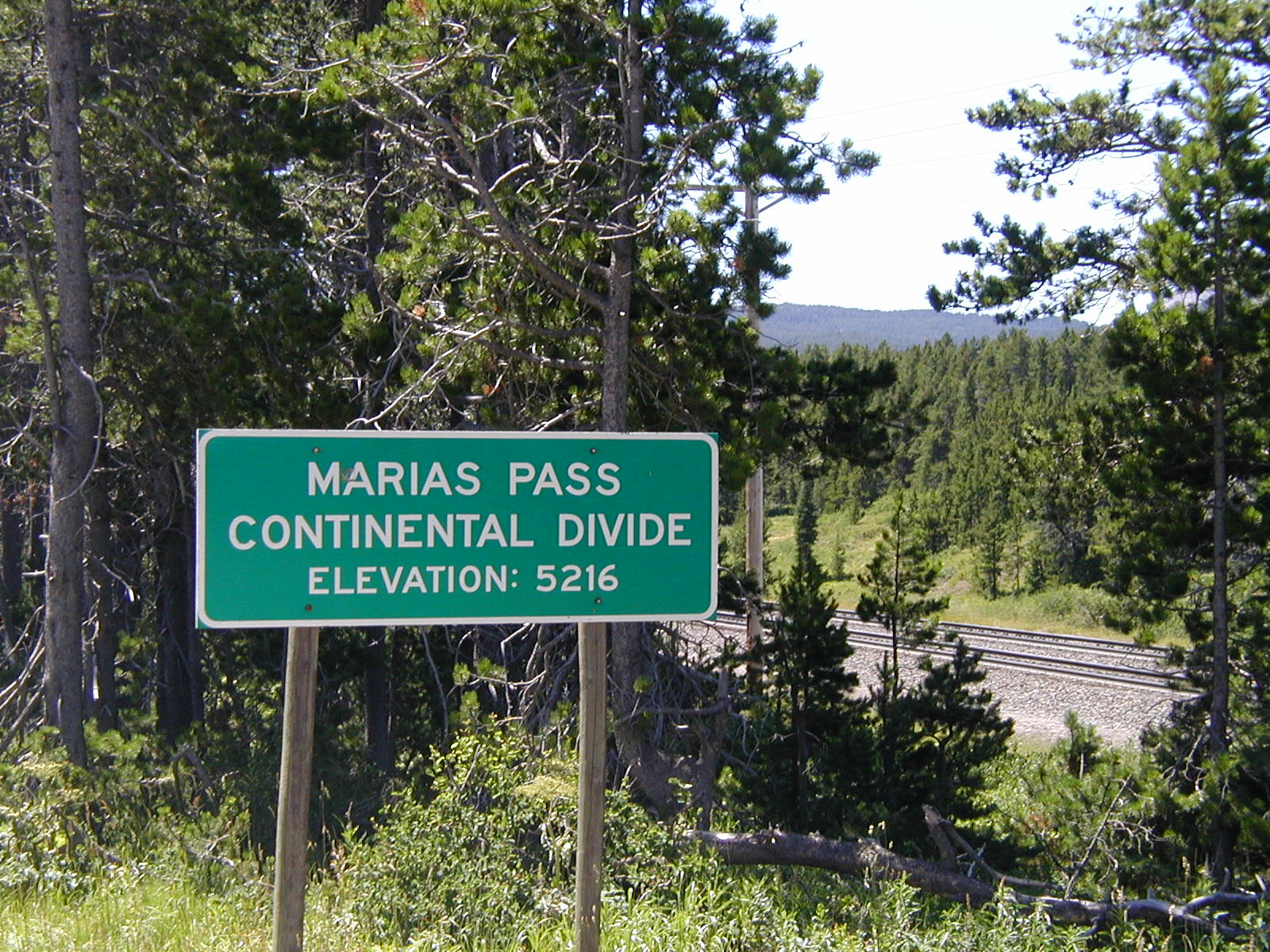
Range Lewis Range Coordinates 48°19′06″N 113°21′19″W / 48.31832123°N 113.35525513°W Marias Pass (el. 5213 ft./1589 m.) is a high mountain pass near Glacier National Park in northwestern Montana in the United States.
The pass traverses the continental divide in the Lewis Range, along the boundary between the Lewis and Clark National Forest and the Flathead National Forest. The pass forms the southern limit of the Continental Ranges, a major grouping of the Rocky Mountains which extends as far north as McGregor Pass in the Northern Rockies of the Canadian province of British Columbia. The Great Bear Wilderness in Lewis and Clark National Forest is south of the pass and Glacier National Park is to the north. During the winter, the pass is the only way to cross the continental divide in the United States north of Montana's Rogers Pass, because of the Bob Marshall Wilderness Complex (to be distinguished from British Columbia's Rogers Pass).
History
The pass was charted by John Frank Stevens, principal engineer of the Great Northern Railway, in December 1889. The location of the pass had been rumored for several years beforehand, but it took Stevens and a Blackfoot Indian guide named Coonsah to discover it. The pass proved ideal for a railroad, because its approach was broad and open, within a valley ranging from one to six miles wide, and at a gentle grade that would not require extensive excavation or rockwork. Construction of the railroad through the pass began on August 1, 1890, starting from Fort Assinniboine to Marias Pass. The railroad followed the Middle Fork of the Flathead River west of the continental divide.[1]
Today, U.S. Highway 2, the BNSF Railway, successor to the Great Northern, and Amtrak's Empire Builder passenger train use the pass. The railway line is still the principal BNSF northern transcontinental line. A statue of John Frank Stevens stands at the summit of Marias Pass.
The route forms part of the Microsoft Train Simulator game.[2] HP Trainz also made the Marias Pass route for Trainz 2006, 2007, & Classics.
-
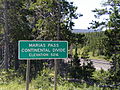
Marias Pass highway marker along US Route 2
Coordinates: 48°19′06″N 113°21′19″W / 48.31832123°N 113.35525513°W
See also
- Mountain passes in Montana
References
- ^ Guthrie, C.W., (2004), All Aboard for Glacier, Farcountry Press: Helena, MT, 1-56037-276-1
- ^ "Train Simulator". Microsoft Game Studios. 2008. http://www.microsoft.com/games/pc/trainsim.aspx.
Categories:- Landforms of Glacier County, Montana
- Rail mountain passes of the United States
- Mountain passes of Montana
- Rocky Mountains
- Great Northern Railway (U.S.)
-
Wikimedia Foundation. 2010.