- Astore District
Infobox Pakistan district
district = Astore District
area = 5,092
population = 71,666
pop_year = 1998
density =
caption = Map of the Northern Areas of Pakistan, showing the six districts and tehsil boundaries
region =Northern Areas (Pakistan)
established =
nazim = Mohammad Ramzan
naib_nazim =
seats =
tehsils = 2
languages = Shina
website = [http://www.myastore.com www.myastore.com]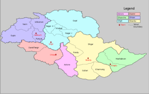
Astore is one of the six districts of the Northern Areas of
Pakistan . The district contains theAstore Valley and is bounded to the west byDiamer District (from which is was separated in 2004), to the north byGilgit District , to the east bySkardu District and to the south byNeelum District ofAzad Kashmir and theNorth-West Frontier Province . According to the 1998 census of Pakistan the population was 71,666. [1998 Census of Pakistan]The valley
The Astore vally is located at 35° 2'20.30"N , 75° 6'36.91"E and has an area of 5,092 km² and an altitude of 2600m.
Accessibility:
Astore is connected to Gilgit which is well connected by air with Islamabad(weather dependent) and by road with Islamabad/Rawalpindi, Skardu and Chitral. You can take a flight to Gilgit from the capital of the country and drive to Astore from Gilgit on metalled road.
History
According to the
Imperial Gazetteer of India , around 1600:Sub Divisions
*Bunji
*Choungrah
*Chilm
*Dashkin
*Douan
*Eidgah
*Fina
*Gorikot
*Gudai
*Guzair
*Minimarg
*Mirmalik
*Pakora
*Parishing
*Qamri
*Rahman Pur
*Rama
*Rattu
*Shodas
*Tarashing
*Zian
*Zilla Bala
*Nasir Abad (Qamri)
*Nasir Abad (Zilla Bala) Climate
Astore valley has a moderate climate during summer. In winter it can snow up to 6 inches (15 cm) in the main valleys and up to 2–3 feet (60–90 cm) in the mountains. In Mirmalik valley it snows up to 6 feet in February.
Languages
The main language spoken in the valley is Shina (also known as Tshina).
Urdu , which is the National language of Pakistan, is the second most frequently spoken language. Since Astore has a history of modest tourist traffic in the summer months, local guides and police in Tarashing or Astore may speak some English.Transport
There were some negative perceptions in past due to rough mode of transport but nowadays there are paved roads connecting
Gilgit andIslamabad through theKarakorum Highway . Landslides and rockfall may be an issue in some areas of the Indus Valley. There is a permanent road through Gilgit as well as seasonal road access viaDeosai Plateau toSkardu . Here you can obtain all types of vehicles (Jeeps, taxis, wagons, SUVs) and hire jeeps and SUVs at affordable prices. The most used vehicles are Jeeps and SUVs with a local preference for Pajeros and Landcruisers.Places of interest
Astore lies about the massive base of
Nanga Parbat , the 9th highest peak in the world. To the south of theNanga Parbat massif lies Rama Valley, which is home to Rama Lake, with basic facilities for visitors. It has a hotel called the PTDC, constructed by the government of Pakistan. Astore valley is a unique area for tourists to visit, surrounded by the high peaks of the far westernHimalaya . Nearby peaks includeNanga Parbat ,Shaigiri ,Rupal Peak ,Chongra Peak andLaila Peak (Rupal Valley) . Astore Valley ascends from theIndus River Valley nearJaglot ,Pakistan .ee also
*
Rupal Valley
*Tarashing
*Nanga Parbat References

Wikimedia Foundation. 2010.