- Mid Calder
-
Coordinates: 55°53′30″N 3°28′52″W / 55.8918°N 3.4810°W
Mid Calder Scots: Mid Cauder 
View of Mid Calder, West Lothian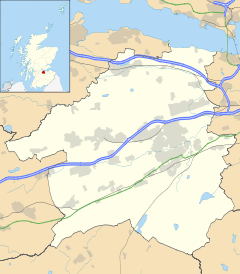
 Mid Calder
Mid Calder shown within West LothianPopulation 5,370 [1] Council area West Lothian Lieutenancy area West Lothian Country Scotland Sovereign state United Kingdom Post town Livingston Postcode district EH53 Dialling code 01506 Police Lothian and Borders Fire Lothian and Borders Ambulance Scottish EU Parliament Scotland UK Parliament Livingston Scottish Parliament Livingston List of places: UK • Scotland • Mid Calder (Scots: Mid Cauder) is a town in West Lothian, Scotland. It is located on a steep hill overlooking the River Almond and Calder Wood, around 15 miles (24 km) west of Edinburgh. The town has been on a major crossroads since its origin sometime in the eleventh century.
Contents
History
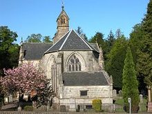
James Sandilands received the lands of Calder from his brother in law, William IV, Lord of Douglas, in the 14th century. During the Wars of Scottish Independence, Sir James de Sandilands distinguished himself in the wars against the English. For his services he was rewarded with a royal charter of his lands by David II of Scotland. James was well connected and married Eleanor, the only daughter of Sir Archibald Douglas, Regent of Scotland.[1] The gift included extensive estates in what is now West Lothian, and the Barony of Calder. After the Reformation in 1560, Sir James Sandilands, the head of the Sandilands family, was created Lord Torphichen. Since 1348 the family seat has been at Calder House,[2] near to the middle of the village.
For centuries a large part of the economy of the Scottish Highlands revolved around the breeding and trading of Highland cattle. They were moved along drove roads from all parts of the country, including some of the islands, to trysts or markets held in Crieff and Falkirk. Most of the cattle would then be driven south to feed consumers in England. Several of the drove routes used came together at Mid Calder. Huge herds of cattle would come across fords or bridges over the River Almond before crossing the Pentland Hills to West Linton. The peak year was 1840 when some 150,000 cattle passed through the area over the three months from August to October. This traffic helped support no fewer than nine public houses in the village.
Meanwhile, Mid Calder also lay on the main turnpike road from Edinburgh to Glasgow, adding a steady flow of east-west traffic to the seasonal influx of drovers heading south. However, the importance of the turnpike lessened at the same time as the cattle droving stopped, and for the same reason: the railways. And for once the acumen and foresight that had allowed the Sandilands to retain their position for so many centuries missed a beat. When the railway came to West Lothian in 1848, the then Lord Torphichen decreed that it should not come near Calder House.
As a result Mid Calder was served by a station at Kirknewton, three miles away. This meant that adapting to the loss of its traditional sources of income could have been difficult for the village. But at precisely the right moment the world's first oil boom occurred, in West Lothian. This was based on oil extracted from shale, and by 1870 over 3 million tons of shale were being mined each year in the area around Mid Calder. Output declined with the discovery of liquid oil reserves around the world in the early 1900s, but shale mining only finally ceased in 1962. The "bings" that characterise oil shale mining elsewhere in West Lothian have largely been flattened around Mid Calder and the land reclaimed for recreation, industry and housing.
Another major factor leading to Mid Calder's current prosperity has been the dramatic growth of nearby Livingston, now the second largest settlement in the Lothians and whose main shopping centre is only a mile to the west.
Mid Calder is also home to Lodge St John Mid Calder number 272 on the Roll of the Grand Lodge of Scotland. This Freemason lodge was formed on the 4th May 1818 (although Freemasonry was active in the area since at least the 1750s). Since 1936 the lodge has owned its own building at the entrance of the Calder Wood Country Park.
The outlying areas of Mid Calder were heavily built upon in the 1980s, and as a result, middle-class housing estates are a stone-throw away from both Calder House and woodlands.
In 2005, Mid Calder was subject to unwanted publicity when it became the first place in Britain to issue an ASBO in a village-wide crackdown on the anti-social behaviour of drunken teenagers.[3] The ASBO allowed police to disperse any young person found outdoors. After one month of operation, the order was deemed a success and to this day, Mid Calder remains one Central Scotland's most desirable village locations.
Famous Residents
- John Spottiswoode archbishop of St. Andrews
References
- ^ http://www.scotweb.co.uk/info/sandilands/
- ^ http://www.scottish-places.info/features/featurefirst8109.html
- ^ "The Year of the Asbo". The Daily Telegraph (London). 2005-12-18. http://www.telegraph.co.uk/news/uknews/1505729/The-Year-of-the-Asbo.html. Retrieved 2010-05-12.
External links
- Local History Link [2]
Categories:- Villages in West Lothian


Wikimedia Foundation. 2010.