- Bologa
Infobox Romania Villages
name=Bologa
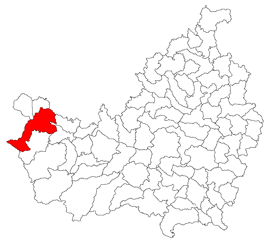
county=Cluj County
commune=Poieni
year=1304 ("Sebuswar")
area=
census=2002
population=687
density=
coordinates=coord|46|53|30.84|N|22|52|46.92|E|type:city
zip-code=407471
site-address=
site-language=
site-name=
notes=|Bologa (
Latin : "Resculum"; Hungarian: "Sebesvár") is a village in theCluj county ,Transylvania ,Romania .Geography
Location: coord|46|53|30.84|N|22|52|46.92|E|type:cityPostal code (zip): 407471
The village is situated at the confluence of the
Crişul Repede and Henţ (Sebeş or Săcuieu) rivers (the confluence is known as "gura apelor" - "the mouth of the waters" - in the local toponymy) and at the foot of the Vlădeasa mountains (1863 m), part of the Apuseni Carpathians. The closest town isHuedin .Transportation links: on the
European route E60 . Small railway stop ("haltă") for regional trains ("Personal") on theOradea -Cluj-Napoca main Romanian railroad. On the national road 128 which heads South towardsSăcuieu .Pre-history
4000 years old artefacts (stone axes) were found at the place called "Drumul găunos" ("Potholed Road").
Antique history
A Roman
castrum calledResculum is the oldest documented settlement in the area. It was built around 106 AD, as a garrison for the “II Cohortis Hispanorum” (seeDux ), whose mission was probably to defend theRoman Empire 's border. As the Romans tried to tighten their hold on the region during the 2nd century A.D., they brought in colonists to the village fromGreece , possibly fromPatras .The ruins of the castrum are still visible today in the place still called "Grădişte" which means "fortified settlement", although most of the area is cultivated. The ruins of a Roman bath also exist near the castrum.
Middle Ages
Overlooking the castrum, on the opposite bank of the Henţ (Sebeş) river, on top of a steep hill lies one of the first Hungarian fortresses in
Transylvania , which was mentioned for five centuries as Sebesvár, featuring on most Middle-Age maps of the region. Probably due to the fortress, the place was also known as Varalja ("under the fortress") or Sebesváralja. Bologa was first attested in 1304 as Sebuswar then as Sepuswar în 1324, Sebeswar -1329, Sebeswar alio nomine Hunyadwar - 1398, Castrum regis Sebes - 1393, Castrum regis Hunyad - 1397, Sebes Varallya - 1760.The Hungarian king,
Sigismund of Luxembourg after signing inBraşov an alliance treaty against the Turks in 1399 gave the fortresses of Bran and Bologa toWallachia 's princeMircea cel Bătrân .Built to watch the strategic road that went from
Oradea insideTransylvania , the fortress also served as a refuge for the local population throughout the centuries. It gained in importance when the Turks conqueredOradea in the 17th century as it was hindering the tax collection. The sultan ordered its demolition but the order was not carried out. The fortress was later destroyed by the Austrian soldiers through explosion. The tower and many walls are still standing. In the mid 20th century the tower lost its roof, probably the last wooden element of the ruins. All that remains is stone.Modern times
Probably it was after the Romanian unification (1918) that the current name (Bologa) was assigned. The etymology is not clear.
The Second Vienna Diktat in 1940 temporarily re-situated Bologa in
Hungary , right at the border (some teritorry on the hills nearby remained in Romania). This began yet another period of tensions between ethnicRomanians andHungarians which ended in 1945 with the restoration of the Romanian Western border.A stone
quarry was opened in 1930 providingdacite stone for theBudapest -Bucharest road. The quarry was later on taken over by the Romanian railways, most of whose embankments are made of stone from the area. After 1989 the quarry was privatised and did not do very well comparing to neighbouring quarries, so it stopped being the main source of income for the villagers. The upcoming highway projects in Romania are expected to improve the quarry prospects.Forestry is also active in the area, though more active in the neighbouring valley of Drăgan.Agriculture is widely practiced but the land size and quality in the hilly-montainous area only allows for the individual needs of the land owners.
The Potras
Most of today's village inhabitants (around 700) are ethnic
Romanians , probably descendants of the original Roman population and its indigenousDacian component. The language spoken is a variety of Romanian that includesLatin elements such as "ai" (fromLatin "alium", garlic) and "fărină" (fromLatin "farina", flour) which are not found outside the Carpathian basin, thus supporting the Romanian continuity theory.The majority of inhabitants have the surname Potra, which according to accounts is a link to the colonists from
Patras (the Potras/Patras variation exists in other Greek-related names too). Most of the Potras are said to have been shepherds, which probably allowed them not to becomeserfs to the dominant Hungarian nobility, thereby maintaining their relative prosperity and independence. The leading of the Potras were quite active in setting up thequarry as acooperative , leading to even more prosperity. However, such entrepreneurship was not something that the communist regime could tolerate so a number of Potras were sent to forced labour.Geography
It is part of Poieni commune and has a population of 687 people (2002).
References
*"Atlasul localităţilor judeţului Cluj" (Cluj County Localities Atlas), Suncart Publishing House, Cluj-Napoca 2003
External links
* [http://www.nada.kth.se/~ovidiu/maps/images/ort-tr.jpg"Transilvania" map] by Ortelius, 1570. Bologa/Sebesuar is just above and to the right from the OCCIDENS indicator at the middle left of the map. This map is a color copy of the oldest known map of Transsylvania (Honter, 1532)
* [http://www.madeintransylvania.rdsor.ro/Thomas%202003/MVC-134F.jpgThe fortress and the stone quarry today]
* [http://www.madeintransylvania.rdsor.ro/Thomas%202003/MVC-117F.jpgThe whirlpool] at Bologa'swatermill , a natural washing machine!
* [http://www.welcometoromania.ro/E60_Oradea_Cluj/E60_Oradea_Cluj_Bologa_e.htm The fortress of Bologa]
* [http://www.geocities.com/zoliren2/sebes/sebes.htm A description in Hungarian, featuring a coat of arms and early 20th century photography]
* [http://www.harta-turistica.ro/map.php?ID=21 Cluj County map]
* hu icon [http://sebok1.adatbank.transindex.ro/legbelso.php3?nev=Kolozs Administrative map of the county]
Wikimedia Foundation. 2010.