- New Waddell Dam
-
New Waddell Dam  Location of New Waddell Dam
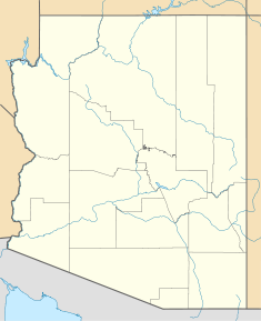

Country United States Location Maricopa County, Arizona Coordinates 33°50′49″N 112°15′58″W / 33.84694°N 112.26611°WCoordinates: 33°50′49″N 112°15′58″W / 33.84694°N 112.26611°W Status Operational Construction began 1985 Opening date 1994 Construction cost $625 million Owner(s) U.S. Bureau of Reclamation Dam and spillways Type of dam Embankment, zoned earth-fill Height (thalweg) 300 ft (91 m) Height (foundation) 440 ft (134 m) Length 4,700 ft (1,433 m) Crest width 35 ft (11 m) Base width 1,514 ft (461 m) Volume 16,200,000 cu yd (12,385,789 m3) Impounds Agua Fria River Spillways 2 Type of spillway Un-gated, free-flow, fuseplug embankment Spillway capacity 316,000 cu ft/s (8,948 m3/s) (combined; at elevation) Reservoir Creates Lake Pleasant Capacity 1,108,600 acre·ft (1.367437965×10⁹ m3) Catchment area 1,459 sq mi (3,779 km2) Surface area 12,040 acres (49 km2) Normal elevation 1,725 ft (526 m) (maximum) Power station Commission date 1994 Turbines 8 x Pump-generators Installed capacity 45 MW The New Waddell Dam is an embankment dam on the Agua Fria River in Maricopa County, Arizona, 35 mi (56 km) northwest of Phoenix. It serves as part of the Central Arizona Project (CAP) while also providing water for the Maricopa Water District. The dam creates Lake Pleasant with water from the Agua Fria and also the CAP aqueduct. In addition, it affords flood protection, hydroelectric power production and recreational opportunities. Construction on the dam began in 1985 and ended in 1994. Its reservoir submerged the Old Waddell Dam which had been completed in 1927 after decades of vision and planning.
Contents
History
Old Waddell Dam
 The Old Waddell Dam
First referred to as the Frogs Tank Dam, the original Waddell Dam was the ambition of local businessmen who wanted to develop a project that used the Agua Fria for the irrigation of around 100,000 acres (405 km2) of land. This was to be accomplished with a storage dam, diversion dam and system of canals. Their advancement of the project began in 1888 with the formation of the Agua Fria Water and Land Company. The company hired George Beardsley's Agua Fria Construction Company and in 1892, construction on the project began. In 1895, Breardsley died and his brother William who was now president of the Water and Land Company helped continue the project. In 1896, due to a lack funding caused by poor nationwide economic conditions, the project was halted. The Water and Land Company soon went bankrupt but William Beardsley would keep the project alive. Work had been primarily done on the diversion dam and canal while only the foundation of the storage dam, a gravity dam, was completed. The diversion dam, Camp Dyer Diversion Dam, was named after Edgar J. Dyer, a surveyor on the project.[1]
After nearly 30 years of struggling with funding and pursuing various deals, William Breadsly hired engineer Carl Pleasant to assist with designing. Pleasant recommended hiring the engineer firm Peckham and James to draft plans for the storage dam at the Frogs Tank site. The gravity dam design was dropped and a relatively new, cheaper and improved design at the time was adopted; the multiple-arch buttress dam. In 1925, under a new state law, Beardsley was able to create the Beardsley-Agua Fria Water Conservation District. Under the new district, funds could be raised through a bond issue. On December 20, 1925, the construction contract was signed but the bonds had yet to be purchased. Five days before the contract was signed, Beardsley died. His son, Robert took direction of the project along with Pleasant. In early 1926, Pleasant eventually sold the needed bonds to the New York firm Brandon, Gordon and Waddell. The firm sent Donald Ware Waddell to oversee construction. Although the initial implementation of worker camps and site preparation had begun in 1925, the main effort of construction began in 1926. In that same year, the dam was renamed to Pleasant Dam. By February 1927, concrete pouring for the 20 buttresses was nearing completion. The dam was complete in October 1927; employing a maximum of 600 workers and costing over $3 million. Prior to its inauguration, cracks were discovered in the dam's buttresses. This led to much controversy over whether the dam was safe or not which delayed its inauguration. The situation was exacerbated on 12 March 1928 after the St. Francis Dam in California had a catastrophic failure. In 1929, it was decided that the spillway for the dam be lowered 24 ft (7 m) to prevent excess water levels and stress on the dam. It was also required that specific water levels in the reservoir be maintained. The dam was rehabilitated until 1935 and a steel roadbed was installed atop it that same year. In the early 1960s, it was renamed the Waddell Dam.[1][2]
New Waddell Dam
 The New Waddell Dam in 1992 with Old Waddell Dam in background
In 1973, construction on the Central Arizona Project (CAP) began while many of its facilities were still being planned and approved. The predecessor project to the New Waddell Dam was the Orme Dam. The dam was deemed as required at first but in 1977, President Jimmy Carter recommended that it and two other projects on the Gila River be removed from the CAP plan because of their negative impacts and cost. While the two other projects (Hooker and Charleston) were easily removed, Orme was not. Its only recommended alternative was the Buttes Dam. Orme's removal was hampered by controversy that led to the Central Arizona Water Control Study (CAWCS) being created in 1979. In 1980, the CAWCS recommended the removal of any storage units on the Gila River, to include the Buttes Dam. Recent flooding within the CAWCS area and the problem at hand led to an expansion of the study. Three years later, the Bureau of Reclamation and the State of Arizona agreed on an alternative to Orme. This was known as Plan 6 and it recommended four projects: a reconstruction of the Stewart Mountain Dam, a new or larger Roosevelt Dam, the Cliff Dam on the Verde River and finally, the New Waddell Dam on the Agua Fria River. On November 6, 1981, the Secretary of the Interior James G. Watt recommended Plan 6. In April 1984, it was approved with the exception of the Cliff Dam which needed further study and would eventually be removed from CAP.[3]
In 1985, construction on the New Waddell Dam began with the excavation of its foundation. A diversion tunnel was constructed along with another to divert water releases from the Old Waddell Dam to the Beardsely Canal.[3] Construction on the dam's intakes continued through 1991 and by the end of 1992, a controlled breach was performed on two arches of the Old Waddell Dam, allowing its reservoir to freely fill behind the New Waddell Dam which was already mostly inundated.[2] By 1994, the reservoir was filled and had nearly tripled the size of the Old Waddell Dam. In that same year, the dam's pump-generating plant began operation. The dam's cost was in excess of $625 million. Large sediment releases from the New Waddell Dam deteriorated the Camp Dyer Diversion Dam 1.25 mi (2 km) downstream. This masonry dam had to be rehabilitated by the Bureau in 1992.[3]
Design and operation
 The New Waddell Dam with adjacent irrigation and power facilities
The New Waddell Dam is 300 ft (91 m) high from the riverbed and 440 ft (134 m) high from its bedrock foundation. It is a zoned earth-fill type and is 4,700 ft (1,433 m) long; containing 16,200,000 cu yd (12,385,789 m3) of material. The dam has a crest width of 35 ft (11 m) and a base width of 1,514 ft (461 m).[4] The reservoir created by the dam, Lake Pleasant, has a capacity of 1,108,600 acre·ft (1.367437965×10⁹ m3) at its maximum elevation above sea level: 1,725 ft (526 m). At maximum elevation, its surface area is 12,040 acres (49 km2). The maximum conservation storage level of the reservoir is 1,702 ft (519 m) when the reservoir has a surface area of 9,970 acres (40 km2). Conservation storage for the reservoir is 812,100 acre·ft (1.001710600×10⁹ m3) and minimum storage 40,500 acre·ft (49,956,014 m3). The dam sits at the head of a 1,459 sq mi (3,779 km2) catchment area.[5] Located 1.25 mi (2 km) northwest of the dam and serving excess water levels are two different spillways; a 590 ft (180 m) long un-gated free flow with a crest elevation of 1,706.5 ft (520 m) and a 370 ft (113 m) long fuse plug embankment with an elevation of 1,711 ft (522 m). The free flow spillway has a discharge capacity of 187,000 cu ft/s (5,295 m3/s) and the fuse plug 129,000 cu ft/s (3,653 m3/s). At at elevation of 1,728 ft (527 m), both spillways would have a combined capacity of 2,187,000 cu ft/s (61,929 m3/s).[6]
Water from the dam's reservoir is released through its outlet works or power plant to either the Waddell Canal or into Hank Raymond Lake which is formed just downstream of the dam by the Camp Dryer Diversion Dam. The diversion dam is a composite concrete and masonry dam with a height of 79 ft (24 m) and length of 872 ft (266 m). It can store up to 590 acre·ft (727,754 m3) at an elevation of 1,445 ft (440 m). Water from Hank Raymond lake is diverted into the Beardsely Canal which has a main extension 33 mi (53 km) long to serve 60 sq mi (155 km2) of the Maricopa Water District (MWD). The Beardesly Canal also has an interconnection 4.5 mi (7 km) south of the dam at 33°46′48″N 112°16′54″W / 33.78°N 112.28167°W with the CAP aqueduct which allows it to receive additional water from that source.[7] Water released into the 4.7 mi (8 km) long Waddell Canal first travels under the Agua Fria River via a 2,440 ft (744 m) long siphon before being returned to the surface canal where it continues south to meet the CAP aqueduct just west of Arizona State Route 303. The capacity of the pump-generating plant, Waddall Canal and siphon is 3,000 cu ft/s (85 m3/s) while the outlet works for the diversion dam and Beardsely Canal are 5,600 cu ft/s (159 m3/s) but only 4,300 cu ft/s (122 m3/s) can be diverted to the canals at a time. Water from the New Waddell Dam reservoir augments supply in the CAP and helps deliver 15% more CAP water to Arizona. Water in Lake Pleasant is divided between the CAP (658,300 acre·ft (812,001,094 m3)) and MWD (162,142 acre·ft (199,999,212 m3)). Water from the CAP aqueduct is also drawn into Lake Pleasant via the New Waddell Dam's pump-generating station. During the winter months, when energy rates are low, additional water in the aqueduct is pumped a maximum of 192 ft (59 m) up into the lake for storage.[5] During the summer months, when energy rates are higher, water is released back down through the generators for hydroelectric power production. Sale of this electricity is being used to pay part of the dam's cost. The pump-generating plant contains eight pump-generators and has an installed capacity of 45 MW.[8]
Recreation
Lake Pleasant created by the dam offers recreational opportunities to tourists and locals. The lake is served by a marina and surrounding areas containing over 450 picnic sites, 225 camping sites and several miles of trails. Because the lake is seasonal, fluctuating up to 125 ft (38 m) annually, these facilities are located for accessibility during these periods.[5]
Environmental impact
Before the New Waddell Dam was constructed, two phases of a three phase study were carried out to determine the effects of the dam on fisheries. Completed in 2005, the third phase of the study has determined that the larger reservoir has less nutrient concentrations due to CAP water introduction and that water fluctuations have reduced fish cover, likely effecting food and spawning. Large mouth bass populations have also declined but striped bass have entered the lake, likely by eggs transferred through CAP water.[9] Around the lake, Reclamation has taken steps to protect wildlife habitats, including those for bald eagles and Gila topminnows.[5]
References
- ^ a b "Waddell Dam". Historic American Engineering Record. pp. 3–15, 49–68, 117. http://lcweb2.loc.gov/cgi-bin/ampage?collId=pphhdatapage&fileName=az/az0200/az0230/data/hhdatapage.db&recNum=0. Retrieved 31 May 2011.
- ^ a b Giordano, Gerard (2009). Lake Pleasant. Charleston, S.C.: Arcadia. pp. 64–69. ISBN 0738571768. http://books.google.com/books?id=z7bKZERM314C&pg=PA130&sig=7aRWLo3Ktj8WEE9haP0It0X8A1E&hl=en#v=onepage&q&f=false. Retrieved 31 May 2011.
- ^ a b c Zuniga, Jennifer E. (2000). "The Central Arizona Project". U.S. Bureau of Reclamation. pp. 38–41. http://www.usbr.gov/projects//ImageServer?imgName=Doc_1303158888395.pdf. Retrieved 31 May 2011.
- ^ "New Waddell Dam - Dimensions". U.S. Bureau of Reclamation. http://www.usbr.gov/projects/Facility.jsp?fac_Name=New+Waddell+Dam&groupName=Dimensions. Retrieved 31 May 2011.
- ^ a b c d "New Waddell Dam". U.S. Bureau of Reclamation. http://www.usbr.gov/lc/phoenix/projects/waddelldamproj.html. Retrieved 31 May 2011.
- ^ "New Waddell Dam - Hydraulics & Hydrology". U.S. Bureau of Reclamation. http://www.usbr.gov/projects/Facility.jsp?fac_Name=New+Waddell+Dam&groupName=Hydraulics+%26+Hydrology. Retrieved 31 May 2011.
- ^ "Camp Dyer Diversion Dam". U.S. Bureau of Reclamation. http://www.usbr.gov/projects/Facility.jsp?fac_Name=Camp+Dyer+Diversion+Dam&groupName=Overview. Retrieved 31 May 2011.
- ^ ed, A.I. Johnson (1992). Geographic information systems (GIS) and mapping : practices and standards ; International Symposium on Mapping and Geographic Information Systems, held 21-22 June 1990 in San Francisco, California. Philadelphia, Pa.: ASTM. pp. 184–185. ISBN 0803114710. http://books.google.com/books?id=50efwV36OeUC&pg=PA184&lpg=PA184&dq=new+waddell+dam+pump+generating+plant&source=bl&ots=F9fbwcemzb&sig=-JxJV1Gwl6KHYddGGfiWTpQNJXY&hl=en&ei=KjbkTfqOOoW6ugPGiPmMBw&sa=X&oi=book_result&ct=result&resnum=5&ved=0CDUQ6AEwBA#v=onepage&q=new%20waddell%20dam%20pump%20generating%20plant&f=false.
- ^ "The Lake Pleasant Fishery: Then and Now". Arizona Game and Fish Department. http://www.azgfd.gov/w_c/research_lake_pleasant.shtml. Retrieved 31 May 2011.
External links
- New Waddell Dam at the U.S. Bureau of Reclamation
- Waddell Dam history at the U.S. Library of Congress
Categories:- Dams in Arizona
- Maricopa County, Arizona
- Earth-filled dams
- Hydroelectric power plants in Arizona
- Pumped storage power stations


Wikimedia Foundation. 2010.