- Drygarn Fawr
-
Drygarn Fawr 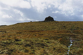
Eastern approach to Drygarn FawrElevation 645 m (2,116 ft) Prominence c. 254 m Parent peak Plynlimon Listing Marilyn, Hewitt, Nuttall Translation Three large cairns (Welsh) Location Location Powys,  Wales
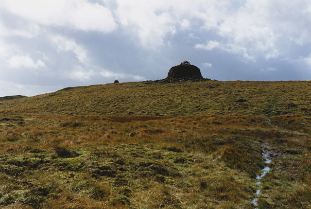
WalesRange Cambrian Mountains Topo map OS Landranger 147 OS grid SN862584 Listed summits of Drygarn Fawr Name Grid ref Height Status Gorllwyn SO196643 613 metres (2,011 ft) Hewitt, Nuttall Y Gamriw SO213636 604 metres (1,982 ft) sub Hewitt Drygarn Fawr is a mountain in the county of Powys, Wales. It is one of the highest summits in Mid Wales standing at 645 metres above sea level. Rising above the remote moorland plateau of the Cambrian Mountains, the summit is topped by two distinctive, large cairns. The mountain has a gentle, grassy, conical shape with a few rocks near the summit. Nearby are the summits of Gorllwyn and Y Gamriw, both over 600m.
There are two paths to the summit which can offer impressive views. From Llannerch Yrfa, a bridleway winds up through forests in the Nant y Fedw valley before skirting the southern edge of the mountain.
An alternative route may be taken starting from Rhiwnant on the edge of the Caban Coch reservoir, one of the Elan Valley Reservoirs, and following the Nant Paradwys before turning off west towards the summit cairn. Both routes pass across wild moorland and peat bogs and the path may become difficult to follow and impassable, particularly after heavy rain.
A compass, map and suitable clothing (the weather can be unpredictable) are recommended. However, it is very rewarding walk passing through the almost untouched desert of Wales.
The views to the north include Pen y Garn and Plynlimon, to the east Rhos Fawr and Gorllwyn and the Brecon Beacons to the south.[1]
References
- ^ Nuttall, John & Anne (1999). The Mountains of England & Wales - Volume 1: Wales (2nd edition ed.). Milnthorpe, Cumbria: Cicerone. ISBN 1-85284-304-7.
External links
Categories:- Elenydd
- Mountains and hills of Powys
- Mountains and hills of mid Wales
- Hewitts of Wales
- Marilyns of Wales
- Nuttalls
Wikimedia Foundation. 2010.