- Dibbinsdale
-
Coordinates: 53°19′52″N 2°59′42″W / 53.331°N 2.995°W
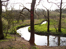 River at Dibbinsdale
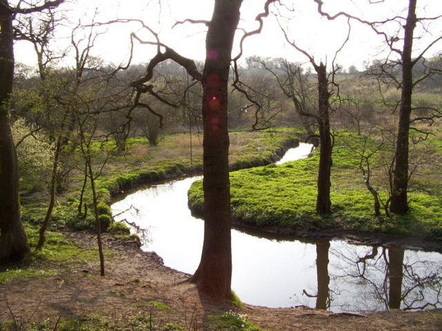
Brotherton Park and Dibbinsdale comprise an area of over 80 acres (320,000 m2) of park and woodland within the Metropolitan Borough of Wirral, England.
Situated between Spital and Bromborough, the valley woodland is one of the finest examples of ancient woodland on Merseyside and is a Site of Special Scientific Interest (SSSI).
Dibbinsdale is thought to have formed part of the boundary in the 10th and 11th centuries between the Norse colony in Wirral, to the north and west, and Anglo-Saxon Mercia to the east and south. After the Norman Conquest, the whole area became part of the Hundred of Wirral.[1]
References
- ^ Stephen J. Roberts, A History of Wirral, 2002, ISBN 978-1-86077-512-3
External links
- Metropolitan Borough of Wirral: Brotherton Park & Dibbinsdale LNR
- Metropolitan Borough of Wirral: Dibbinsdale SSSI
- Metropolitan Borough of Wirral: Nature Conservation
- Steven Round Bird Photography - Many wild bird images from Dibbinsdale
Dee Cliffs • Dibbinsdale • Hesketh Golf Links • Heswall Dales • Meols Meadows • Mersey Narrows • New Ferry • North Wirral Foreshore • Red Rocks • Ribble Estuary • Sefton Coast • Stanley Bank Meadow • The Dungeon • Thurstaston CommonCategories:- Parks and commons in Wirral (borough)
- Sites of Special Scientific Interest in Merseyside
- United Kingdom Site of Special Scientific Interest stubs
- Merseyside geography stubs
Wikimedia Foundation. 2010.