Dogfeiling

Dogfeiling

Coordinates: 52°41′56″N 3°15′22″W / 52.699°N 3.256°W / 52.699; -3.256

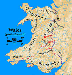
Post-Roman Welsh kingdoms. Dogfeiling is in the north center, between Rhos and Tegeingl. The modern Anglo-Welsh border is also shown.

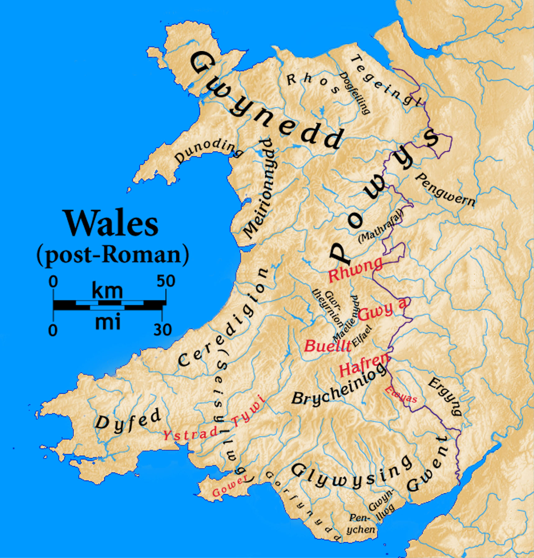
Dogfeiling was a minor sub-kingdom and later a commote in north Wales.

It formed part of the eastern border of the Kingdom of Gwynedd in early medieval Wales. The area was named for Dogfael, one of the sons of the first King of Gwynedd, Cunedda. It existed from the year 445 until sometime around the year 700 when it was re-absorbed back into Gwynedd proper.

References


Wikimedia Foundation. 2010.

Игры ⚽ Поможем написать реферат

Look at other dictionaries:

  • Догвейлинг — валл. Dogfeiling суб королевство Гвинеда ← …   Википедия

  • Manwgan ap Selyf — was an early 7th century King of Powys, the son of Selyf Sarffgadau. One theory asserts that when Manwgan ap Selyf came to the throne in 613 he was a young boy, which led to an invasion of Powys by Eluadd ap Glast (alias Eiludd Powys), the… …   Wikipedia

  • Eiludd Powys — was an early 7th century King of Powys. One theory asserts that when Manwgan ap Selyf came to the throne in 613 he was a young boy, which led to an invasion of Powys by Eluadd ap Glast (alias Eiludd Powys), the erstwhile King of Dogfeiling. The… …   Wikipedia

  • List of extinct states — This page attempts to list the many extinct states, countries, nations, empires or territories that have ceased to exist as political entities, grouped geographically and by constitutional nature.Ancient and medieval statesStates and realms that… …   Wikipedia

  • Great Britain in the Middle Ages — Great Britain during the Middle Ages (from the 5th century withdrawal of Roman forces from the province of Britannia and the Germanic invasions, until the Early modern period) was fragmented into a number of independent kingdoms. By the High… …   Wikipedia

  • List of hundreds of England and Wales — This is a list of hundreds of England and Wales. Most English counties were divided into hundreds from the late Saxon period and they were effectively abolished under the Local Government Act of 1894.Fact|date=February 2007 In some areas,… …   Wikipedia

  • Maelienydd — Coordinates: 52°15′18″N 3°20′24″W / 52.255°N 3.340°W / 52.255; 3.340 …   Wikipedia

  • Kingdom of Dyfed — Teyrnas Dyfed ← …   Wikipedia

  • Cynddylan — Cynddylan, or Cynddylan ap Cyndrwyn (Cynddylan son of Cyndrwyn) was a seventh century ruler associated with Pengwern. He is described in the poem Marwnad Cynddylan (Elegy of Cynddylan) as a king of Dogfeiling, a sub kingdom of Gwynedd near… …   Wikipedia

  • Wales in the Early Middle Ages — Post Roman Welsh kingdoms. History of Wales …   Wikipedia

Share the article and excerpts

Direct link
Do a right-click on the link above
and select “Copy Link”