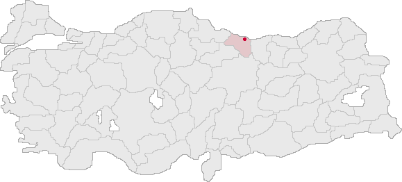
- Ulubey (district), Ordu
Infobox Settlement
settlement_type = Town
subdivision_type = Country
subdivision_name = TUR
timezone=EET
utc_offset=+2
map_caption =Location of PAGENAME within Turkey.
timezone_DST=EEST
utc_offset_DST=+3official_name = Ulubey |
image_caption =
image_blank_emblem =
blank_emblem_type =
subdivision_type1=Region
subdivision_name1 = Black Sea
subdivision_type2=Province
subdivision_name2 = Ordu| population_total = 7000|population_footnotes=
population_as_of =| 2003
population_footnotes =
population_density_km2 =
area_total_km2 =
elevation_m = 602|latd = 40
latm = 52
latNS = N
longd = 37
longm = 44
longEW = E
postal_code_type=Postal code
postal_code = 52
area_code = 0452
blank_info = 52|blank_name=Licence plate
leader_name =
website =Ulubey is a town and district of
Ordu Province in the Black Sea region ofTurkey , convert|21|km|mi|0|abbr=on south of theBlack Sea in thePontic Mountains . TheMelet River runs through the district.Economy
The economy of the district depends mainly on agriculture.
Hazelnuts ,beekeeping ,dairy farming ,corn , andkale are the main products. In recent decades the population has declined as people have migrated away to jobs in Turkey's larger cities or abroad, now mainly their grandparents remain.External links
* [http://www.ulubey.bel.tr/ District municipality's official website] tr icon
Wikimedia Foundation. 2010.
