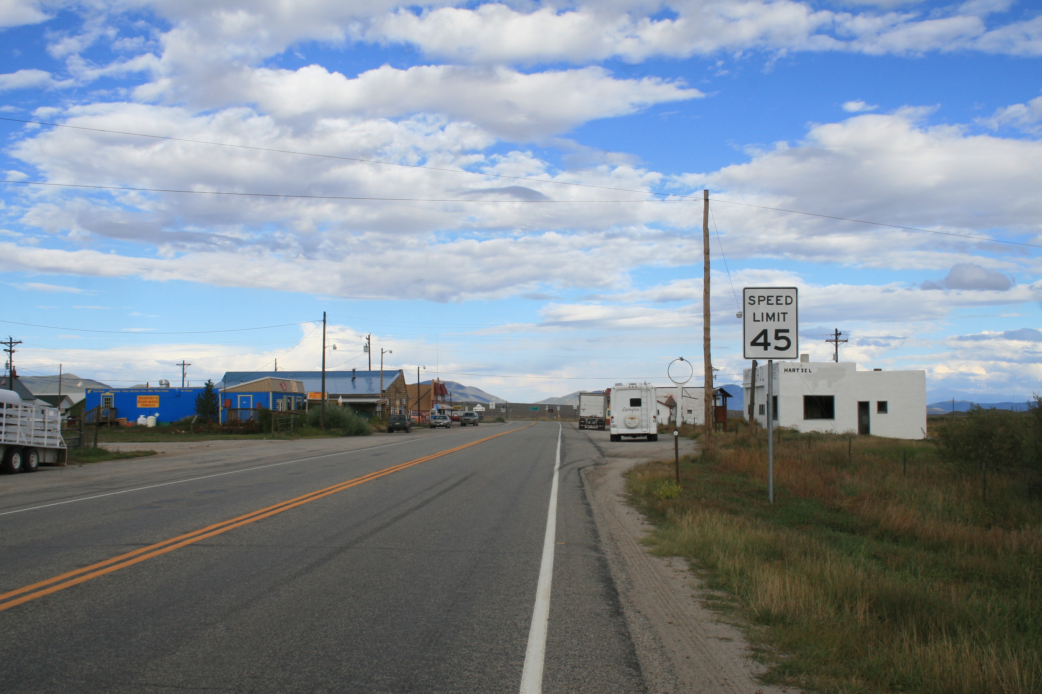
- Hartsel, Colorado
Infobox Settlement
official_name = Hartsel, Colorado
other_name =
native_name =
nickname = The Heart of Colorado
settlement_type = Town
motto =
imagesize =
image_caption =U.S. Route 24 passing through Hartsel
flag_size =
image_
seal_size =
image_shield =
shield_size =
image_blank_emblem =
blank_emblem_type =
blank_emblem_size =
mapsize =
map_caption =
mapsize1 =
map_caption1 =
image_dot_
dot_mapsize =
dot_map_caption =
dot_x = |dot_y =
pushpin_
pushpin_label_position =
pushpin_map_caption =
pushpin_mapsize =
subdivision_type = Country
subdivision_name = USA
subdivision_type1 = State
subdivision_name1 = flag|Colorado
subdivision_type2 = Counties
subdivision_name2 = ParkGR|3
subdivision_type3 =
subdivision_name3 =
subdivision_type4 =
subdivision_name4 =
government_footnotes =
government_type =
leader_title =
leader_name =
leader_title1 =
leader_name1 =
leader_title2 =
leader_name2 =
leader_title3 =
leader_name3 =
leader_title4 =
leader_name4 =
established_title = Founded
established_date =1880
established_title2 =
established_date2 =
established_title3 =
established_date3 =
area_magnitude =
unit_pref = Imperial
area_footnotes =
area_total_km2 =
area_land_km2 =
area_water_km2 =
area_total_sq_mi =
area_land_sq_mi =
area_water_sq_mi =
area_water_percent =
area_urban_km2 =
area_urban_sq_mi =
area_metro_km2 =
area_metro_sq_mi =
area_blank1_title =
area_blank1_km2 =
area_blank1_sq_mi =
population_as_of = 2000
population_footnotes =
population_note =
population_total = 677
population_density_km2 =
population_density_sq_mi =
population_metro =
population_density_metro_km2 =
population_density_metro_sq_mi =
population_urban =
population_density_urban_km2 =
population_density_urban_sq_mi =
population_blank1_title =
population_blank1 =
population_density_blank1_km2 =
population_density_blank1_sq_mi =
timezone = MST
utc_offset = -7
timezone_DST = MDT
utc_offset_DST = -6
latd= 39
latm= 01
lats= 17
latNS=N
longd= 105
longm= 47
longs= 45
longEW=W
elevation_footnotes =
elevation_m = 2702
elevation_ft = 8864
postal_code_type =ZIP code cite web | date =December 28 2006 | url = http://zip4.usps.com/zip4/citytown.jsp | title = ZIP Code Lookup| format =JavaScript /HTML | publisher = United States Postal Service | accessdate = December 28 | accessyear = 2006]
postal_code = 80449
area_code =
blank_name =
blank_info =
blank1_name =
blank1_info =
website =
footnotes =Hartsel is an unincorporated town and a U.S. Post Office located in Park County,
Colorado ,United States . Hartsel was founded in 1880. Located at the geographic center of the state, it is often referred to as "The Heart of Colorado". The community's namesake is Samuel Hartsel, a local cattle rancher. [http://www.growingyourfuture.com/programs/activity_books/pdf/Cattle%20History%20Book.pdf] The Hartsel Post Office has theZIP Code 80449. The ZCTA for 80449 had a population of 677 at the 2000 census.GR|2Geography
Hartsel is located at coor dms|39|01|17|N|105|47|45|W|city (39.021318,-105.795765).
According to the
United States Census Bureau the town has a total area of 605.10 square miles (973.60 km²), 601.18 square miles (967.29 km²) is land and 3.92 square miles (6.30 km²) is covered with water. Hartsel's elevation is 2,702 meters (8,864 feet).Demographics
As of the
census of 2000GR|2, the population of ZIP code 80449 was 677 with 284 households. Thepopulation density was 1.13 per square mile (1.81 per km²). The racial makeup of the ZIP code was 94.1% White, 0.9% Native American, 2.7% other races, and 2.4% from two or more races.References
External links
* [http://www.hartselspringsranch.com/ Hartsel Springs Ranch] Historic ranch - Indian lookout, herds of buffalo, historic buildings
* [http://stevegarufi.com/hartsel.htm Photos of Hartsel]
* [http://www.wunderground.com/cgi-bin/findweather/getForecast?query=80449 Hartsel Weather]
Wikimedia Foundation. 2010.
