NoMa, Washington, D.C.

NoMa, Washington, D.C.
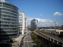
Facing north on First Street, N.E., in NoMa. The Washington Metro's Red Line track is visible on the right-hand side.

NoMa (sometimes stylized NoMA) is a portmanteau of the words "North of Massachusetts Avenue" that is being used by real estate developers to brand a large tract of land in Washington DC that is located just north of Capitol Hill and Union Station. The area comprises the neighborhoods of Truxton Circle, Sursum Corda, and Near Northeast and includes a section historically known as Swampoodle. It is home to several important historic structures including the Woodward & Lothrop Service Warehouse (on the National Register of Historic Places), the Uline Arena, St. Aloysius Church, Gonzaga College High School, and the Government Printing Office.

Although much of the planning for the area took place during the late-1990s, formal development commenced when the District of Columbia City Council approved creation of the NoMa Business Improvement District (BID). Development has ushered in a number of prominent commercial businesses, government organizations, and retail establishments. The area is served by multiple modes of transportation including rail (via the Red Line of the Washington Metro), bus (via the Greyhound Lines terminal) and bicycle (via the Metropolitan Branch Trail).

External links


Coordinates: 38°54′23.4″N 77°0′17.7″W / 38.9065°N 77.004917°W / 38.9065; -77.004917


Wikimedia Foundation. 2010.

Игры ⚽ Нужна курсовая?

Look at other dictionaries:

  • Noma — may refer to: NOMA (company) Noma (disease) Noma (restaurant) Noma, Florida, United States NoMa, Washington, D.C., United States Noma pony Noma Prize, a group of Japanese literary awards New Orleans Museum of Art Non overlapping magisteria, a… …   Wikipedia

  • NoMa — – Gallaudet University Station statistics Address …   Wikipedia

  • Washington Metro — Not to be confused with Washington Metropolitan Area. Washington Metro Overview Type …   Wikipedia

  • Ronald Reagan Washington National Airport (WMATA station) — Ronald Reagan Washington National Airport Station statistics Address 2400 South Smith Boulevard Arlington, VA 22202 …   Wikipedia

  • Massachusetts Avenue (Washington, D.C.) — Massachusetts Avenue Historic District U.S. National Register of Historic Places U.S. Historic district …   Wikipedia

  • Chinatown (Washington, D.C.) — Map of Washington, D.C., with Chinatown highlighted in red Chinatown in Washington, D.C., is a small, historic neighborhood east of downtown consisting of about 20 ethnic Chinese and other Asian restaurants and small businesses along H and I… …   Wikipedia

  • Near Northeast, Washington, D.C. — Map of Washington, D.C., with Near Northeast highlighted in red Near Northeast is a neighborhood in Northeast Washington, D.C.. It is bounded by North Capitol Street to the west, Florida Avenue to the north, H Street to the south, and 15th Street …   Wikipedia

  • Downtown Washington, D.C. — Downtown Washington, D.C. is the central business district in the northwest quadrant of the District of Columbia, the capital city of the United States. LocationGeographically, downtown Washington is broadly considered to be anything north of… …   Wikipedia

  • New York Avenue (Washington, D.C.) — New York Avenue N.W. in Washington D.C. at the intersection of 14th Street looking east. New York Avenue is one of the diagonal avenues radiating from the White House in Washington, D.C. It is a major east west route in the city s Northwest and… …   Wikipedia

  • Hyatt Place Washington DC/ US Capitol — (Вашингтон,США) Категория отеля: 3 звездочный отель Адрес …   Каталог отелей

Share the article and excerpts

Direct link
Do a right-click on the link above
and select “Copy Link”