- Ilia Prefecture
Infobox Pref GR
name = Elis
name_local = Νομός Ηλείας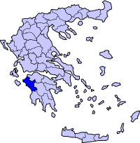
periph =West Greece
capital = Pyrgos
population = 198,763
population_as_of = 2005
pop_rank = 13th
pop_dens = 75.9
popdens_rank = 13th
area = 2,618
area_rank = 22nd
postal_code = 27x xx
area_code = 262x0
licence = ΗΑ
provinces = 2
municip = 22
commun =
ISO = GR-14
website = [http://www.nailias.gr www.nailias.gr]Ilia (Modern Greek: Ηλεία - "Ileía", also "Elia") is a prefecture in the Western
Peloponnese and in Western portion ofGreece . The prefecture is part of the periphery ofWest Greece . It covers the area of ancientElis , and was formerly a department. Its capital is Pyrgos.Overview
About 50% to 60% of the population live in villages, towns and cities that lie in the northern portion of the prefecture. from the European highway from
Lechaina andMyrsini down into theAlpheus River and Olympia. 25% live around the tiny metropolitan area of Pyrgos, with a population of approximately 25,000. Between 70% to 75% of the population live within fertile lands away from the mountains. The population is ranked third or fourth in the peninsula. Less than 1% is water, most of it found in artificial reservoirs and dams. Half a percent less before the construction began to wipe out about 2 km² of forest and around 10 km² of land as well. About 1/3 of the land is fertile. A range of 450 to 500 km² of land is barely flat. About 2/3 of the rest is mountainous and not suitable for crops. There are 7 dialing codes. They are Lechainá (2623), Amalias (2622), Pyrgos (2621), (Anc.) Olympia (2624), Kréstena, Zácharo and Andrítsaina.Ilia used to cover (not as a prefecture, department or a province) as far north as the western cape of Araxos before boundaries were changed, and Neo Vouprasía were part of Ilia. Its original boundary were what is now Móvri-Larissoú line in Achaea (Achaia). Lambeia belong to Arcadia in ancient times. And portions of modern Ilia belonged to ancient Arcadia. The prefecture excludes what is now New Vouprasía, Kalógria, and includes Lambeia and parts of former Arcadia. Its present day boundary is at Neda River, going a little East of Andrítsaina, Erymanthus River, Dívri, west of Scollis, and ends between Manoláda and Kalógria with green forests bordering
Larissos River .Swamplands used to cover about 1% to 1.5 (one-and-a-half) percent of the region, especially in the Samiko area. Draining of swamp waters expanded farming by about another 1% and subtracting swamplands only to the present-day deltas of the Peneus, Alpheus and Neda rivers. Only 10 km² left and they are protected by recreational services.
Some of its islands used to belong to the neighboring Septinsular Republic in the 1800s. Today it is a regional boundary of the Peloponnese and the Ionian Islands bordering there.
The population of ancient Ilia (from 1000-1 BC) was in the range of 5,000 to 10,000 and reached 10,000 or 20,000 by 1 BC. The history of the population of Ilia had suffered sharp population declines during invasion from northern and Eastern Europe, plagues, a couple of wars, and poor economy. Most of the population growth above 1% occurred in the 1800s and well into the 1900s. The biggest decline to its population was probably when invaders from Northern Europe dominate Ilia and some wars as well. The population surpassed the 100,000 mark around the quarter of the 20th century and more than 150,000 in the late-20th century. Pyrgos became the largest city having the population over the 10,000 mark in the mid-20th century, and above 20,000 in the late-1980s. The population may hit the 200,000 mark. Even though it will not surpass the Corinthia prefecture population, it may be ranking 3rd in the entire peninsula. The population in the northwest is growing while the population is declining in the southeast and east.
Ilia is steadily growing and around placed nearly in the middle in percentage in the peninsula, but growing quite steadily. Achaea prefecture is the first. Northern part is one of the fastest. Southern Ilia's population has growing mostly steadily like Andritsaina (less than 500 persons added to their population), and the flatlands has been growing quite steadily, (1 to 2%). Most of the small villages are losing population, some towns and cites are gaining population. The population has been growing steadily throughout more than 4,000 years (with some exceptions in the 20th century, the northern part has been growing between 1,5%, 2% and 3%).
The urban population is about higher than 60% and has surpassed population in the latter part of the 20th century, and rising to 70% and 80% of the population. Over the last 4,000 years, the majority of the population lived in rural areas.
The area is rich in beaches, climate, and forests.
Municipalities
See also:
*List of settlements in the Ilia prefecture
*List of municipalities in the Ilia Prefecture Population
*1991: 174,021, density: 65 inh./km²
*2001: 192,340, density: 71.74/km²
*2005: 198,765, density: 75.9/km²Geography
The northernmost point is 38.1° or 38° 06′ N, the westernmost is around 22.2° E or 22° 12′ E, the southernmost is 37.3° N or 37° 18′ N, and the easternmost is 21.9° E or 21° 54′ E. The length from north to south (Directly is 100 km (60 miles), and from east-to-west is around 55 km (35 miles). There two tiny peninsulas in the region. Its coast line includes 120 km of sandy beaches.
The longest river is the Alpheus River (Greek: Πόταμος Αλφειόυ "Alfeios"). Other rivers are Erymanthus (Ερύμανθος "Erymanthos") by the boundary of Ilia-Arcadia, Peneus (Πόταμος Πηνειός "Pineios") of the west runs down into the southern part of Vartholomio. The
Neda (Νέδα) river is the boundary of Messenia and Ilia. More rivers can be found here. Peneus used to emptied near what is now Lechaina and Aghios Panteleimonas in ancient times. The distance of Peneus river flows near Palaeochori today.The prefecture has about 250 to 300 kilometers of sandy coastline filled with beaches, rocks, the port of Kyllini and contains the mouths of Peneus, Alpheus and its delta and Neda Rivers. north of Neochori and Kyllini, the only spot of not having a beach, rocky cliffs dominate their shoreline. The total length is around 1 km. The coastline throughout history was a bit longer 3,000 to 4,000 years ago.
Unlike the Aegean and the Ionian islands, there is only one rocky island, and it has a lighthouse on top of the cape. Ilia's largest island has a cape for the Kyllini coast. The size of the island is only about 7,000 m². All of its islands is deforested, and rocky. The island was cut off from the rest of the land as the water level rose, and soil erosion of rocks, wiping out 0.2 km² over tens of thousands of years. There was an island tens of thousands of years ago existed between Ilia and Zakynthos. Today the depth is only 5 m under the sea. It is the highest point under the sea, it almost look like an island. There are 3 lagoons covered between the sea.
Lighthouses like in Kyllini are scattered throughout its coastlines and there are less than 10 lighthouses in the area.
Forests are founded in the east. The other is plain or rocky least-forested hills. Piney trees are mostly founded in places from Neda River up to Peneus River. About half of the area are covered with forest. The other is plain of rocky least-forested hills. There are forest preserves in
Pholoe (Φολόη "Foloi", "Pholoi", modern Greek or "Pholoe", ancient and modern Greek.), and the mountain ranges of Eastern Ilia. Another forests in the northern part is theStrofylia forests which has pine trees.Tree-planting is very rare, or not being planted. The rate of
forestation is slightly decreasing, mainly by fires and road networks. But larger forests not linked by any roads are getting protected, mainly in Pholoe.Its mountain range is the southern part of
Movri (Μόβρη "Movre") (around 400 m/1,700 ft),Pholoe ranges (around 300 m),Divri (Δίβρί) (around 1500 m),Minthe (Μίνθη) (around 1100m), and more.Reservoirs are founded in the north and east. the first is Peneus which supplies water for Northern Ilia. The water is not safe for drinking, because it contain some
contaminant s. It dams up the Peneus River. Its dam is made out of earth and it is considered the highest dam in Ilia, but not the Peloponnese. The second is not far from Olympia and Krestena. This reservoir is small but is supplies water from Pyrgos to the southern part. It dams up the Alpheus River.The port of Kyllini in the northwest is the busiest port in Ilia. It ferries cars into the port and out into the islands of Zante and Corfu with two ferry lines. Other ports or harbors are small in size and fits only small or smaller boats.
Two thermal springs offers beautiful blue-colored sea with the best beaches around. Thermal springs of Kyllini, Kaiafa are the major springs there.
There are mountains filled with spring water, but there are no spring water factories in Ilia, such as
Avra (Temene) (Άυρα) from Temene andLoutraki (spring water) fromLoutraki , outside Ilia.Loutraki orAvra is thetop-selling spring water in the entire region.There are no skiing resorts in the area. The nearest from the north is on the Panachaicus, and from the south is from Mainalon, and Taygetus.
Ilia is located in the heart of the
earthquake zone, and the faultline. Every year, tens of minor earthquakes andaftershock s are trembled each year. There are a number of faultlines scattered in the area. Ilia or the western Peloponnese has a lot of history of earthquakes.Here lies the ancient ruins of
Elis (Ancient Greek Ηλίς "Elis", Modern Greek Ηλίδα "Ilida"),Epitalium (Επιτάλιον, Επιτάλιο (modern Greek spelling "Epitalion") and Olympia, and once held the ancient Olympic games which started in 776 BC. A museum is founded with statues that relate with the history of Olympia. Another museum is in Elis, but the size is very small.Ilia has a military airport in Andravida located slightly north of Pyrgos, 3 km north of the center of Andravida. There are no international or local airports in the area. There are
military base s in Elis, like the one in Kyllini.The nearest
airport on land is inKalamata , and from Kyllini, the nearest airport is in the island of Zakynthos which is around 20 km southwest.Monasteries are scattered around the region. The nearest from Amalias is
Agia Frangavilli about 5 km SE of Amalias and N or Pyrgos via GR-9.Straws and bamboo sticks are founded along the roads in the plains of the area. Its total length of roads running into the bamboo sticks is about 8% to 15% of the total length of roads. Every year, fires are set on the Bamboo sticks to make road conditions clearer, other are cutting them for use. Marshes are founded in riverbanks and some swamps in which the use for products is sometimes rare.
Ilia's most crowded train station is near the heart of Pyrgos. it has 5 to 6 tracks line up within the station. The location is about a 100 m east of the old Pyrgos to Patras Road.
There are about four lagoons in the west, right next to the Ionian Sea. Some of them were drained to make room for farmland. They are concentrated between SW of Pyrgos and into the Alpheys Delta and south to the beaches of Kaiafa. Some of the lagoons near Epitalio has been drained for farming purposes.
Climate
In spring, temperatures in May can climb to around 20 to 25 °C. Temperatures in the summer can soar over 30 °C (86 °F). Sunny takes over cloudy days. Series of late-1970s, late-1990s and early 2000s heatwaves pounded the area, setting or reached near record highs around the mid-40s °C mark. One summer of 2002, daily high temperatures for the season were hovering around the 35 °C mark. Normal temperature is between the low to mid 30s °C mark. In the fall, temperatures decline around the 20 °C mark. The only time that the leaves change colors is near winter. Winter highs is about 13 °C to 14 °C. Snow covers the mountains. Temperatures at elevations over 1000 m can reach 5 °C.
There had been some summer years where places from Kyllini to SE of Pyrgos, and in the Western Peloponnese has received more than 50 days of sunshine in a row, especially in portions of early and mid-1990s, 1997, 1998, and 2001. No other places in other parts of Elia received over 50 days of sunshine in mountainous regions, which rain and clouds have been dominant, mainly in late-day skies.
Rainy weather in 2002-2003 caused destruction of villages by mudslides, and some bridges and roads were also cut off. It repeated in 2005 and 2006. Not too much rainy weather ravaged the prefecture. When the low pressure system arrived from
Central Europe , it brought snow to Greece, the snowstorm had no effect in almost all of the Prefecture along with the temperatures which went as low as the freezing mark in the low lying areas, only the mountains received almost normal snowfall. On February 2008, frost devastated many crops in Manolada, Nea Manolada (the Manoladas) andKounoupeli Agriculture
The primary source of agriculture is corn, tomatoes, potatoes, green peppers, livestock, watermelon, melon and some vegetables. There are 3 major operating tomato factories in Savalia (Kyknos), Gastouni (
Pelargos ), and north of Andravida (Asteris ). The most fertile land is a plain that covers northern section of the region. The production is one of being #1 in the Peloponnese and the whole of Western Greece. There are almost the same amount of fertile land as in Achaea, being the #1 in amount of fertile andarable land in the peninsula.Textiles used to be dominant in business from ancient times to medieval times. It had been replaced by agriculturalism in times of the Ottoman Empire and a couple of plagues. In the 1950s, agriculture was the most dominant business and the most jobs in Elis numbered at 100% with the exception of parts of
Amaliada and Pyrgos, where urbanization covered more than half and a quarter in Amalias. In the late-1970s, the majority of jobs in Lechaina, Myrsini and Varda is primarily urban. Business in the agricultural sector has been declining to one-third to this day.The most popular pasta in western Greece is shaped like stars and dots. It is common in the western half. Other pasta delicacies are also common and were affordable until the mid-20th century. Poverty was very common when the economy is poor.
A part of the agriculture particularly on some farms, groves and cattle were devastated by the fire.
Some of the new farmers are of
Pakistan i origin, their income is mainly in the middle class range annually.Forestry
Before the mid-20th century, logging was rarely common to third-class residents. They used it for heating, cooking, and some other resources. Nowadays, logging is very rare in Ilia. The only place for logging is near residential and industrial expansion, mining, and highway networking expansion. Most of the forest is consumed by forest fires.
There are no sawmills and papermills in Ilia and the Western Peloponnese, unlike Northern Europe. The nearest sawmill is to the north and the nearest paper mill is probably in Athens.
Fishing information
Squid, and all types of fish are common in the waters of Ilia. Fishing is mainly done in the southeastern Ionian and as well in the waters of the Bay of Patras. Most of the production is sent into Patras, some into Athens, some elsewhere in the world (with small production) and some into the local markets of Ilia from Kyllini and Katakolo. Overfishing is a problem north of Lechaina. There are people fishing near the coastal waters of the Western Peloponnese. Fishing without a permit is illegal, and they are trying to prevent overfishing, but fishing continues well after the comment about preventing overfishing.
Information and features
Lechaina international festival had taken place in mid-summer of 2002. It hosted concerts, not as big as others, and shows.
There are no race tracks, or a main airport. not even a speedway. Soccer fields, track and field, and basketball are common. Also, there are hospitals in the area. There are a number of health centers founded from north to south.
Total number of buildings number around 50,000 and 60,000.
Peneus Dam also has a watch tower and a water control station which guards the water flow of that reservoir. It even has a road over which connects Psari, Ag. Ilia, Daphni, and Gastouni. It even features the only single-span suspension bridge in Elis which is 300 meters long. This bridge runs over the flowing waters from the dam when is above the limit. Kentro is in the middle between the dam, the river and the channel.
There are three tomato plants, they include
Kyknos in Savalia,Asteris north of Andravida, andPelargos southeast of Gastouni.There are about 10s of post office scattered in the area.
100s of water towers are scattered to half of the villages carrying 2,000,000 litres of water for most of the region.
The supermarkets and warehouse stores that are available are
Lidl andVeropoulos (part of theSpar ,Eurospar chain) in Pyrgos. This location opened in the late 20th century, being the first supermarket in Pyrgos and Ilia, not as a whole of the Western Peloponnese. The main regional chain of supermarket isSupermarket Ilida . Department stores and hypermarkets that are not available isCarrefour ,Praktiker ,Champion Mariopoulos andMicro Land , their nearest location for a store is founded only in Patras, the capital of the Peloponnese.Its length of barbwires is about 2000 to 5000 km, and the rest are fenced near farms with grasses and bushes.
Tourism
Tourism is mainly found along the beaches of western Peloponnese. In the range of 60% to 70% tour the beaches of Ilia or the western Peloponnese every year and decade. Tourism flourishes in the summer season in hotels in the Kyllini area, and its thermal springs next to the Ionian Islands. Many tourists in the area go to places like
Agia Lagana on the Kyllini coast. Tourists flock through seaside restaurants which is a hotspot for tourists. Another tourist attraction is Olympia, along with its ancient ruins. Most of the stores are almost flourished with items that relate with ancient Olympia. There are hotels in Pyrgos.The history of tourism began in the 1960s when airplanes came to the market. tourism has steadily increasing throughout the latter part of the 20th century. Most of the tourists are from Western and Northern Europe, especially Southern Europe, and Germany. The remainder of tourists come from the Americas, Israel and South Africa. Far East states are the smallest. Bad weather had taken a toll on tourism which began in 2002. More touristic info can be found here.
History
Ancient, Classical and Roman Elia
"For the earlier history, see
Elis "776 BC: The first Olympic games held in Olympia. These games lasted into the Roman Empire and the Byzantine Empire.
Byzantine Ilia
3rd - 4th century: Goths, Slavs and Vandals rampaged through the region, leaving untold destruction of homes and people were panicking not just in Elia but also around Greece.
1000s - 1200s Fortress-like "Chlemoutsi" were built by the
Franks to prevent attacks from the northern frontiers from conquering.Frankish Ilia
1204 The
principality of Achaea was created and Ilia was included in the principality for the next 256 years (about 2 and a half centuries). The principality had its own capital atAndravida . TheGreat Plague affected about half of the population and it declined after spreading the disease. One exception was that it later became a part of the Venetians in the 1400s for a few decades.Venetian and Ottoman Ilia
1460 The
principality of Achaea which included much of Ilia conquered and joined theOttoman Empire which lasted until Greek independence of 1821 (length: 361 years, 3 centuries, 61 years, around 326 with the Ottomans) with some exceptions of the Venetian rule which ran in the 1490s, a part of the early 16th century and from 1681 until 1715. Ilia produced several revolutionary leaders including the Avgerinos, the Sisins (Georgios and Chrysanthos),Charalambos Vilaetis ,Athanasios Christopoulos ,Krestenitis , etc. Battlegrounds include Chlemoutsi, Gastouni in 1821, Lala in 1822 which many fell, near Lampeia (Divri), near Pyrgos, the area of Andritsaina and several to the south, all of these were to be liberated in the mid-1820s.The first years after the Ottoman rule and with Greece
After the late-1820s around 1828, Ilia finally joined a new country known as Greece. In the first years it merged to form
Achaea-Ilia in which lasted for several years, it split but it rejoined again and remain united until 1934 with one exception.During the first decades of being a part of Greece, it experienced an economic and agricultural boom, houses were built, Pyrgos boomed, there were some emigration in which did not succeed until after the conflicts. Municipalities were created in 1831 and originally numbered nine, including Olena, Olympia, Pyrgos (Letrina), Andritsaina, Krestena/Zacharo, Gastouni, Amaliada? and several that no longer exists including Myrtountio (named after Myrtountio or Myrtuntium) and Kalotychia (now split into Vouprasia), prior was the province of Ilia which had its capital in Gastouni, these municipalities were later dissolved in 1912 reducing to Amaliada and Pyrgos (Letrina). The
King of Greece owned a tract of land that ran from theLarissos River south of theMavros Oros south to Amaliada and was filled with willow trees. Like most of thePeloponnese , the area was unaffected duringWorld War I .During the
Asia Minor Catastrophe , refugees fromAsia Minor settled into the northeast tract and much of the forests were cut and were reduced into the vicinity of Amaliada and north of the GR-9, Lappa was partly included as the boundary was not created until 1931 marked at the stream 1 km north of Nea Manolada. The section in the forest northeast to near Sageika was mainly depopulated and had only a few places.Earthquakes rumbled
Chavari in 1909 which ruined everything, Vartholomio in 1910 and Kyllini in 1920.Wartime Ilia
1940s
World War II struck portions of Ilia, houses were damaged, people were homeless, and theGreek Civil War strucked later on. Buildings were rebuilt in the early-1950s.Post-war Ilia
Remnants of the Ionian earthquake in 1953 trembled nearly the whole area. The damage was probably in the minor range. Some buildings were damaged and some people were injured. Most of the damage happened northwest of Pyrgos. Other earthquakes occurred later in Oreini Pineias a year later (1954), Lechaina two years later (1955) and Vartholomio and Neochori Myrtountiou in 1988 which ruined some biildings, it was also felt in Machos, Kyllini, etc.
1980s to 1990s New highway extension and a by-pass began to open and E55 was remapped. It spanned 65 kilometers, including 42 kilometers of widening, and 23 kilometers of extensions and by-passes. It meant better flow of traffic from Patras to Pyrgos.
Modern Ilia
mid-1992: A fire in Lechaina's east destroyed 50 square kilometers of forest, land, farms and property. Power was cut off for several days.
mid-1993 An earthquake trembled most of Elia. A mid-afternoon earthquake caused minor of some severe damage to property. It was nearly a strong earthquake, because it is located near an earthquake zone.
late-1990s (1997 to 1999) Tens of forest fires have been reported. Total cost of fires was in the 30,000,000 drachmas ($100,000) range.
mid-1999 Mudslide devastates road connecting Pyrgos, Krestena, Andritsaina, Megalopolis, Sparta, and Laconia. Access was completely cut off for several days. The road was repaired with better engineering.
July-August, 1999 Forest fire threatens forest near the ancient city of Olympia. Tens of square km were consumed by an enormous fire. GR-74 during that day along with other rarely used roads were shut down. The fire was completely put out in a couple of days.
2001: Workers opened a Neochori by-pass which will send vehicles to Kyllini (Kyllene) in just around 15 minutes in a 60 km/h zone. The distance is reduced to 10 kilometers from 13 kilometers. This is a result of closing down a railway (railroad) that communicates Kavasila or Kavasilas and the Port of Kyllini.
August 2001:: Farmers demand more money during a strike. Farmers were blocking traffic by tractors. The strike lasted for about a week. Attempts were done on GR-9 1.5 km SW of Kardamas and 20 km NW of Pyrgos at the Dounaiika-Amalias Junction. Hundreds attend to protest lower prices and lower production.
August-September 2002: A series of late August-early September (late-summer) earthquakes rattle the area. One measuring the
Richter Scale in the 5.4 range, and happened 10 km (6 mi.) deep in the Ionian sea south of Vartholomio. Houses and buildings were shaking and so did the trees. No damages were reported. The other was almost 5.6. All of the earthquakes happened around 11PM (23.00) local daylight time (20.00 UTC).August 14 ,2003 : Remnants of the Lefkada earthquake tremored as far south as the northern tip of Ilia, no damages were reported.November 16, 2003 Remnants of the Cephallonia earthquake also rumbled into the region from Kalogria or Manolada southward. Damages were mostly done on that Ionian island.
In the later years, in 2005, a whale ended up on a shoreline near Neochori in the southern part of the prefecture.
A low pressure system that arrived from southern and central Europe brought devastating hailstorm to the plains near
Pyrgos damaging many of the crops including the watermelon. The ground resembled a snowy day in the month of November and December with 2 cm that happens in northern and eastern Europe nearby, this scene is very rare and it occurs in February.August 2007: The
Ilia Prefecture is devastated by enormousforest fires which lead to tens of deaths and a massive environmental and economical disaster.2007 Greek forest fires#August_2007 The final toll (according to the newspaper "TA NEA"; September 3, 2007) for the prefecture was: 45 dead, 100,000 effected by the fire, 3,500 left homeless by the fire, 25,000 dead animals, 8,500 hectares of burned forests, 2,300 hectares of burned farmland.Months after the fires, the government had announced to replant the olive trees lost by the fire, the date was scheduled earlier than the start of the planting season in late-January 2008. A few lesser known fires would dominate the area in the summer of 2008.
The earthquake that affected from Erymanthos shook only the northeastern part of the prefecture on February 2008. On
February 14 ,2008 , an earthquake from the west shook a part of the prefecture and caused almost no damages, a few of the forty earthquakes in late February ravaged several parts of the prefecture. It was terror stricken again by another earthquake in nearly four months onJune 8 ,2008 at 15:21 (3:21 PM) local time and measured at 6.7 on the richter scale and shook the entire region, scientists located the epicenter around Andravida, the northeastern hills and outside the prefecture in AraxosFact|date=August 2008. Hundreds of homes and buildings were damaged and were reported in Lechaina, Gastouni?, Amaliada, Vartholomio and parts northeast. It also devastated rail services southwest of Patras, no road closures were reported. The horrific scenes were immediately cleaned up within a week or two and were sealed off. Injuries were reported. Residents panicked into the streets and wandered within the rubble for hours until the evening hours.Transportation
Total highways are exactly 200 km, with 25 km being old national roads. Most of the roads were entirely made out of earth before the modern period. Before the 1940s, every quarter of Ilia's roads were either made out of stone or made out of earth. Almost 95% to 99% of the roads were surfaced in the 1950s. Pavement of roads result in the 70s and the 80s, being half of the roads being paved. There were a lot of accidents on the road, one reason is car passengers not wearing seat belts, poorly-built roads, and lower funding of money than in Athens. Today, it only stands out in a quarter range, because construction of paved roads go on into the 21st century.
There are no expressways, freeways or superhighways, especially with tolls in the prefecture, or interchanges, There may be a freeway connecting from Patras to Pyrgos which will probably be planned or a 4-lane GR9 with a couple of traffic lights and interchanges in the works. Start of the extension of GR9 and is undetermined, while GR74 is in the works, extending the 80 km/h highway well east of Elia in 2004 connecting Langadi in Arcadia to Olympia.
The principal
highway s include:
*E55 (GR Highway 9). Its length is 110 km , while bypassing Pyrgos. The highway runs through the entire western coast of the Peloponnese, with a few exceptions, Kyllini and Katakolon coasts.
*GR Highway 74, the Pyrgos-Tripolis Road which last around 50 to 60 kilometers in Ilia linking up to the small one-lane narrow tracherous bridge Construction is under way for a by-pass and a 2-lane bridge will also be built over the riverbanks of Erymanthus. This is the only road connects outside Ilia, being running from W to E parts of the Peloponnese.
*GR Highway 76, part of which is funded locally and not being GR Highway 76 though. The Ilia portion of Pyrgos-Andritsaina-Megalopolis road is 60 km long This road runs almost entirely being the Peloponnesian highway running from NW (Kyllini) to SE (Monemvasia ).
*GR Highway 33, about 30 km (with curves for Patras-Tripolis Highway in Ilia. And the Pyrgos to Kyllini (Kyllene) road is 12 km long. Today, it's only 10 km (6 miles when workers shortened by constructing a new section only 2 km in length). Cost: 30 to 75,000,000 drachmas ($100,000 to $250,000) range, including the abandonment of the train track system.Railway tracks enters through Ilia. And the length is around 140 km. 155 km before 2001. The region has about only two tracks left. Three was the original number before 2001. There are tens of train stations scattered around Ilia. Tens of trains are used every day. Pyrgos Train station has the most passengers. Its average speed limit is 80 km/h.
The first street signs were poorly read, and boarded. The first signs were put po on four of its Greek roads. Most of the signs were beginning to put up on Ilia's and municipality's and district's roads in the 1980s, to increase road safety. Then more roads added street signs in unused roads in the 1990s. There are about more than 50,000 to 80,000 signs posted in the region.
Speed limit before the 1980s were around 40 to 50 km/h on GR9. The average maximum speed limit in present day on national highways is 60 km/h (GR9, and GR74 west of Olympia.), 30 to 40 hm/h on GR33, GR76 and GR74 east of Olympia. The average speed limit is 30 to 40 km/h n the mountains and hills (excluding sharp, sharper, and sharpest turns and curves which posts it lower), 40 km/h to 60 km/h (except on some roads which speed limit signs may post it lower, (example, Myrsini-Myrsini Beach Road)) on straight roads, mainly in fertile land.
There are transformer lines that powers hydro to its residents from mainly Megalopolis power station. Around 300 to 500 km of minor power lines are in the Area powering electricity to the people, including one which light up for the road. There are no power stations that produce electricity in the area. Before the 1940s, there were no transformer lines existed. Another power line around 10 km in length were bringing hydro to residents of the island of Zante. Construction began around 2001-2002. The line opened somewhere in 2002.
Its first lamp post was in the mid-20th century, and the villages in the mid to late 1980s. Today, they are one of the areas that has the most lighting in the Peloponnese, placed 3rd or 4th on the peninsula. Around 4 to 5 km of GR9 (Patras-Pyrgos) are lighted (30 to convert|40|ft|m|sing=on posts or 10 to 15 m posts) .
The highway expansion returned as the GR-76 is ready for construction with faster access with Megalopoli and Sparta and two-lanes with edges as the GR-9 and the GR-74 and possibly in decades, a section of the GR-9 from Pyrgos to the prefectural boundary with Achaea will see a superhighway with several interchanges.
Telecommunications
Telephones were more common after the 1960s when they created hundreds of kilometres of phone lines in the region. Now nearly every household has a telephone, and it costs 10 cents US a minute to call. Hellenic Telecommunication Organization (ΟΤΕ) built tens of towers to connect more lines for the internet, telephones, and cell phones to increase the service. Lines began around the mid-20th century to enable more people to communicate by phones in the whole of Greece. There are also several communication towers throughout the prefecture.
*ORT ("Olympiaki Radiophonio Teleorassi" meaning the Olympic Broadcasting Television) serves the whole of Elia in local programming to the area. ORT is also a Polis affiliate along with
Music All Day . The building is located between two one-way streets running north to south and has two stories. The logo includes the five Olympic rings.There are number of radio stations like RSA,
Radio Station of Amalias from Amalias,Eleftheri Radiofonas Krestenas from Krestena, and so on. There are 100s of tramsmitter towers scattered over Elia.Ilis has two provinces:
Ilia district contains Hollow or Lowland Ilia and the northern part of Pisatis has the most people, and not in size. The seat is Pyrgos.Olympia district containing most of Pisatis or Pisa and Triphylia, is the second in population. Its seat for the entire district isAndritsaina , in the mountains, Krestena and Zacharo are the largest towns in the district.Persons
*
Panagiotis Adraktas (b.September 28 ,1948 in Kardamas), a New Democracy politician
*Hristodoulos Aholos or Acholos
*Panagiotis Anagnostopoulos , revolutionary leader
*Avgerinos family:
**Agamemnon Avgerinos
**Andreas Avgerinos
**Charalambos Avgerinos
**Dimitrios Avgerinos
**Nakis Avgerinos
**Petros Avgerinos
*Dionyssios N. Bokos , writer of "Myrsini", "Nihta Pepromenou", etc.
*Andreas Bratis, writer of "To Vartholomo" ("The Vartholonio")
*Christopoulos family:
**Agamemnon Christopoulos , politician, brother of Asimakis
**Anastasios Christopoulos , revolutionary leader
**Asimakis Christopoulos , politcians, brother of Tzannetos
**Charalampos Christopoulos , politician
**Christos Christopoulos, father of Anastasios
**Tzannetos Christopoulos , politician, son of Anastasios
*Christos Daralexis , journalist
*Themistoklis Daralexis , politician
*Vyronas Davos , a writer, historian and a poet, he published works on Ilia during the Frankish, Ottoman, Venetian periods, the Greek War of Independence and the Modern period
*Dionyssis Diakos , revolutionary leader
*Ioannis Diakos , revolutionary leader
*Takis Doxas , writer
*Ioannis Giannopoulos , politician
*Kostis Gontikas (b. 1934), politician
*Dimitrios Gontikas , (1888-1967) a politician and former president of the Greek parliament
*Aristeidis Griboutis , journalist
*Miltiadis Iatridis , revolutionary leader
*Nikos Kahtitsis , writer
*Antonios Kalogeropoulos , a revolutionary leader from Myrsini (then Souleimanaga)
*Athanassios Kanellopoulos, politician
*Andreas Karkavitsas
*Kostas Kazakos , actor
*Dimitrios Kioussopoulos , formerPrime Minister of Greece
*Dionyssos Kokkinos , writer
*Dimitrios Korkolis , politician and mayor of Pyrgos
*Krestenitis family:
**Aristeidis Krestenitis
**Georgios Krestenitis , two politicians
**Ioannis Krestenis (elder)
**Ioannis Krestenitis (younger) , politician
**Lykourgos Krestenitis (1793-1873), president of the Greek parliament
**Stamatis Krestenitis , a Greek revolutionary leader
*Christos Laskaris , poet
*Liourdis family:
**Ioannis Liourdis , politician
**Spyros Liourdis , Greek revolutionary leader
**Georgios andPetros Mitzos , revolutionary leaders
*Georgios Nikoloutsopoulos , a revolutionary leader from Myrsini (then Souleimanaga)
*Alexandros Panagoulis
*Georgios Papandreou, an unrelated historian
*Theodoros Papasimakopoulos , revolutionary leader
*Ioannis Pesmazoglou
*Takis Sinopoulos , poet
*Sisinis family:
**Chrysanthos Sisinis , A Greek revolutionary leader and a politician
*Georgios Sisinis , a Greek revolutionary leader
*Christos Stefanopoulos , politician
*Theodoridis family:
**Thallis Theodoridis (elder) , a Greek revolutionary leader
**Thallis Theodoridis (younger) , a politician
**Vasileios Theodoridis , journalist
*Konstantinos Varouxis , journalist, "Patris" writer
*Leonidas Varouxis , journalist, "Patris" writer
*Alexis Vilaetis , a 19th century politician who was elected in 1868
*Charalambos Vilaetis , a Greek revolutionary leader
*Lysandros Vilaetis , a chief of Pyrgos and a politician
*Nikolaos Vilaetis
*Panagis Vourloumis porting teams
*Aias - Gastouni
*Asteras - Amaliada
*Dafni -Andravida
*Iliakos - Lechaina
*Panileiakos - Pyrgos
*PAO Varda - VardaReferences
*"I Ileia Dia Meson ton Aionon" ("Ilia In The Middle Of The Age") Georgios Papandreou
*"Ston Pyrgo kai stin Ileia tou 1821-1930" ("Στον Πύργο και στην Ηλεία του 1821-1930" = "In Pyrgos And In Ilia (1821-1930)Vyronas Davos 1996
*"Ilia Before The Revolution of 1821" ("η Ηλεία πρίν την επανάσταση του 1821" = "I Ileia prin tin epanastasi tou 1821") Vyronas Davos 1997
*"The Life Of The Inhabitants Of Ilia During The Turkish Rule" ("η ζωή των κατοίκων της Ηλείας κατα την τουρκοκρατία" = "I zoi ton katoikon tis Ileias kata ton tourkokratia") Vyronas Davos 1997
*"Toponmia tis Ileias" ("Τοπονύμια της Ηλείας" = "Toponym of Elis") Vyronas DavosExternal links
* [http://www.amaliada.net Amaliada City Web Portal- Η Διαδικτυακή Πύλη της Αμαλιάδας ("I Diadiktyaki Pyli tis Amaliadas") - www.amaliada.net]
* [http://www.nailias.gr The Prefectural administration of Ilia]
* [http://5dim-pyrgou.ilei.sch.gr/ilia.html Geography of Ilia] (in Greek)
* [http://en.structurae.de/geo/geoid/index.cfm?ID=11273 Structurae: Structural engineering and architecture Guide to Ilia Prefecture]
Wikimedia Foundation. 2010.