- Chûn Castle
-
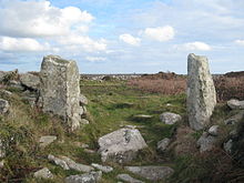 Entrance to Chûn Castle
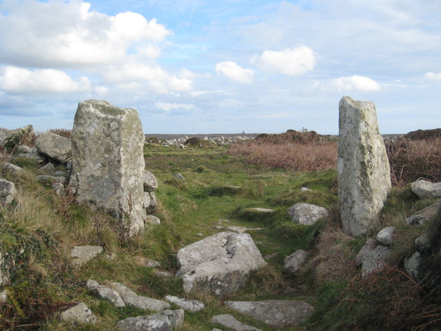
Chûn Castle is a large Iron Age hillfort near Penzance in Cornwall, United Kingdom.[1] The fort was built around two and a half thousand years ago, and fell into disuse until the 6th century AD when it was possibly reoccupied to protect the nearby tin mines. It stands beside a prehistoric trackway that used to be known as the Old St. Ives Road.
Contents
Description
Edward Lluyd made a plan of this fort in around 1700 remarking that its structure and security showed, 'military knowledge superior to that of any other works of this kind which I have seen in Cornwall'. What is of note is the fact that the fort has a strategic inner and outer wall and ditch. The remains today are still breathtaking despite the fact that the once twenty-feet-odd walls now stand at around five feet due to its use in the nineteenth century as a quarry for buildings in Penzance and Madron.
The fort was excavated in 1895, 1925, 1927 and 1930. Much pottery was uncovered, the earliest dating to the 4th century BC due to its similarity to known Breton pottery of that age. However, it is quite possible that the fort was built upon a much older structure. Chûn Quoit, twenty metres neighbouring, is dated to around 2400BC.
The purpose of the fort is speculated to be for protection of tin and copper gathered in the tin-rich locality of what is now Pendeen, with its famous Geevor Tin Mine, and surrounding villages. Iron and tin slags were found within the castle, near the well. However, the castle is located at the top of a moor and so easily spotted, which would not be a wise place to put a hoard of precious metal. It overlooks many miles of ocean, the Celtic Sea, to the north, and overlooks the only land route to this peninsula (west Penwith) to the south. Therefore not only its structure but its location suggest a much more actively militaristic function.
The well, within the inner walls, is of note as it once had a stairway leading to the water, water which remains to this day even during dry spells. Locals used the well water until the 1940s for domestic purposes and some for superstitious reasons, viz. the endowment of perpetual youth. Pagans still make pilgrimages to the site on religiously significant days.
It is believed that the fort fell into disuse around the first century AD but was reoccupied and modified several centuries later, until the 6th century. However, occupation may date to the later Roman period.
See also
References
- ^ Craig Weatherhill Cornovia: Ancient Sites of Cornwall & Scilly (Alison Hodge 1985; Halsgrove 1997, 2000)
External links
Categories:- Cornwall building and structure stubs
- Hill forts in Cornwall
- Military history of Cornwall
- Iron Age sites in Cornwall
Wikimedia Foundation. 2010.