- Mission Water Aerodrome
-
Mission Water Aerodrome IATA: none – ICAO: none – TC LID: CAY7Summary Airport type Private Operator Klahanie-Air Ltd. Location Mission, British Columbia Elevation AMSL 10 ft / 3 m Coordinates 49°08′N 122°18′W / 49.133°N 122.3°WCoordinates: 49°08′N 122°18′W / 49.133°N 122.3°W Map Location in British Columbia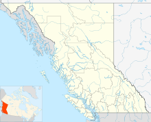
 CAY7
CAY7Runways Direction Length Surface ft m n/an/an/aWaterSource: Water Aerodrome Supplement[1] Mission Water Aerodrome,
(TC LID: CAY7), was located adjacent to Mission, British Columbia, Canada.References
- ^ Canada Flight Supplement's Water Aerodrome Supplement. Effective 0901Z 12 March 2009 to 0901Z 11 March 2010
Airports in Canada By name A–B · C–D · E–G · H–K · L–M · N–Q · R–S · T–ZBy location indicator CA · CB · CC · CD · CE · CF · CG · CH · CI · CJ · CK · CL · CM · CN · CO · CP · CR · CS · CT · CV · CW · CY · CZBy province/territory National Airports System Calgary · Charlottetown · Edmonton · Fredericton · Gander · Halifax · Iqaluit · Kelowna · London · Moncton · Montréal-Mirabel · Montréal-Trudeau · Ottawa · Prince George · Québec · Regina · Saint John · St. John's · Saskatoon · Thunder Bay · Toronto · Vancouver · Victoria · Whitehorse · Winnipeg · YellowknifeRelated List of airports by ICAO code: C · List of defunct airports in Canada · List of heliports in Canada · List of international airports in Canada · National Airports System · Operation Yellow Ribbon Category ·
  Portal ·
  WikiProjectCategories:
- Defunct airports in British Columbia
- Mission, British Columbia
- British Columbia airport stubs

Wikimedia Foundation. 2010.