- Port Noarlunga, South Australia
Infobox Australian Place | type = suburb
name = Port Noarlunga
city = Adelaide
state = sa
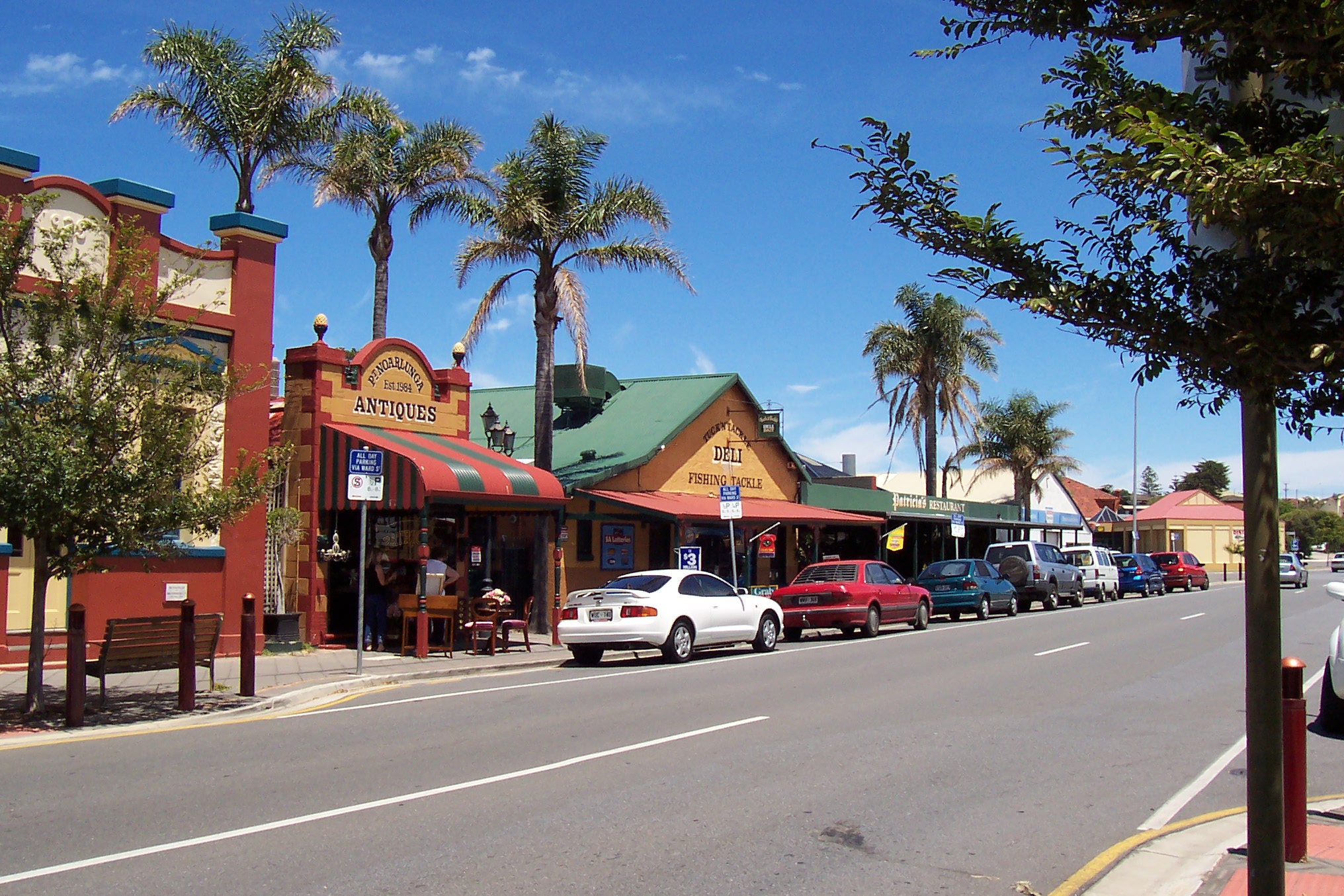
caption = The main street
lga =City of Onkaparinga
postcode = 5167
pop = 2 549 (2001 census) [Census 2001 AUS | id = SSC42336 | name = Port Noarlunga (State Suburb) | quick = on | accessdate = 2008-02-28]
est = 1859
area =
propval =
stategov =
fedgov =
near-nw =
near-n = Christies Beach
near-ne = Noarlunga Centre
near-w =
near-e = Noarlunga Downs
near-sw =
near-s = Port Noarlunga South
near-se = Seaford MeadowsPort Noarlunga is a
suburb in theCity of Onkaparinga ,South Australia . It is a small sea-side suburb, population 2,549, [Census 2001 AUS|id=SSC42336|name=Port Noarlunga (State Suburb)|accessdate=2007-06-30] about 30km to the south ofAdelaide and was originally created as a sea port. This area is now popular as a holiday destination or for permanent residents wishing to commute to Adelaide or work locally. There is ajetty that leads nearly all the way to one of South Australia's few natural reefs. The beach is large and very long and has reasonable surfing in the South Port area whose name is taken from its location - 'South of the Port' .The suburb is bounded to the south by the
Onkaparinga River , including a tidal estuary. It is bounded to the west by theGulf Saint Vincent and to the north and east by artificial boundaries.History
In pre-European times, this area along with most of the Adelaide plains was inhabited by the
Kaurna tribe.European settlement of this area began in 1839 and in 1841 the population was estimated to be about 150. The government town of Port Noarlunga was surveyed and offered for sale on 14 April 1859.Martella, L: "Port Noarlunga An Endearing Coastal Town". Lita Martella, 2000]
The township was originally settled as a port for the produce from the proposed market town of Noarlunga a few kilometres upstream. The Onkaparinga River mouth proved unsuitable to coastal ketches, so produce was barged down river to the sandhills and then taken by horse drawn rail trucks to the jetty. The current jetty was constructed in 1921 and is the second jetty to have been constructed on that site. The original jetty, 30 metres south of the current jetty, was constructed in 1855, but was destroyed in several severe storms in the early 1900s.
In the early 20th century Port Noarlunga was a popular coastal holiday destination, with the beach proving an attraction with its natural beauty and in summer amusement fairs were run, as well as row boating on the river estuary.
With the gradual incursion of
urban sprawl , and in particular immigration-fuelled expansion in the 1960s and 1970's, the township eventually became an outer suburb of Adelaide. TheSouth Australian Housing Trust in particular developed housing in the nearby areas of Christies Beach and O'Sullivan Beach and with the extension of the metropolitan rail line to adjacent Noarlunga Centre in 1978 the township of Port Noarlunga had largely lost its attraction as a holiday destination.It is now largely occupied by permanent residents, although it still retains much of its early village charm. The City of Onkaparinga council has assisted with maintaining this spirit of the old township, working with the State government in the late 1990s to divert through road traffic around the town centre.
Attractions
The beach and the jetty are obviously the biggest attractions to visitors. The close proximity of a diverse range of aquatic features making this area stand out from other coastal locations. A narrow reef about 400 metres offshore is approximately 1.6km long and was formed from a consolidated
Pleistocene sand dune. The reef runs parallel to shore and has two sections, with the area separating them called The Gap.There is also a small main street (Gawler Street) that serves visitors and locals in this beach area. It has several cafes, a pub, a fish and chip shop, a surf shop and several other businesses providing services to the locals. The old "Institute" building, built in 1924, is now the community centre.
Onkaparinga Aquatic Reserve/Underwater Trail
The Port Noarlunga Reef and Onkaparinga Estuary Aquatic Reserve was the first proclaimed reef reserve in South Australia, being established in 1971 to protect the reef life and adjacent river estuary. The boundaries of the reserve were extended in 1993 to include the adjacent limestone reef of Horseshoe Reef at Christies Beach. Fishing is a popular activity from the jetty, however the reserve places a`non-fishing’ area on North Reef within 100m of reef
It is a popular
scuba diving location, with more than 200 marine plant species and over 60 fish species. There is a self guided diving trail which was established in 1994, which is marked with a series of 12 glass plaques. The plaques indicate aspects of the reef ecosystem relevant to their location. [http://www.sardi.sa.gov.au/pages/fisheries/sas/postgrad/ptnoarlunga.htm]Port Noarlunga Aquatic Centre
Since 1976 the Port Noarlunga Aquatic Centre has operated classes for primary school children from throughout the state. The program runs in the first and last school terms each year and provides the opportunity to try waveskiing, canoeing, fishing, snorkelling, sailing, swimming and sailboarding. About 15,000 students have access to this program each year.
Onkaparinga Community Playground
In the south of the suburb there is a large community playground. This is a community built playground and as such is unique to South Australia. AU$250 000 was raised from community sponsorship before the playground was built using community labour over the period of 18-
23 June 2002 . This project began after research by "Living Neighbourhood" in nearby Christies Beach. There was a public meeting, after which a non-profit incorporated body was formed for the project.Notes
References
*cite book |last=Martella |first=Lita |authorlink= |title=Port Noarlunga An Endearing Coastal Town |year= |publisher= Lita Martella |location= Australia |isbn=0-646-40222-6
* [http://www.users.bigpond.com/sch57/portnoarlunga/portnorfront.html Port Noarlunga]
* [http://www.sardi.sa.gov.au/pages/fisheries/sas/postgrad/ptnoarlunga.htm Port Noarlunga Reef Underwater Trail]
* [http://www.environment.sa.gov.au/coasts/pdfs/onka_info_pack.pdf Onkaparinga Estuary Information Package]
* [http://www.postcards.sa.com.au/features/pt_noarlunga.html Postcards profile]
* [http://users.senet.com.au/~ocp/ Onkaparinga Community Playground]
Wikimedia Foundation. 2010.