- Morton (SEPTA station)
-
Coordinates: 39°54′28″N 75°19′42″W / 39.907904°N 75.328356°W
Morton
SEPTA regional rail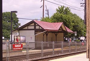
Passenger shelter across from Morton StationStation statistics Address 1 Yale Avenue & Morton Road
Morton, PA 19070Lines Media/Elwyn LineConnections SEPTA Suburban Bus: 107 Platforms 2 side platforms Tracks 2 Parking 252 Free/30 with Permits Bicycle facilities Yes (2 racks) Other information Opened 1867 Rebuilt 1880 Electrified 1928 Accessible 
Fare zone 2 Formerly Morton-Rutledge Services Preceding station SEPTA Following station toward ElwynMedia/Elwyn Line toward Temple UniversityMorton, also known as Morton-Rutledge, is a station along the SEPTA Regional Rail Media/Elwyn Line, the former Pennsylvania Railroad West Chester Line. It is located at Yale & Morton Avenues west of PA 420 in Morton, PA 19070. The south, in-bound platform of the station is in Morton Borough while the north, out-bound side is in Springfield Township.[1] Both dollar-a-day and permit parking are available.
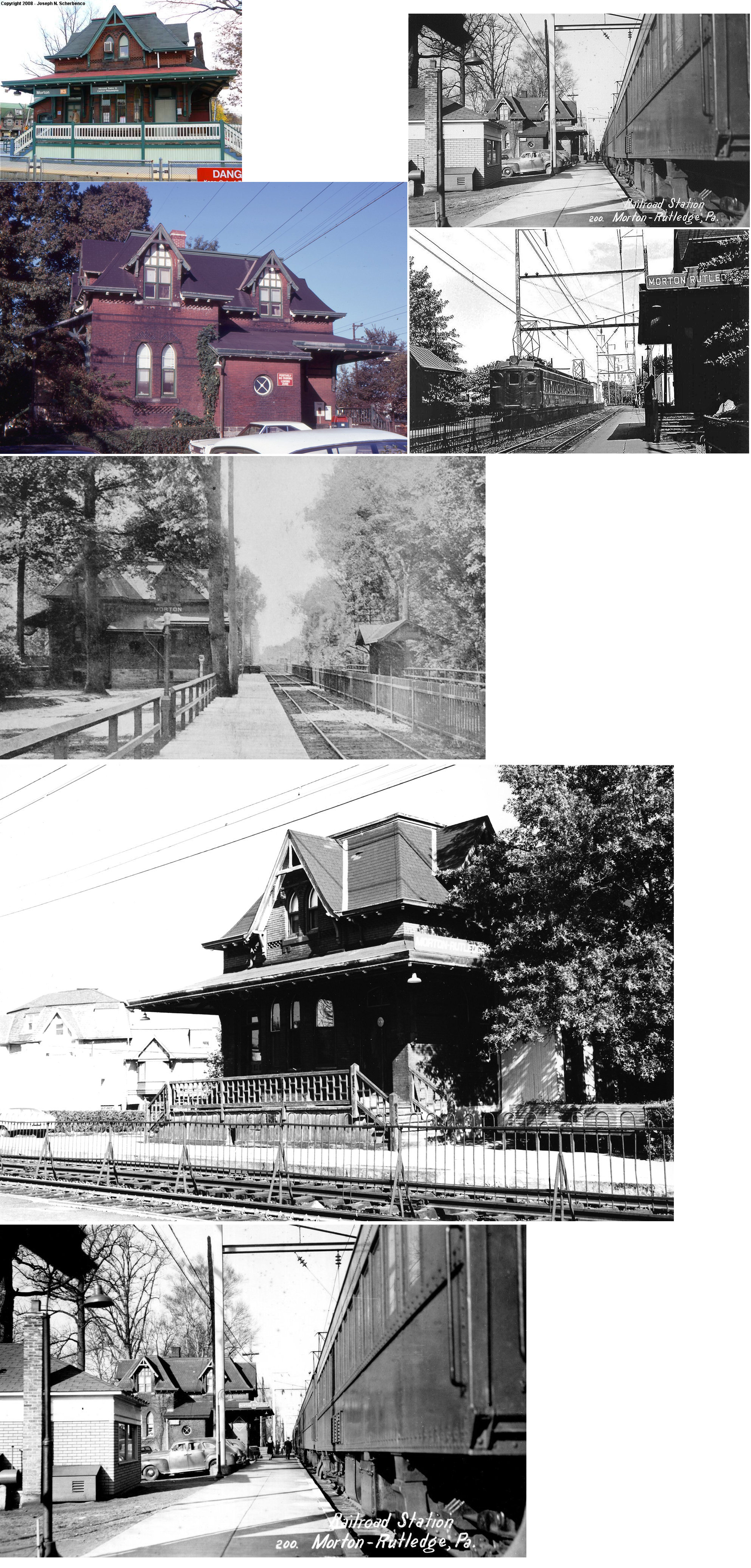
Morton Station was originally built in 1867 for the West Chester and Philadelphia Railroad. It was rebuilt in 1880 by architect Joseph Wilson of the Wilson Brothers architectural firm (although some have mistakenly credited the building to Frank Furness) for the Pennsylvania Railroad.[2] The second station is believed to have been designed in a manner similar to that of Glen Mills (PRR station), which is now owned by the West Chester Railroad. In 1892, PRR added a westbound passenger shelter. A former freight house built in 1879 exists 50 feet west of the station house, both of which are maintained by the Morton Station Preservation Committee.[3][4]
On May 28, 2009, Septa approved a $2.6 million dollar rehabilitation effort for Morton Station.[5]
References
External links
- SEPTA – Morton Station
- Original Morton PRR Station
- Station from Woodland Avenue/Morton Avenue from Google Maps Street View
Categories:- SEPTA Regional Rail stations
- Stations along Philadelphia, Baltimore and Washington Railroad lines
- Pennsylvania railway station stubs
- SEPTA stubs

Wikimedia Foundation. 2010.