- New Liskeard Airport
-
New Liskeard Airport IATA: none – ICAO: none – TC LID: CPX3Summary Airport type Private Operator J.A. Rundle Location New Liskeard, Ontario Elevation AMSL 800 ft / 244 m Coordinates 47°32′N 079°37′W / 47.533°N 79.617°WCoordinates: 47°32′N 079°37′W / 47.533°N 79.617°W Map Location in Ontario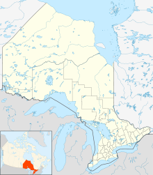
 CPX3
CPX3Runways Direction Length Surface ft m 10/282,745837TurfSource: Canada Flight Supplement[1] New Liskeard Airport,
(TC LID: CPX3), was a small privately owned airstrip near New Liskeard, Ontario, Canada.References
- ^ Canada Flight Supplement. Effective 0901Z 20 October 2011 to 0901Z 15 December 2011
Airports in Canada By name A–B · C–D · E–G · H–K · L–M · N–Q · R–S · T–ZBy location indicator CA · CB · CC · CD · CE · CF · CG · CH · CI · CJ · CK · CL · CM · CN · CO · CP · CR · CS · CT · CV · CW · CY · CZBy province/territory National Airports System Calgary · Charlottetown · Edmonton · Fredericton · Gander · Halifax · Iqaluit · Kelowna · London · Moncton · Montréal-Mirabel · Montréal-Trudeau · Ottawa · Prince George · Québec · Regina · Saint John · St. John's · Saskatoon · Thunder Bay · Toronto · Vancouver · Victoria · Whitehorse · Winnipeg · YellowknifeRelated List of airports by ICAO code: C · List of defunct airports in Canada · List of heliports in Canada · List of international airports in Canada · National Airports System · Operation Yellow RibbonCategories:- Defunct airports in Ontario
- Transportation in Timiskaming District, Ontario
- Temiskaming Shores
- Ontario airport stubs

Wikimedia Foundation. 2010.