- Connecticut Route 3
-
"CT 3" redirects here. For the congressional district, see Connecticut's 3rd congressional district.For the Route 3 that existed in the 1920s, see U.S. Route 6 (Connecticut).
Route 3

Route information Maintained by ConnDOT Length: 14.48 mi (23.30 km) Existed: 1941 (extended 1991) – present Major junctions South end:  Route 66 in Middletown
 I-91 in Wethersfield
North end:  Route 2 at the Glastonbury-East Hartford town line
Highway system Routes in Connecticut
Special Service Roads • State Roads←  Route 2A
Route 4  →
→Route 3 is a 14.48-mile (23.30 km) long route connecting Middletown to the Glastonbury-East Hartford town line. It passes through the towns of Cromwell, Rocky Hill, Wethersfield, and Glastonbury. The northernmost 3 miles (4.8 km) of Route 3 is an expressway that was originally intended for the cancelled Interstate 491.
Contents
Route description
Route 3 begins at Route 66 in Middletown. It is a secondary, minor arterial road from Middletown up to its interchange with Interstate 91 in Wethersfield. It crosses, but does not have a direct interchange with the Route 9 freeway in Cromwell (access is via Route 372) and with Interstate 91 in Rocky Hill. The last 3.5 miles (5.6 km) of Route 3 from the Interstate 91 interchange in Wethersfield to East Hartford is freeway. Then Route 3 freeway crosses the Connecticut River on the William H. Putnam Memorial Bridge from Wethersfield into Glastonbury. The freeway has one intermediate exit into Glastonbury. Route 3 ends at an interchange with the Route 2 freeway just after crossing into East Hartford. The last 0.75 miles (1.21 km) of Route 3 is the merging ramp from Route 3 northbound to Route 2 westbound.
Special designations
Route 3 through the town of Rocky Hill is also known as the Disabled American Veterans Memorial Highway.
History
Route 3 was established in 1941. It originally ran from West Street/Berlin Road in Cromwell, which was part of Route 72 at the time (now Route 372), to the Silas Deane Highway (Route 99) in Wethersfield.
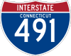
In late 1958, as part of the planned Interstate 491 (a southeastern bypass of Hartford), a freeway from I-91 to Route 2, crossing the Connecticut River on the Putnam Memorial Bridge, was opened. The Route 3 designation was temporarily extended along this freeway pending completion of I-491. In 1973, I-491 was cancelled due to local opposition and the Route 3 designation along this freeway segment became permanent.
In 1991, when the Route 9 freeway through Berlin and New Britain was completed, Route 72 was truncated to end at Route 9 in New Britain. The east–west portion of the old alignment of Route 72 was reassigned to an extended Route 372 (running along Berlin Road/West Street to end at Route 99 in Cromwell). The north–south portion of old Route 72 from Cromwell to Middletown (ending at Route 66) was reassigned to Route 3.
Junction list
Town Mile Destinations Notes Middletown 0.00 Route 66Cromwell 3.37 
 Route 372 to Route 9
Rocky Hill 6.59 SSR 411 (West St) To I-917.40  Route 160
Wethersfield 10.21  Route 287
10.37  Route 99
10.99 Elm Street At-grade intersection
Begin Expressway11.28 I-91 – Hartford, New HavenNo direct access Route 3 North to I-91 South Putnam Bridge (Connecticut River crossing) Glastonbury 13.1 Main Street – Glastonbury 13.68 Route 2 – East Hartford, ColchesterReferences
Coordinates: 41°37′58″N 72°40′35″W / 41.632894°N 72.676277°W
External Links
Categories:- State highways in Connecticut
- Transportation in Hartford County, Connecticut
- Transportation in Middlesex County, Connecticut


Wikimedia Foundation. 2010.