- Döbeln (district)
-
Döbeln — District — 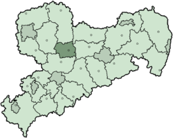
Country  Germany
State Saxony Adm. region Leipzig Disbanded 2008-08-01 Capital Döbeln Area – Total 424 km2 (163.7 sq mi) Population (2001) – Total 77,900 – Density 183.7/km2 (475.8/sq mi) Time zone CET (UTC+1) – Summer (DST) CEST (UTC+2) Vehicle registration DL Website landkreis-doebeln.de Döbeln is a former district in the Free State of Saxony, Germany. It was bounded by (from the north and clockwise) the districts of Torgau-Oschatz, Riesa-Großenhain, Meißen, Mittweida and Muldentalkreis.
Contents
History
The region was originally populated by Sorbic peoples. In the early Middle Ages, the Daleminzian people settled along this section of the Mulde River. They were driven away by Germans after the Battle of Jahna in 928.
The present borders of the district were established in 1952, when the government of East Germany formed the new districts. Döbeln is one of the few districts which have not been changed after the German reunification. In August 2008, as a part of the district reform in Saxony, the districts of Döbeln, Freiberg and Mittweida were merged into the new district Mittelsachsen.
Geography
The district was located on the banks of the Freiberger Mulde in the triangle between the cities of Dresden, Leipzig and Chemnitz.
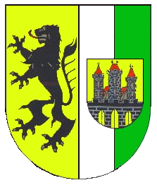
Coat of arms
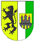
The lion is the heraldic animal of Saxony. Green and white are the colours of the flag of Saxony. The shield on the right side displays the arms of the city of Döbeln. Towns and municipalities
Towns Municipalities External links
- Official website (German)
 Urban and rural districts in the Free State of Saxony in Germany
Urban districts Rural districts Former urban districts Former rural districts Annaberg · Aue-Schwarzenberg · Chemnitzer Land · Delitzsch · Döbeln · Freiberg · Kamenz · Leipziger Land · Löbau-Zittau · Mittlerer Erzgebirgskreis · Mittweida · Muldentalkreis · Niederschlesischer Oberlausitzkreis · Riesa-Großenhain · Sächsische Schweiz · Stollberg · Torgau-Oschatz · Weißeritzkreis · Zwickauer Land Categories:
- Former districts of Saxony

Wikimedia Foundation. 2010.