- California State Route 185
Infobox road
state=CA
type=SR
route=185
section=377 and 485
maint=Caltrans 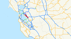
length_mi=10.826
length_ref=
length_round=3
established=1964 renumbering [ [http://cahighways.org/185-192.html#185 California Highways: State Route 185] ]
direction_a=South
terminus_a=jct|state=CA|SR|92|SR|238 in Hayward
direction_b=North
terminus_b=jct|state=CA|I|880 in Oakland
previous_type=SR
previous_route=184
next_type=SR
next_route=186
browse=ca browse
previous_type=SR
previous_route=76
route=
next_type=SR
next_route=78State Route 185 is a
state highway in theSan Francisco Bay Area of theU.S. state ofCalifornia . It runs along sections of Mission Boulevard in Hayward, East 14th Street in San Leandro and International Boulevard in Oakland. ("see below")The south end of SR 185 is a five-way intersection in downtown Hayward, with E Street heading northeast, State Route 92 heading southwest, and State Route 238 heading southeast and north. SR 185 heads northwest on Mission Boulevard and East 14th Street, crossing under Interstate 238, and meeting the east end of State Route 112 (signed as State Route 61) in downtown San Leandro. SR 185 ends just northwest of High Street in Oakland at 42nd Avenue, where the short State Route 77
freeway heads southwest to Interstate 880. However, SR 77 is signed as part of SR 185, so SR 185 is signed to end at I-880.The .45-mile (.72 km) State Route 77 is part of a planned 13.8-mile (22.2 km) route, which would run from I-880 northeast past SR 185 to Interstate 580 near High Street. There it would turn northwest on I-580 to around Park Boulevard, splitting there to head northeast and north to State Route 24 near Lafayette. [http://www.dot.ca.gov/hq/tsip/HSEB/products/state_highway_routes_selected_information_1995_revised.pdf State Highway Routes, Selected Information - 1994 with 1995 Revisions] (
PDF )] Only the part east of unbuilt State Route 93 west of Moraga is part of theCalifornia Freeway and Expressway System ; this does not include the constructed part, which is built as a shortfreeway .SR 185 traverses a once-deadly stretch of what was then called East 14th Street in East Oakland. For years throughout the 1980s to today it was a scene of prostitution, drug dealings and murders, causing a negative synonomity in that part of Oakland. Thus in 1996 the city council changed the name to International Boulevard, including the portion maintained by the city between
Lake Merritt and 42nd Street and the one under SR 185's designation. Eventually the red light reputation continued untilCalifornia Highway Patrol stepped in years later (SR 185 counts as CHP jurisdiction) to curtail crime.Major intersections
:"Note: Except where prefixed with a letter,
postmile s were measured in 1964, based on the alignment as it existed at that time, and do not necessarily reflect current mileage. The entire route is in Alameda County."References

Wikimedia Foundation. 2010.