- Mississippi Highway 172
-
MS Highway 172
Route information Maintained by MDOT Length: 12.074 mi[1] (19.431 km) Major junctions West end:  US 72 near Burnsville
 MS 25 in Iuka
East end: US 72 near OldhamLocation Counties: Tishomingo Highway system Numbered highways in Mississippi
Interstates • U.S. Routes • State highways
Unsigned state highways←  MS 161
MS 178  →
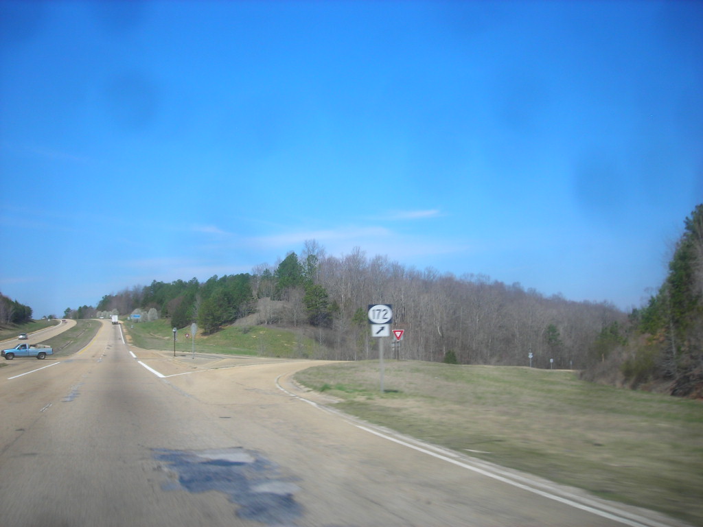
→Mississippi Highway 172 (MS 172) is a state highway located in Tishomingo County, Mississippi. The route runs 12.074 mi (19.431 km) from U.S. Route 72 (US 72) near Burnsville east to US 72 near Oldham, just west of the Alabama border. The route is a two-lane undivided road its entire length and runs mostly through wooded areas. It also passes through the town of Iuka, where it has an intersection with MS 25.
What is now MS 172 was originally designated as part of the Lee Highway auto trail in 1920 before becoming part of US 72 when the U.S. Highway System was created in 1926. The route was briefly US 78 before being redesignated US 72 by 1932. The route was fully paved by the end of the 1930s and served as a part of US 72 until 1986, when a new divided highway was built to the south. By 1998, the former routing of US 72 was designated MS 172.
Contents
Route description
 MS 172 shield along westbound US 72 at eastern terminus
MS 172 begins at an intersection with US 72 near Burnsville in the western part of Tishomingo County.[2] The route heads to the north of US 72 as a two-lane undivided road before soon turning east-southeast at an intersection with County Road 982. From this point, the road heads through woodland with some residential and commercial development. Further east, the surroundings become more agricultural before MS 172 enters a dense forest.[3] Several miles later, the route turns more east and the surroundings become more developed as it becomes Quitman Street and reaches an intersection with MS 25 on the western edge of Iuka.[2][3]
Past MS 25, MS 172 passes several businesses in Iuka as it comes to the MS 25 Business junction. The route continues east through wooded residential neighborhoods prior to making a turn to the southeast.[3] At this point, residential development along MS 172 decreases as it leaves Iuka and heads back into forests as an unnamed road, running a short distance to the southwest of a Norfolk Southern railroad line. Further southeast, the route draws closer to US 72 and curves to the east, passing a few fields. MS 172 makes a sharp turn south away from the railroad tracks and comes to its eastern terminus at US 72 immediately west of the Alabama border near Oldham.[2][3] MS 172 is legally defined in Mississippi Code § 65-3-3.[4]
History
What is now MS 172 was originally designated as a part of the Lee Highway, an auto trail that connected Washington, D.C. with San Diego, in 1920.[5] With the establishment of the U.S. Highway System in 1926, this route was initially designated as part of US 72, a U.S. route that was to run from Memphis, Tennessee east to Chattanooga, Tennessee.[6] However, the route was instead designated as part of US 78 by 1928, at which time it was a gravel road.[7] By 1932, US 72 and US 78 switched routes in Mississippi, with the present-day alignment of MS 172 again becoming part of US 72 as initially planned in 1926.[8] In 1935, the road was paved to the east of Iuka.[9] The paved portion was extended slightly west of Iuka in 1936 and further west by 1938.[10][11] By 1939, the section of US 72 that would be redesignated as MS 172 was fully paved.[12] In 1986, US 72 was moved to a new divided highway alignment to the south through Tishomingo County.[13] By 1998, MS 172 was marked on the former two-lane alignment of US 72 in Tishomingo County.[14]
Major intersections
The entire route is in Tishomingo County.
Location Mile[1] Road Notes Burnsville 0.000 US 72Western terminus Iuka MS 25 (Veterans Memorial Drive)
MS 25 Bus. (Battleground Drive)Oldham 12.074 US 72Eastern terminus References
- ^ a b "Mississippi Public Roads Selected Statistics" (PDF). Mississippi Department of Transportation. 2008. http://www.gomdot.com/Divisions/IntermodalPlanning/Resources/Planning/pdf/HighwayStats.pdf. Retrieved 2010-06-03.
- ^ a b c Mississippi Department of Transportation (2008). Official Highway Map of Mississippi (Map). http://www.gomdot.com/Divisions/IntermodalPlanning/Resources/Maps/pdf/StateHighwayMapsArchive/HWY%20Map%202008%20Front.pdf. Retrieved 2010-06-03.
- ^ a b c d Google, Inc. Google Maps – overview of Mississippi Highway 172 (Map). Cartography by Google, Inc. http://maps.google.com/maps?f=d&source=s_d&saddr=US+72+and+MS+172+burnsville,+ms&daddr=34.80848,-88.18703+to:US+72+and+MS+172+oldham,+ms&hl=en&geocode=FateEwIdbLW8-imXYJJxQ5h9iDH_Y3Q4bIJxTw%3BFaAiEwIdal---inXez2MtZ99iDEzzfyAdxtEEg%3BFSZ_EgId_3S_-ikt_wtBJHR9iDFTUba9ZGjRqQ&mra=dpe&mrcr=0&mrsp=1&sz=12&via=1&sll=34.796043,-88.206139&sspn=0.148014,0.308647&ie=UTF8&t=h&z=12. Retrieved 2010-06-03.
- ^ Mississippi Code Of 1972 As Amended - SEC. 65-3-3. State highways designated., Mississippi Legislature, http://www.mscode.com/free/statutes/65/003/0003.htm, retrieved 2010-06-03
- ^ Weingroff, Richard F.. "Dr. S. M. Johnson - A Dreamer of Dreams". Federal Highway Administration. http://www.fhwa.dot.gov/infrastructure/johnson.cfm. Retrieved 2010-06-03.
- ^ Bureau of Public Roads (1926). United States System of Highways (Map). http://en.wikipedia.org/wiki/Image:1926us.jpg. Retrieved 2009-04-27.
- ^ Mississippi State Highway Department (1928). Condition Map of State Highway System (Map). http://www.gomdot.com/Divisions/IntermodalPlanning/Resources/Maps/pdf/StateHighwayMapsArchive/HWY%20Map%201928%20State%20Highway%20Map.pdf. Retrieved 2010-06-03.
- ^ Mississippi State Highway Department (1932). Road Map of Mississippi (Map). http://www.gomdot.com/Divisions/IntermodalPlanning/Resources/Maps/pdf/StateHighwayMapsArchive/HWY%20Map%201932%20Road%20Map%20of%20MS.pdf. Retrieved 2010-06-03.
- ^ Mississippi State Highway Department (1935). Road Map of Mississippi (Map). http://www.gomdot.com/Divisions/IntermodalPlanning/Resources/Maps/pdf/StateHighwayMapsArchive/HWY%20Map%201935%20Road%20Map%20of%20MS.pdf. Retrieved 2010-06-03.
- ^ Mississippi State Highway Department (1936). Road Map of Mississippi (Map). http://www.gomdot.com/Divisions/IntermodalPlanning/Resources/Maps/pdf/StateHighwayMapsArchive/HWY%20Map%201936%20Road%20Map%20of%20MS.pdf. Retrieved 2010-06-03.
- ^ Mississippi State Highway Department (1938). Road Map of Mississippi (Map). http://www.gomdot.com/Divisions/IntermodalPlanning/Resources/Maps/pdf/StateHighwayMapsArchive/HWY%20Map%201938%20Road%20Map%20of%20MS.pdf. Retrieved 2010-06-03.
- ^ Mississippi State Highway Commission (1939). Official Highway Map State of Mississippi (Map). http://www.gomdot.com/Divisions/IntermodalPlanning/Resources/Maps/pdf/StateHighwayMapsArchive/HWY%20Map%201939%20January%20Front.pdf. Retrieved 2010-06-03.
- ^ Mississippi Highway Department (1986). Official Highway Map of Mississippi (Map). http://www.gomdot.com/Divisions/IntermodalPlanning/Resources/Maps/pdf/StateHighwayMapsArchive/HWY%20Map%201986%20Front.pdf. Retrieved 2010-06-03.
- ^ Mississippi Department of Transportation (1998). Official Highway Map of Mississippi (Map). http://www.gomdot.com/Divisions/IntermodalPlanning/Resources/Maps/pdf/StateHighwayMapsArchive/HWY%20Map%201998%20Front.pdf. Retrieved 2010-06-03.
External links
Categories:- State highways in Mississippi
- Tishomingo County, Mississippi

Wikimedia Foundation. 2010.