- Deir el Qamar
-
Deir el Qamar
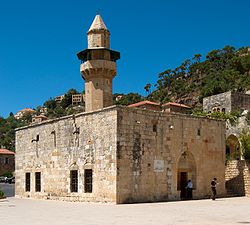
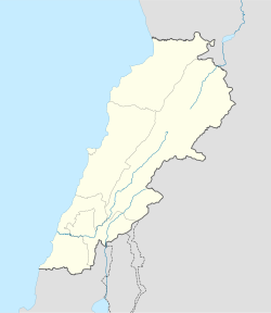
دير القمر— City — Fakhreddine Mosque Location within Lebanon Coordinates: 33°42′N 35°34′E / 33.7°N 35.567°ECoordinates: 33°42′N 35°34′E / 33.7°N 35.567°E Country  Lebanon
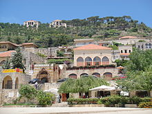
Governorate Mount Lebanon Governorate District Chouf District Time zone EET (UTC+2) – Summer (DST) EEST (UTC+3) Postal code Dialing code +961 Deir el Qamar (in Arabic دير القمر, meaning "Monastery of the Moon") is a village in south-central Lebanon, five kilometres outside of Beiteddine, consisting of stone houses with red-tiled roofs. During the 16th to 18th centuries, Deir el Qamar was the residence of the governors of Lebanon. It is also notable for its 15th century Fakhreddine Mosque, Fakhreddine II Palace, and other historical palaces and administrative buildings. The 17th century Deir el Qamar Synagogue is also in the village, although closed to the public. During its peak, the city was the centre of Lebanese literary tradition. It was the first village in Lebanon to have a municipality in 1864, and it is the birthplace of many well known personalities, such as artists, writers, and politicians. It was the capital of the Druze Cancimat of Lebanon (1840-1860).
See also
References
External links
- Deir el Qamar Website
- Deir el Qamar Festival
- Art Site at Deir el qamar
- Photographs of the village
- photography site DEIR AL QAMAR
Categories:- Lebanon geography stubs
- Populated places in the Mount Lebanon Governorate
- Chouf District
- Tourism in Lebanon
- Visitor attractions in Lebanon
Wikimedia Foundation. 2010.


