- 1991 Pacific typhoon season
Infobox hurricane season
Basin=WPac
Year=1991
Track=1991 Pacific typhoon season summary.jpg
First storm formed=March 5 ,1991
Last storm dissipated=December 5 , 1991
Strongest storm name=Yuri
Strongest storm pressure=885
Strongest storm winds=150
Total depressions=31
Total storms=29
Total hurricanes=20
Total intense=5
five seasons=1989, 1990, 1991, 1992, 1993The 1991 Pacific typhoon season has no official bounds; it ran year-round in 1991, but mosttropical cyclones tend to form in the northwesternPacific Ocean between May and November. [Gary Padgett. [http://www.typhoon2000.ph/garyp_mgtcs/may03sum.txt May 2003 Tropical Cyclone Summary.] Retrieved2006-08-26 .] These dates conventionally delimit the period of each year when most tropical cyclones form in the northwesternPacific Ocean .The scope of this article is limited to the Pacific Ocean, north of the equator and west of the
international date line . Storms that form east of the date line and north of the equator are called hurricanes; see1991 Pacific hurricane season . Tropical Storms formed in the entire west pacific basin were assigned a name by theJoint Typhoon Warning Center . Tropical depressions in this basin have the "W" suffix added to their number. Tropical depressions that enter or form in the Philippine area of responsibility are assigned a name by thePhilippine Atmospheric, Geophysical and Astronomical Services Administration or PAGASA. This can often result in the same storm having two names.torms
31 tropical cyclones formed this year in the Western Pacific, of which 29 became tropical storms. 20 storms reached typhoon intensity, of which 5 reached super typhoon strength.
Tropical Storm Sharon (Auring)
Infobox Hurricane Small
Basin=WPac
Formed=March 5
Dissipated=March 14
1-min winds=60
Pressure=980Typhoon Tim
Infobox Hurricane Small
Basin=WPac
Formed=March 21
Dissipated=March 25
1-min winds=70
Pressure=972Tropical Storm Vanessa (Bebeng)
Infobox Hurricane Small
Basin=WPac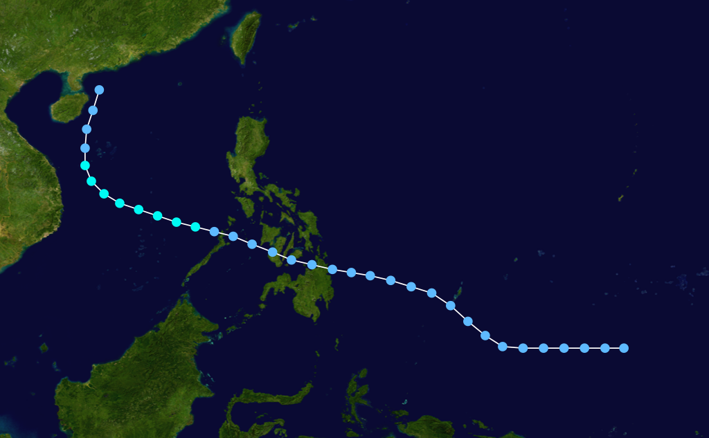
Formed=April 23
Dissipated=April 28
1-min winds=45
Pressure=991uper Typhoon Walt (Karing)
Infobox Hurricane Small
Basin=WPac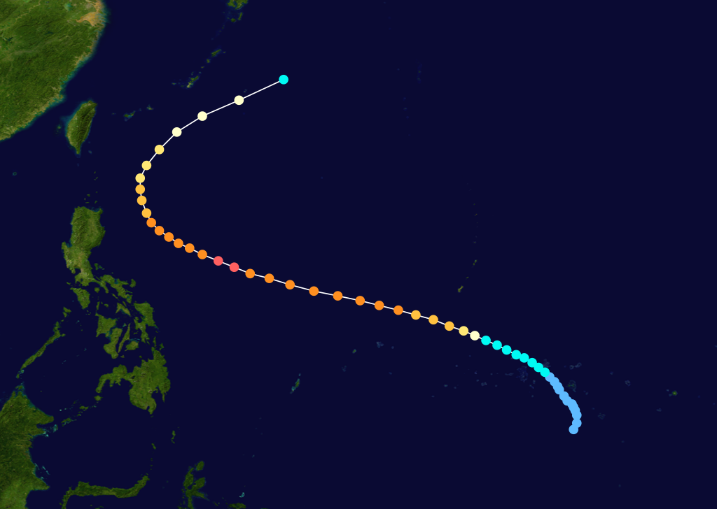
Formed=May 6
Dissipated=May 16
1-min winds=140
Pressure=898Typhoon Yunya (Diding)
Infobox Hurricane Small
Basin=WPac
Track=Yunya 1991 track.pngJune 11
Dissipated=June 17
1-min winds=105
Pressure=938Philippines and south of the Tropical Upper Tropospheric Trough onJune 11 . Located in an area of little wind shear, it headed northwestward, developing spiral-band outflow and becoming a tropical storm on the 12th. As a smallcentral dense overcast (CDO) developed over Yunya, it rapidly developed, becoming a typhoon on the 13th as it paralleled the eastern Philippines. The mid-level ridge forced Yunya westward, where it briefly reached a peak intensity of 120mph (195km/h ) winds on the 14th. Subsequently, the eastward building of the subtropical ridge produced unfavorable vertical wind shear that weakened Yunya to a minimal typhoon before hittingDingalan Bay ,Luzon early on the 15th. Yunya left Luzon as a minimal tropical storm atLingayen Gulf . It turned northward due to a break in the ridge, and dissipated on the 17th near southern Taiwan due to the vertical shear.Yunya would normally have been an uneventful cyclone, but on the day it hit Luzon, the colossal eruption of
Mount Pinatubo took place. The ash cloud that normally would have been dispersed across the oceans was redistributed over Luzon by the cyclonic winds of the typhoon, greatly exacerbating the damage caused by the eruption. The water-laden ash fell over the evacuatedClark Air Base , as well as the rest of Luzon, resulting in downed power lines and the collapse of flat-roofed buildings. In some areas it was practically raining mud.Yunya exited Luzon through the
Lingayen Gulf as a weak tropical storm and then turned north toward a break in the subtropical ridge. The system continued to weaken due to the strong vertical wind shear. It then brushed the southern coast ofTaiwan as a tropical depression and finally dissipated before it could complete full recurvature into the mid-latitude westerlies. Yunya directly caused one death from the flooding and heavy rainfall it left. [Joint Typhoon Warning Center. [http://metocph.nmci.navy.mil/jtwc/atcr/1991atcr/pdf/wnp/05w.pdf Typhoon Yunya.] Retrieved on2006-01-10 .]Typhoon Zeke (Etang)
Infobox Hurricane Small
Basin=WPac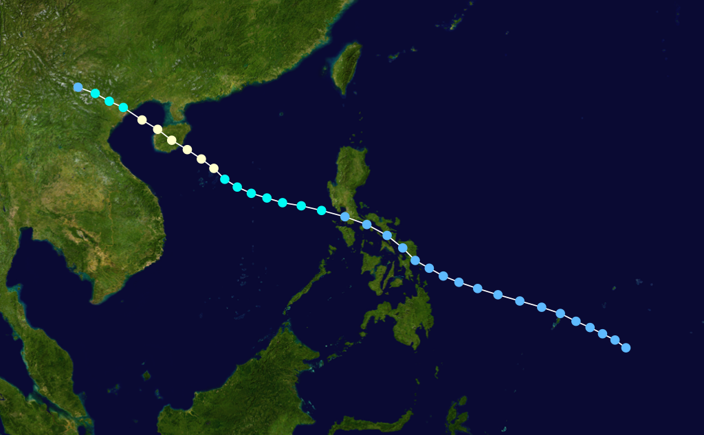
Formed=July 9
Dissipated=July 14
1-min winds=80
Pressure=963Typhoon Amy (Gening)
Infobox Hurricane Small
Basin=WPac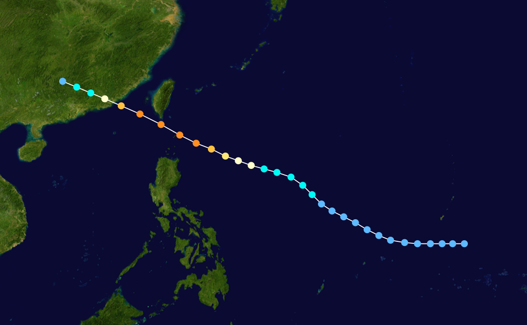
Formed=July 15
Dissipated=July 20
1-min winds=125
Pressure=916Typhoon Brendan (Helming)
Infobox Hurricane Small
Basin=WPac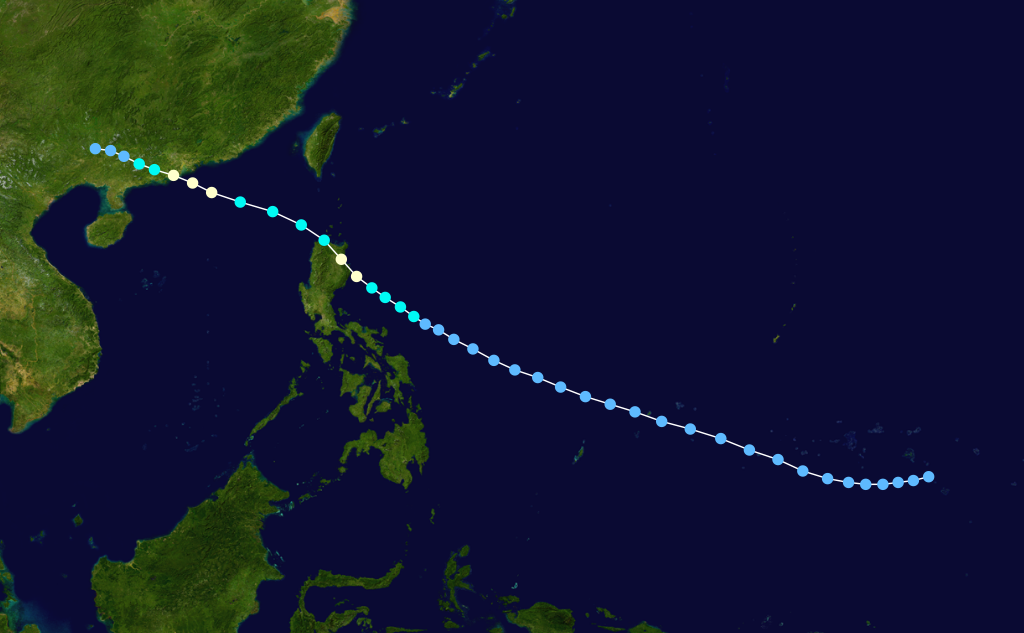
Formed=July 21
Dissipated=July 24
1-min winds=70
Pressure=972Typhoon Caitlin
Infobox Hurricane Small
Basin=WPac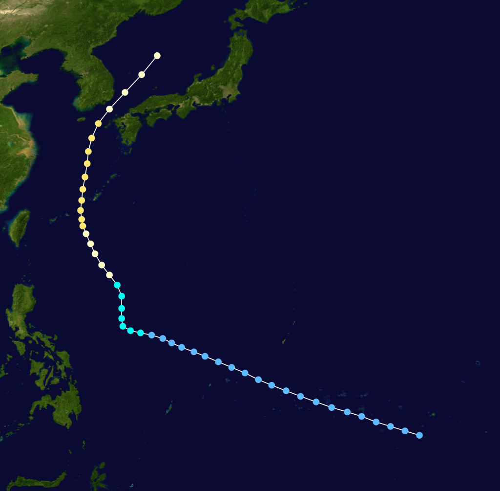
Formed=July 24
Dissipated=July 30
1-min winds=95
Pressure=949Typhoon Caitlin developed from a disturbance in the easternCaroline Islands . A tropical depression formed on July 23th as the system moved towards the northwest. Tropical Storm Caitlin was named the on the 24th and was upgraded to a typhoon the next day. Typhoon Caitlin though several hundred miles away increased the monsoonal flow over thePhilippines . Heavy rains caused landslides in theMt. Pinatubo region killing 16 people. As Caitlin turned to the north the storm passed convert|60|mi|km to the west ofKadena AB ,Okinawa at peak intensity of 110 mph.. The heavy rains from Caitlin helped to relieve the ongoing drought on the island, one death was reported. Typhoon Caitlin then began to accelerate northwards and passed through theKorea Strait before turning extratropical in theSea of Japan . Heavy flooding inSouth Korea killed 2 people and caused $4 million in damage. [Joint Typhoon Warning Center. [https://metocph.nmci.navy.mil/jtwc/atcr/1991atcr/pdf/chapter3.pdf] Retrieved on2007-12-26 .]Tropical Storm Doug
Infobox Hurricane Small
Basin=WPac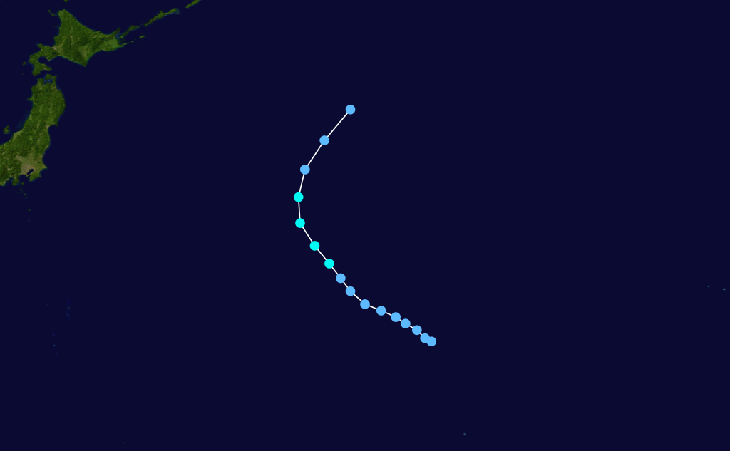
Formed=August 8
Dissipated=August 11
1-min winds=35
Pressure=997Typhoon Ellie
Infobox Hurricane Small
Basin=WPac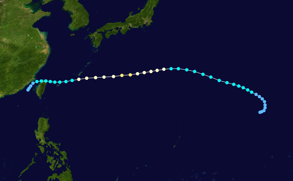
Formed=August 10
Dissipated=August 19
1-min winds=85
Pressure=958Typhoon Fred
Infobox Hurricane Small
Basin=WPac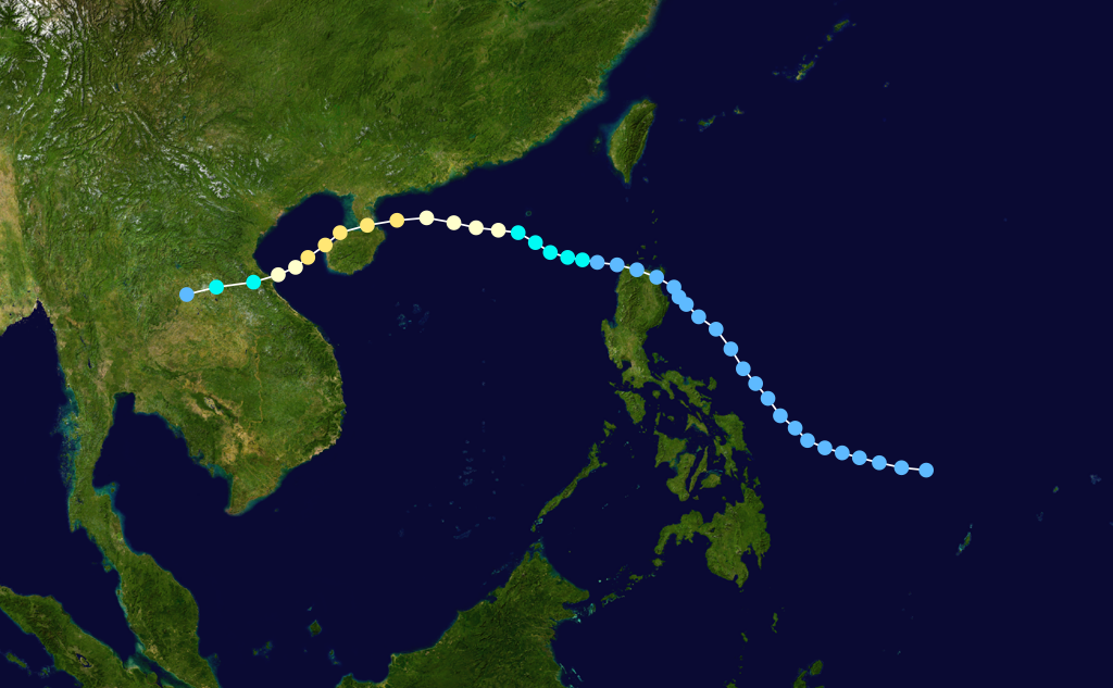
Formed=August 11
Dissipated=August 18
1-min winds=95
Pressure=949Typhoon Fred organized from a monsoon trough situated to the east of the CentralPhilippines , a depression formed on the 11th of August. The depression moved across northernLuzon Island , upon entering theSouth China Sea the depression was upgraded to Tropical Storm Fred. Fred reached typhoon intensity on the 14th of August as the storm moved south ofHong Kong . Typhoon Fred reached peak intensity of convert|110|mi/h|km/h|abbr=on shortly before moving acrossHainan Island . Fred then turned to the southwest across theGulf of Tonkin and made a final landfall in northernVietnam before dissipating. As Typhoon Fred moved south of Hong Kong the oil exploration vessel Derrick Barge sank with 195 people on board, 22 people onboard the ship were killed. On Hainan Island heavy flooding and landslides from Fred's rains killed 16 people. [Joint Typhoon Warning Center. [https://metocph.nmci.navy.mil/jtwc/atcr/1990atcr/pdf/chapter3.pdf] Retrieved on2007-12-26 .]Tropical Depression 13W
Infobox Hurricane Small
Basin=WPac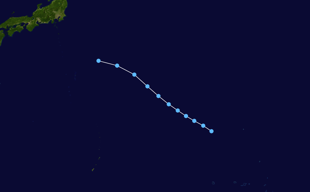
Formed=August 11
Dissipated=August 15
1-min winds=25
Pressure=1004Typhoon Gladys
Infobox Hurricane Small
Basin=WPac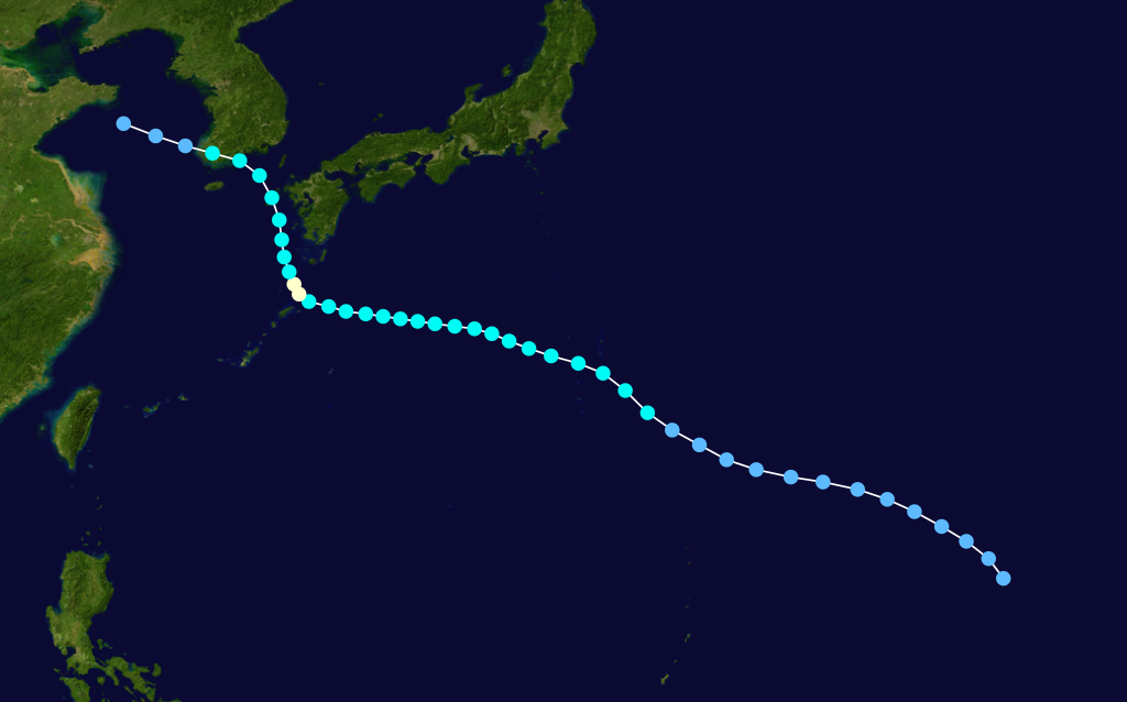
Formed=August 10
Dissipated=August 19
1-min winds=65
Pressure=973Minimal typhoon Gladys brushed by southernJapan onAugust 22 . It moved to the northwest, and hit theKorean Peninsula on the 23rd. It caused more than 20 million yen of damage in Japan, more than 270million won of damage inSouth Korea , and in South Korea, it left 103 dead or missing and more than 20,000 homeless.Tropical Depression 15W
Infobox Hurricane Small
Basin=WPac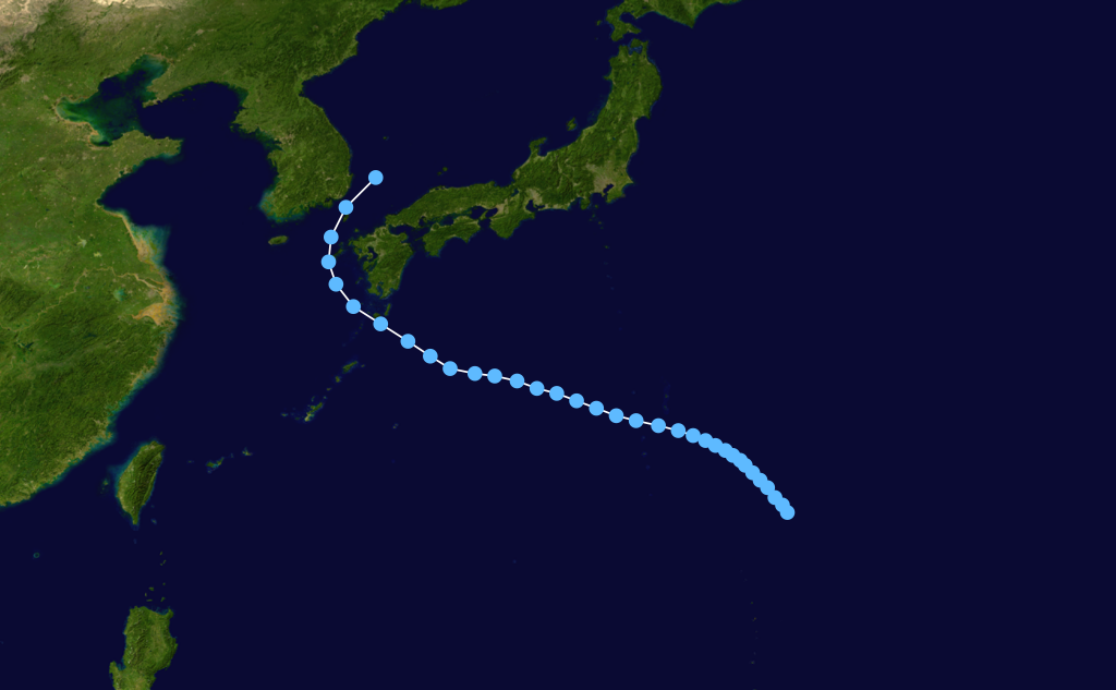
Formed=August 21
Dissipated=August 30
1-min winds=30
Pressure=997Tropical Storm Harry
Infobox Hurricane Small
Basin=WPac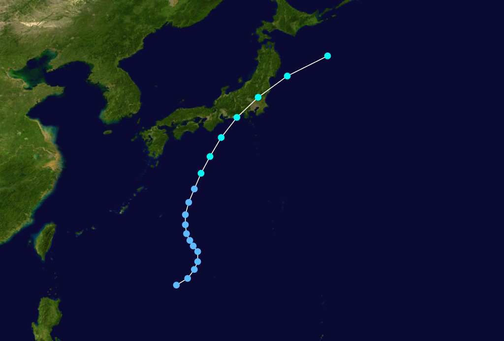
Formed=August 10
Dissipated=August 19
1-min winds=40
Pressure=994Typhoon Ivy
Infobox Hurricane Small
Basin=WPac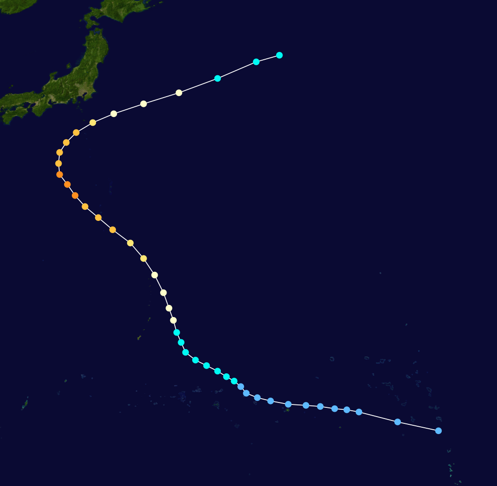
Formed=September 2
Dissipated=September 10
1-min winds=115
Pressure=927Typhoon Ivy formed from a broad monsoon trough situated nearKosrae in the easternCaroline Islands . A tropical depression formed on the 2nd of September as the system moved towards the northwest, the next day the depression strengthened into Tropical Storm Ivy. Ivy began to rapidly intensify and reached typhoon strength as the storm passed convert|130|mi|km east ofTinian andSaipan in theNorthern Mariana Islands . On Saipan one drowning death was reported, but only minor damage was reported in the Northern Marianas. Typhoon Ivy continued on a northwesterly path and reached peak strength of convert|130|mi/h|km/h|abbr=on on the 7th of September prior to recurving to the northeast. Ivy paralleled the southeasternJapan coastline and turned extratropical convert|600|mi|km to the east ofTokyo . As Typhoon Ivy made it's closest approach toHonshū Island , Tokyo and surrounding areas were buffeted by high winds and heavy rains. Over 200 landslides were reported and one person was killed with 4 others missing.Joint Typhoon Warning Center. [https://metocph.nmci.navy.mil/jtwc/atcr/1990atcr/pdf/chapter3.pdf] Retrieved on2007-12-27 .]Tropical Storm Joel
Infobox Hurricane Small
Basin=WPac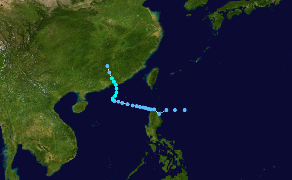
Formed=September 3
Dissipated=September 7
1-min winds=55
Pressure=982Typhoon Kinna
Infobox Hurricane Small
Basin=WPac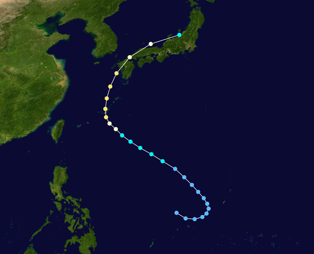
Formed=September 10
Dissipated=September 14
1-min winds=90
Pressure=954Typhoon Kinna formed in a monsoon trough in the westernCaroline Islands a tropical depression began to organize on the 10th of September to the west ofGuam , Tropical Storm Kinna was named later the same day. As Kinna moved towards the northwest the storm began to gather strength and reached typhoon intensity on the 12th of September just prior to turning north threateningJapan . On the 12th Typhoon Kinna made a direct landfall on southernOkinawa Island at peak strength of convert|105|mi/h|km/h|abbr=on. Kinna maintained peak intensity after recurving to the north-northeast and making landfall onKyūshū Island. Typhoon Kinna's eyewall passed directly over Nagasaki and Sasebo cities on the 13th of September, both cities reported wind gusts of convert|115|mi/h|km/h|abbr=on. Kinna continued moving across Japan and became extratropical near the northern coast ofHonshū Island. On Okinawa Kinna dropped more than convert|8|in|mm of rain, in Japan most of the damage occurred near Nagasaki. Throughout Japan and Okinawa 9 deaths were attributable to Typhoon Kinna's passage.Tropical Storm Luke
Infobox Hurricane Small
Basin=WPac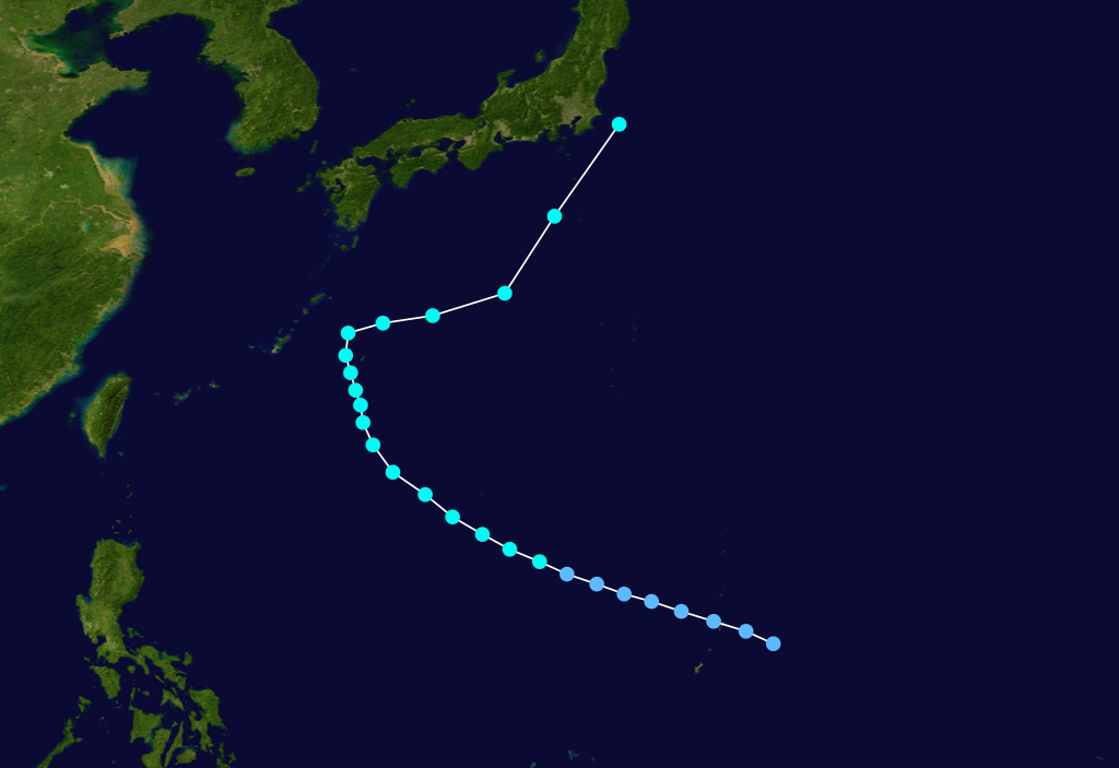
Formed=September 14
Dissipated=September 19
1-min winds=50
Pressure=987Tropical Storm Luke formed from a disturbance that moved through theNorthern Marianas and formed a depression on the 14th of September just to the west of the islands. The depression began to slowly intensify as it moved towards the west-northwest and Tropical Storm Luke was named on the 15th of September. Luke reached peak intensity of convert|60|mi/h|km/h|abbr=on prior to recurving to the northeast and weakening due to increased shear. Tropical Storm Luke then paralleled the southeasternJapan coastline, dropping heavy rains. The resulting flooding and landslides killed 8 people and left 10 others missing prior to Luke turning extratropical east of centralHonshū Island.uper Typhoon Mireille
Infobox Hurricane Small
Basin=WPac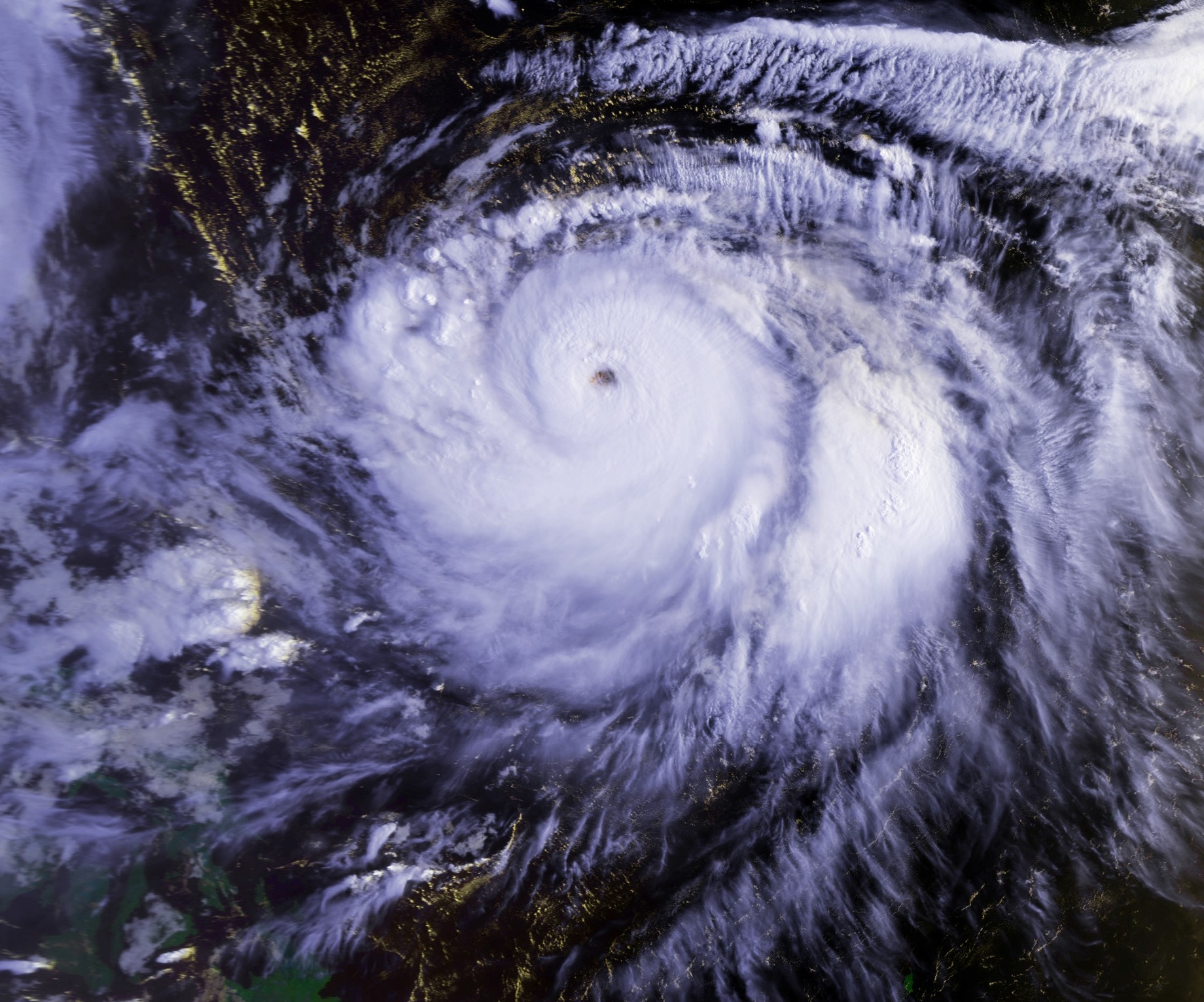
Track=Mireille 1991 track.pngSeptember 15
Dissipated=September 27
1-min winds=130
Pressure=910September 13 , Tropical Depression 21W developed over the open Western Pacific. It tracked westward under the influence of the Subtropical Ridge, slowly organizing until becoming a tropical storm on the 15th. A small storm, Mireille rapidly became a typhoon on the 16th, but larger Tropical Storm Luke to its north and Typhoon Nat to its west kept Mireille a minimal typhoon. When the other 2 storms were far enough away, Mireille rapidly intensified, reaching Super Typhoon strength on the 22nd with a peak of convert|150|mi/h|km/h|abbr=on winds. The storm recurved to the northeast, where it slowly weakened until hitting southwesternJapan on the 27th as a convert|105|mi/h|km/h|abbr=on typhoon. Mireille continued to the northeast, and became extratropical later that day, after causing 52 casualties and heavy crop damage amounting to $3 billion (1991 USD). The name Mireille was retired after this season and was replaced by Melissa.Typhoon Nat
Infobox Hurricane Small
Basin=WPac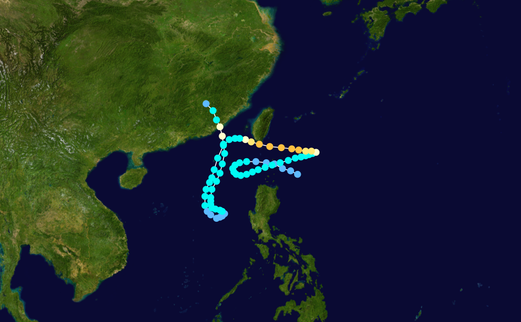
Formed=September 16
Dissipated=October 2
1-min winds=110
Pressure=933Typhoon Orchid
Infobox Hurricane Small
Basin=WPac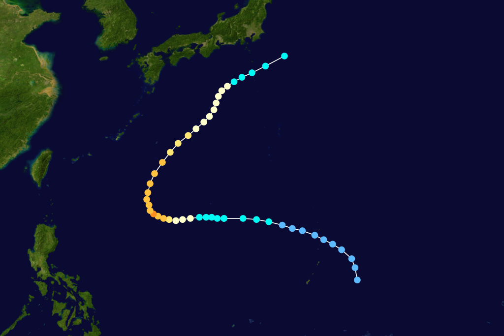
Formed=October 4
Dissipated=October 13
1-min winds=115
Pressure=927Typhoon Orchid formed from a broad monsoon trough that moved through theNorthern Marianas and formed a depression on the 4th of October to the west of the islands. The depression moved on a westerly path and strengthened into Tropical Storm Orchid later the same day. Orchid then began to rapidly intensify and reach peak strength on convert|130|mi/h|km/h|abbr=on on the 7th of October prior to turning to the northeast and accelerating. Typhoon Orchid paralleled the southeast coast ofShikoku andHonshū Islands. As Orchid brushed the islands 96 landslides and heavy flooding were reported in and around theTokyo region, one person was reported killed due to flooding. Though a great distance away the waves from Orchid and Typhoon Pat combined to produced tremendous waves resulting in the deaths of 2 people onGuam .Typhoon Pat
Infobox Hurricane Small
Basin=WPac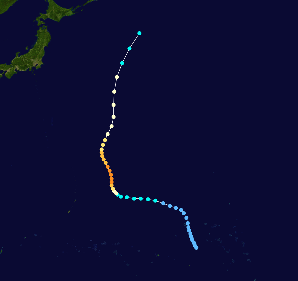
Formed=October 5
Dissipated=October 13
1-min winds=125
Pressure=916uper Typhoon Ruth
Infobox Hurricane Small
Basin=WPac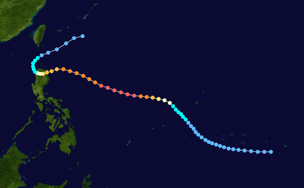
Formed=October 21
Dissipated=October 31
1-min winds=145
Pressure=892Super Typhoon Ruth formed from a tropical disturbance the originated betweenChuuk andPohnpei , as the disturbance moved on a westerly path a tropical depression formed on the 20th of October. Tropical Storm Ruth was named on the 21st as the storm moved to the southwest of Guam and began to steadily intensity. Ruth reached typhoon strength on the 22nd of October and became a Super Typhoon on the 24rd as the storm reached peak intensity of convert|165|mi/h|km/h|abbr=on. Super Typhoon Ruth began to slowly decline in strength as it neared the northernPhilippines . Typhoon Ruth made landfall on the 27th of October on northernLuzon Island with winds of convert|115|mi/h|km/h|abbr=on before weakening to a tropical storm. Heavy flooding and numerous landslides were reported on Luzon Island as a result 12 people were killed. After departing Luzon Island Tropical Storm Ruth recurved south ofTaiwan and dissipated. Heavy seas caused the freighter Tung Lung to sink west of Taiwan, all 18 aboard were killed.uper Typhoon Seth
Infobox Hurricane Small
Basin=WPac
Formed=November 1
Dissipated=November 14
1-min winds=130
Pressure=910Tropical Storm Thelma (Uring)
Infobox Hurricane Small
Basin=WPac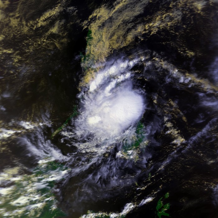
Track=Thelma 1991 track.pngNovember 1
Dissipated=November 8
1-min winds=40
Pressure=991November 4 . It slowly tracked across theArchipelago , bringing heavy flooding across the islands. Vertical shear weakened it as it continued westward, and it dissipated onNovember 8 just after hitting southernVietnam . Thelma, though a weak storm, caused dam failures, landslides, and flash flooding, resulting in a horrendous death toll of 6,000 people.Tropical Storm Verne
Infobox Hurricane Small
Basin=WPac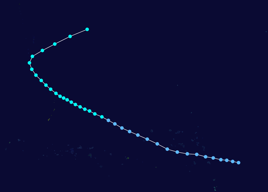
Formed=November 5
Dissipated=November 12
1-min winds=55
Pressure=984Tropical Storm Wilda
Infobox Hurricane Small
Basin=WPac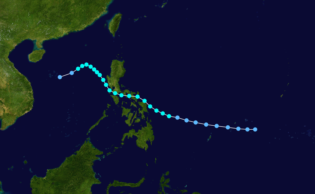
Formed=November 14
Dissipated=November 20
1-min winds=40
Pressure=991uper Typhoon Yuri
Infobox Hurricane Small
Basin=WPac
Track=Yuri 1991 track.pngNovember 14
Dissipated=November 20
1-min winds=155
Pressure=885Pohnpei , including the loss of a radio tower. InGuam , the storm caused extensive beach erosion and destroyed between 60 and 350 buildings. There, damage totaled to $33 million (1991 USD). [Joint Typhoon Warning Center. [https://metocph.nmci.navy.mil/jtwc/atcr/1991atcr/pdf/wnp/30w.pdf Super Typhoon Yuri.] Retrieved on2007-05-18 .]Typhoon Zelda
Infobox Hurricane Small
Basin=WPac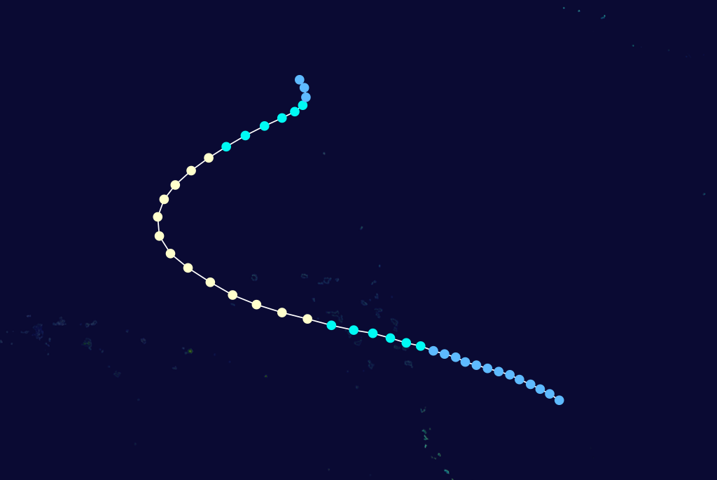
Formed=November 27
Dissipated=December 4
1-min winds=82.5
Pressure=963torm names
Western North Pacific tropical cyclones were named by the
Joint Typhoon Warning Center . The first storm of 1991 was named Sharon and the final one was named Zelda. The names Mireille and Thelma were retired after this season.Philippines The , with the exception of Karing, Helming and Sendang which replaced Katring, Herming and Sisang. The name Uring was retired after this year and was replaced by Ulding.
References
ee also
*
1991 Pacific hurricane season
*1991 Atlantic hurricane season
*1991 North Indian cyclone season
*1991-92 Southern Hemisphere tropical cyclone season External links
* [http://www.typhoon2000.ph Typhoon2000 Philippine typhoon website] .
* [http://www.typhoon2000.ph/plotting/PhilippineTyphoonChart.gifPhilippine Area of Responsibility] .
* [https://metocph.nmci.navy.mil/jtwc.html Joint Typhoon Warning Center] .
* [http://www.weather.gov.hk/informtc/sound/tc_pronunciatione.htm Meaning of Tokyo Typhoon Centre names] .
Wikimedia Foundation. 2010.