- Nizhneudinsk
-
Nizhneudinsk (English)
Нижнеудинск (Russian)- Town[citation needed] - 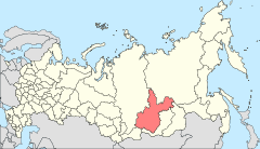
Location of Irkutsk Oblast in Russia
 Nizhneudinsk
Coordinates: 54°54′N 99°02′E / 54.9°N 99.033°ECoordinates: 54°54′N 99°02′E / 54.9°N 99.033°E 
Coat of arms Administrative status Country Russia Federal subject Irkutsk Oblast Statistics Population (2010 Census,
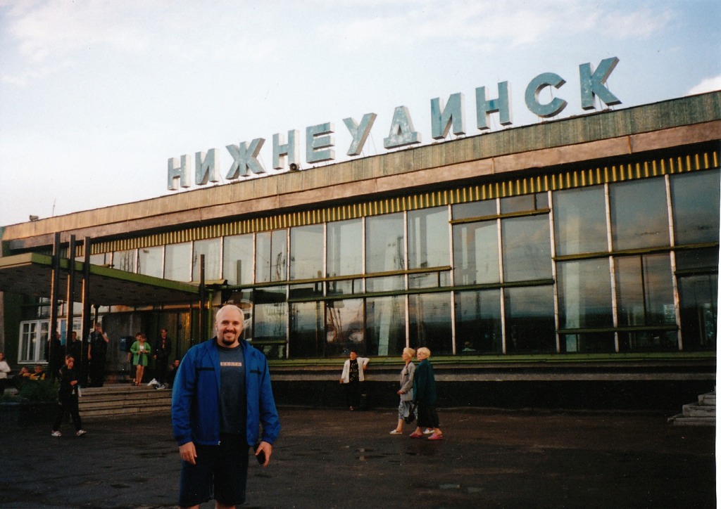
preliminary)37,056 inhabitants[1] Population (2002 Census) 39,624 inhabitants[2] Time zone IRKST (UTC+09:00)[3] Founded 1648[citation needed] Dialing code(s) +7 39557[citation needed] 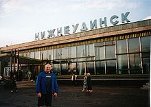 Nizhneudinsk station
Nizhneudinsk (Russian: Нижнеудинск) is a town in Irkutsk Oblast, Russia, located on the Uda River (Yenisei's basin), 508 kilometers (316 mi) northwest of Irkutsk. It stands on the Trans-Siberian Railway, and is served by a small airport, ICAO code UINN.[4] Population: 37,056 (2010 Census preliminary results);[1] 39,624 (2002 Census);[2] 43,759 (1989 Census);[5] 39,700 (1970).
It was founded in 1648 and granted town status in 1783. Nizhneudinsk was so named to distinguish it from Verkhneudinsk (now Ulan-Ude).
Poet Yevgeny Yevtushenko is a native of Nizhneudinsk.
The 187th Base for Storage of Weapons and Equipment of the Siberian Military District is based in the town.[6]
References
- ^ a b Федеральная служба государственной статистики (Federal State Statistics Service) (2011). "Предварительные итоги Всероссийской переписи населения 2010 года (Preliminary results of the 2010 All-Russian Population Census)" (in Russian). Всероссийская перепись населения 2010 года (All-Russia Population Census of 2010). Federal State Statistics Service. http://www.perepis-2010.ru/results_of_the_census/results-inform.php. Retrieved 2011-04-25.
- ^ a b Федеральная служба государственной статистики (Federal State Statistics Service) (2004-05-21). "Численность населения России, субъектов Российской Федерации в составе федеральных округов, районов, городских поселений, сельских населённых пунктов – районных центров и сельских населённых пунктов с населением 3 тысячи и более человек (Population of Russia, its federal districts, federal subjects, districts, urban localities, rural localities—administrative centers, and rural localities with population of over 3,000)" (in Russian). Всероссийская перепись населения 2002 года (All-Russia Population Census of 2002). Federal State Statistics Service. http://www.perepis2002.ru/ct/doc/1_TOM_01_04.xls. Retrieved 2010-03-23.
- ^ Правительство Российской Федерации. Постановление №725 от 31 августа 2011 г. «О составе территорий, образующих каждую часовую зону, и порядке исчисления времени в часовых зонах, а также о признании утратившими силу отдельных Постановлений Правительства Российской Федерации». Вступил в силу по истечении 7 дней после дня официального опубликования. Опубликован: "Российская Газета", №197, 6 сентября 2011 г. (Government of the Russian Federation. Resolution #725 of August 31, 2011 On the Composition of the Territories Included into Each Time Zone and on the Procedures of Timekeeping in the Time Zones, as Well as on Abrogation of Several Resolutions of the Government of the Russian Federation. Effective as of after 7 days following the day of the official publication).
- ^ http://promzona.org/utils/airfields.html?sort=&page=6&dir=asc Promzona Russian aerodromes directory
- ^ "Всесоюзная перепись населения 1989 г. Численность наличного населения союзных и автономных республик, автономных областей и округов, краёв, областей, районов, городских поселений и сёл-райцентров. (All Union Population Census of 1989. Present population of union and autonomous republics, autonomous oblasts and okrugs, krais, oblasts, districts, urban settlements, and villages serving as district administrative centers.)" (in Russian). Всесоюзная перепись населения 1989 года (All-Union Population Census of 1989). Demoscope Weekly (website of the Institute of Demographics of the State University—Higher School of Economics. 1989. http://demoscope.ru/weekly/ssp/rus89_reg.php. Retrieved 2010-03-23.
- ^ http://www8.brinkster.com/vad777/russia/grand_force/districts/sib.htm
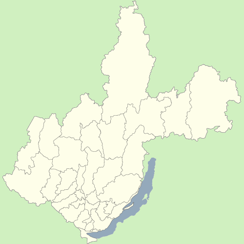
Administrative divisions of Irkutsk Oblast 
Cities and towns Alzamay · Angarsk · Baykalsk · Biryusinsk · Bodaybo · Bratsk · Cheremkhovo · Kirensk · Nizhneudinsk · Sayansk · Shelekhov · Slyudyanka · Svirsk · Tayshet · Tulun · Usolye-Sibirskoye · Ust-Ilimsk · Ust-Kut · Vikhorevka · Zheleznogorsk-Ilimsky · Zima
Districts Angarsky · Balagansky · Bodaybinsky · Bratsky · Cheremkhovsky · Chunsky · Irkutsky · Kachugsky · Katangsky · Kazachinsko-Lensky · Kirensky · Kuytunsky · Mamsko-Chuysky · Nizhneilimsky · Nizhneudinsky · Olkhonsky · Shelekhovsky · Slyudyansky · Tayshetsky · Tulunsky · Usolsky · Ust-Ilimsky · Ust-Kutsky · Ust-Udinsky · Zalarinsky · Zhigalovsky · ZiminskyDistricts of Ust-Orda Buryat Okrug Alarsky · Bayandayevsky · Bokhansky · Ekhirit-Bulagatsky · Nukutsky · OsinskyCategories:- Cities and towns in Irkutsk Oblast
- Populated places established in 1648

Wikimedia Foundation. 2010.