- Chatham-Kent Airport
-
Chatham-Kent Airport
Chatham-Kent Municipal AirportIATA: XCM – ICAO: none – TC LID: CNZ3 Summary Airport type Public Owner/Operator Municipality of Chatham-Kent Location Chatham-Kent, Ontario Elevation AMSL 645 ft / 197 m Coordinates 42°18′21″N 082°04′57″W / 42.30583°N 82.0825°WCoordinates: 42°18′21″N 082°04′57″W / 42.30583°N 82.0825°W Website Map Location in Ontario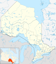
 CNZ3
CNZ3Runways Direction Length Surface ft m 06/24 5,000 1,524 Asphalt Source: Canada Flight Supplement[1] Chatham-Kent Airport, (IATA: XCM[2], TC LID: CNZ3), is located 6 NM (11 km; 6.9 mi) southeast of Chatham-Kent, Ontario, Canada.
The Chatham-Kent Municipal Airport is owned and operated by the Municipality of Chatham-Kent. The airport is managed by Z3 Aviation. Several local pilots and businesses are tenants at the airport in the various hangars.
The airport is operational 9 hours per day, 7 days per week and is capable of supporting both VFR) and IFR operations down to 510 ft (160 m) and 11⁄2 mi (2.4 km) visibility non-precision approach limits and departures in visibility down to 1⁄2 mi (0.8 km).
References
- ^ Canada Flight Supplement. Effective 0901Z 20 October 2011 to 0901Z 15 December 2011
- ^ Accident history for XCM at Aviation Safety Network
External links
- Official site
- Page about this airport on COPA's Places to Fly airport directory
Airports in Canada By name A–B · C–D · E–G · H–K · L–M · N–Q · R–S · T–ZBy location indicator CA · CB · CC · CD · CE · CF · CG · CH · CI · CJ · CK · CL · CM · CN · CO · CP · CR · CS · CT · CV · CW · CY · CZBy province/territory National Airports System Calgary · Charlottetown · Edmonton · Fredericton · Gander · Halifax · Iqaluit · Kelowna · London · Moncton · Montréal-Mirabel · Montréal-Trudeau · Ottawa · Prince George · Québec · Regina · Saint John · St. John's · Saskatoon · Thunder Bay · Toronto · Vancouver · Victoria · Whitehorse · Winnipeg · YellowknifeRelated List of airports by ICAO code: C · List of defunct airports in Canada · List of heliports in Canada · List of international airports in Canada · National Airports System · Operation Yellow Ribbon Category ·
  Portal ·
  WikiProjectCategories:
- Airports in Ontario
- Ontario airport stubs

Wikimedia Foundation. 2010.