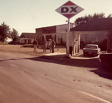
- Manes, Missouri
-

Manes (pronounced /ˈmeɪnɨs/, US dict: mān′·əs) is an unincorporated community in Wright County, Missouri, United States, about 12 miles northeast of Hartville. Located on Route 95, several houses are located here, and at one time the town had a post office (ZIP code 65703), though mail is now served by Mountain Grove.
Manes takes its name from a Baptist minister of Richland, Missouri by the name of Seth Manes. A missionary church was established in Manes in 1893 and in 1894 the first church was built in Manes. This building was used until 1925 when the current Baptist church building was erected.
Manes was a considerable trade center in the early part of the 20th century, boasting at least 3 stores, a bank, a post office, hotel, and eating establishments until automobiles and better highways made travel to larger towns more accessible.
The town is the topic of a song titled What Happens in Manes, Stays in Manes recorded by the shoegazing group Ming's DXMunicipalities and communities of Wright County, Missouri Cities Hartville | Mansfield | Mountain Grove‡ | Norwood
Townships Boone | Brush Creek | Clark | Elk Creek | Gasconade | Hart | Montgomery | Mountain Grove | Pleasant Valley | Union | Van Buren | Wood
Unincorporated
communitiesGraff | Grovespring | Macomb | Manes | Odin
Footnotes ‡This populated place also has portions in an adjacent county or counties
Coordinates: 37°22′48″N 92°22′01″W / 37.38°N 92.36694°W
Categories:- Unincorporated communities in Wright County, Missouri
- Missouri geography stubs
Wikimedia Foundation. 2010.


