- Nain Airport
-
Nain Airport IATA: YDP – ICAO: CYDP
– WMO: 71902Summary Airport type Public Operator Government of Newfoundland and Labrador Location Nain, Newfoundland and Labrador Elevation AMSL 22 ft / 7 m Coordinates 56°33′02″N 061°40′56″W / 56.55056°N 61.68222°WCoordinates: 56°33′02″N 061°40′56″W / 56.55056°N 61.68222°W Map Location in Newfoundland and Labrador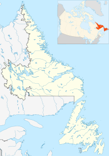
 CYDP
CYDPRunways Direction Length Surface ft m 05/23 1,986 605 Gravel Sources: Canada Flight Supplement[1]
Environment Canada[2]Nain Airport (IATA: YDP, ICAO: CYDP) is located on the shore of Unity Bay near Nain, Newfoundland and Labrador, Canada.
Airlines and destinations
- Civil
Airlines Destinations Air Labrador Goose Bay, Natuashish, Makkovik, Postville, Hopedale, Rigolet Provincial Airlines Goose Bay, Natuashish, Makkovik, Postville, Hopedale, Rigolet, Voisey's Bay Nickel Mine References
- ^ Canada Flight Supplement. Effective 0901Z 20 October 2011 to 0901Z 15 December 2011
- ^ Synoptic/Metstat Station Information
External links
- Past three hours METARs, SPECI and current TAFs for Nain Airport from NAV CANADA as available.
Airports in Canada By name A–B · C–D · E–G · H–K · L–M · N–Q · R–S · T–ZBy location indicator CA · CB · CC · CD · CE · CF · CG · CH · CI · CJ · CK · CL · CM · CN · CO · CP · CR · CS · CT · CV · CW · CY · CZBy province/territory National Airports System Calgary · Charlottetown · Edmonton · Fredericton · Gander · Halifax · Iqaluit · Kelowna · London · Moncton · Montréal-Mirabel · Montréal-Trudeau · Ottawa · Prince George · Québec · Regina · Saint John · St. John's · Saskatoon · Thunder Bay · Toronto · Vancouver · Victoria · Whitehorse · Winnipeg · YellowknifeRelated List of airports by ICAO code: C · List of defunct airports in Canada · List of heliports in Canada · List of international airports in Canada · National Airports System · Operation Yellow RibbonCategories:- Airports in Newfoundland and Labrador
- Atlantic Canada airport stubs

Wikimedia Foundation. 2010.