Morborne

Morborne

Coordinates: 52°30′00″N 0°19′01″W / 52.5°N 0.317°W / 52.5; -0.317

Morborne
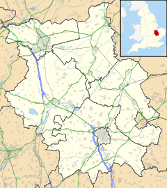
Morborne is located in Cambridgeshire
Morborne

 Morborne shown within Cambridgeshire
OS grid reference TL143905
District Huntingdonshire
Shire county Cambridgeshire
Region East
Country England
Sovereign state United Kingdom
EU Parliament East of England
List of places: UK • England • Cambridgeshire

Morborne – in Huntingdonshire (now part of Cambridgeshire), England – is a village west of Yaxley. Morborne is a very small village occupying 1205 acres, of which most is arable farmland. The population in 1991 was 43, down from a peak of 122 people in 1851.[1] Local landmarks include Manor Farm, which opens annually each Spring for "Lambing Sunday"[2], and the Church of All Saints.[3]


External links

Media related to Morborne at Wikimedia Commons


Wikimedia Foundation. 2010.

Игры ⚽ Нужен реферат?

Look at other dictionaries:

  • BBC Radio Cambridgeshire — Infobox Radio Station name = BBC Radio Cambridgeshire city = Cambridge area = Cambridgeshire branding = slogan = airdate = 1 May 1982 frequency = 95.7 MHz (Peterborough), 96.0 MHz (Cambridge), DAB share = 8.4% share as of = March 2008 share… …   Wikipedia

  • Peterborough transmitting station — The Peterborough transmitting station is a broadcasting and telecommunications facility at Morborne Hill, near Peterborough, Cambridgeshire, (gbmapping|TL127913).There are two tall structures on adjacent sites: a guyed steel lattice mast… …   Wikipedia

  • Peterborough — This article is about the city in the United Kingdom. For other uses, see Peterborough (disambiguation). Peterborough   City and unitary authority   …   Wikipedia

  • Huntingdonshire — District   Non metropolitan district   Huntingdonshire shown within Cambridgeshire …   Wikipedia

  • BT Tower (disambiguation) — British Telecom owns at least 200 radio masts and towers in Britain [Crampsey, D. and Fase, M.L. External Engineering , British Telecommunications Engineering, Vol. 10 Part 1 (April 1991), p.13] . Of these, twelve are reinforced concrete towers.… …   Wikipedia

  • List of places in Cambridgeshire — This is a list of cities, towns and villages in the county of Cambridgeshire, England. It includes places in Huntingdonshire, as Huntingdonshire is currently a district of Cambridgeshire. See List of places in England for lists of settlements in… …   Wikipedia

  • List of civil parishes in Cambridgeshire — This is a list of civil parishes in Cambridgeshire, England.CambridgenoneEast Cambridgeshire* Ashley * Bottisham * Brinkley * Burrough Green * Burwell * Cheveley * Chippenham * Coveney * Downham * Dullingham * Ely * Fordham * Haddenham * Isleham… …   Wikipedia

  • BT site engineering code — A BT site engineering code is a group of letters assigned by BT, or its predecessor the General Post Office, to a physical location which is equipped by the company with unusual amounts or types of telecommunications.Such codes relate to both BT… …   Wikipedia

  • Folksworth and Washingley — is a civil parish in Huntingdonshire (now part of Cambridgeshire), England. It is near Morborne west of Yaxley.ee also*Folksworth *Washingley …   Wikipedia

  • List of Grade I listed buildings in Cambridgeshire — There are over 6000 Grade I listed buildings in England. This page is a list of these buildings in the county of Cambridgeshire, sub divided by district.Cambridge* Church of St Andrew, Cambridge * Little Trinity, Cambridge * Little Trinity:… …   Wikipedia

Share the article and excerpts

Direct link
Do a right-click on the link above
and select “Copy Link”