Bardwell Park, New South Wales

Bardwell Park, New South Wales

Infobox Australian Place | type = suburb
name = Bardwell Park
city = Sydney
state = nsw


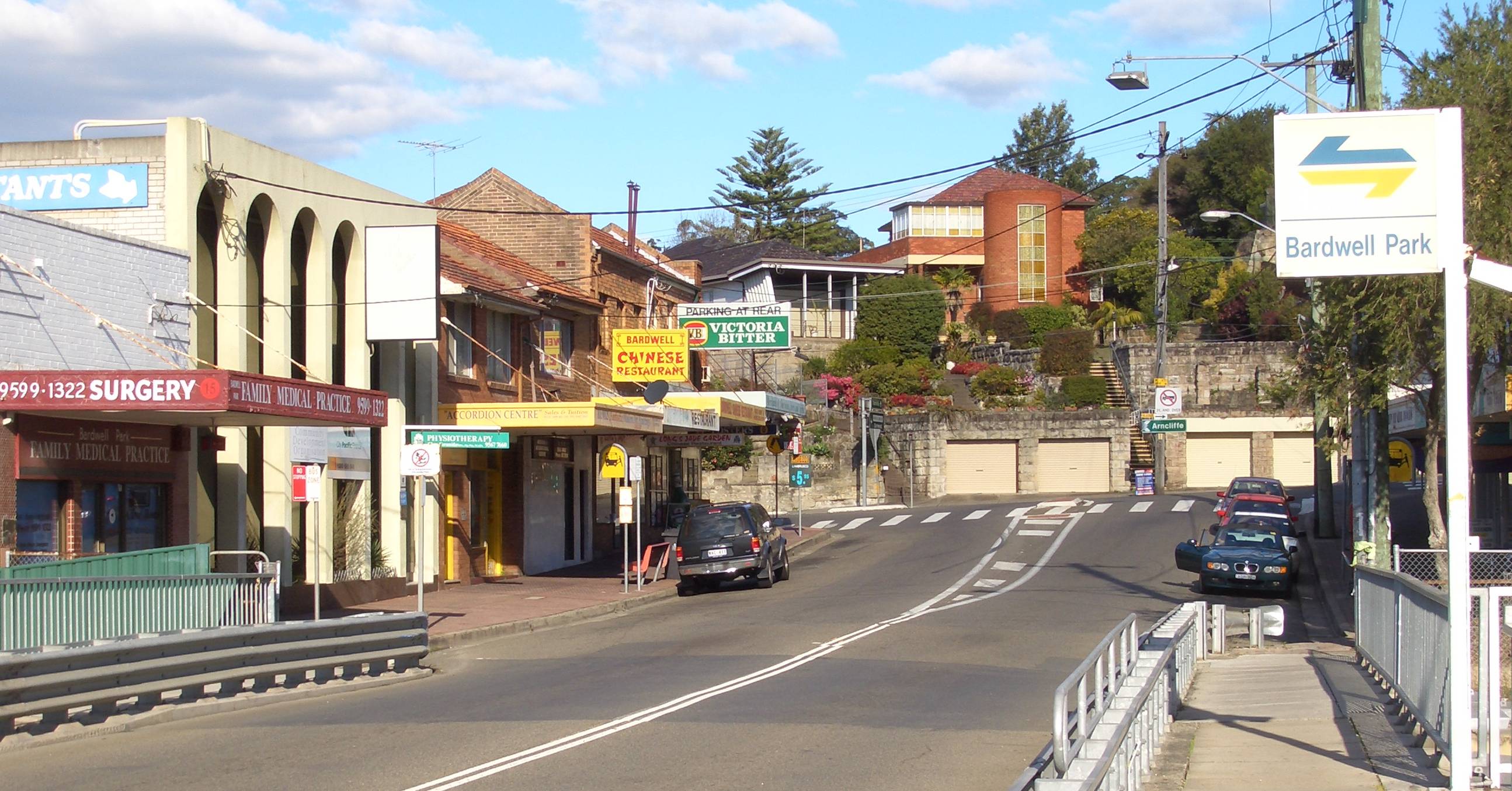
caption = Hartill-Law Avenue (eastern side shops)
lga = City of Rockdale
postcode = 2207
pop =
area =
propval =
est =
stategov = Electoral district of Rockdale
fedgov = Division of Watson
near-nw = Earlwood
near-n = Earlwood
near-ne = Undercliffe
near-w = Bexley North
near-e = Turrella
near-sw = Bexley North
near-s = Bardwell Valley
near-se = Bardwell Valley
dist1 = 12
dir1 = south
location1= Sydney CBD

Bardwell Park is a suburb in southern Sydney, in the state of New South Wales, Australia. Bardwell Park is located 12 kilometres south of the Sydney central business district and is part of the St George area. Bardwell Park is in the local government area of the City of Rockdale. The postcode is 2207. Bardwell Valley is a separate suburb, to the east.

History

Bardwell Park was named after free settler Thomas Hill Bardwell who owned land in the area. His grant was originally heavily timbered and bounded by Wolli Creek, Dowling Street and Wollongong Road. In 1881, the land was auctioned and 1,600 acres were subdivided. The railway station opened on the 21st September 1931 which opened up the area for home sites. The school opened in September 1943 and the post office opened in May 1946. [ "The Book of Sydney Suburbs", Compiled by Frances Pollen, Angus & Robertson Publishers, 1990, Published in Australia ISBN 0-207-14495-8 ]

Commercial area

Bardwell Park is a predominantly residential area but features a small shopping centre around Hartill-Law Avenue and Slade Road, beside the Bardwell Park railway station. The Bardwell Park - Earlwood RSL is also located beside the railway station. The station is only 500m from the centre of Earlwood shopping centre.

Transport

Bardwell Park railway station is on the East Hills line of the CityRail network. Bardwell Park is also serviced by bus services, including State Transit Authority route 471 from Five Dock to Rockdale.

The M5 South Western Motorway runs beneath parts of Bardwell Park in a 4km tunnel. The nearest entrances to travel south-west towards Beverly Hills and Liverpool are located at Arncliffe and Bexley North. The nearest entrances to travel north-east towards Botany and the city are located at Kingsgrove and Arncliffe.

References

External links


Wikimedia Foundation. 2010.

Игры ⚽ Нужно решить контрольную?

Look at other dictionaries:

  • Bardwell Valley, New South Wales — Infobox Australian Place | type = suburb name = Bardwell Valley city = Sydney state = nsw caption = Bardwell Valley, view to city lga = City of Rockdale postcode = 2207 pop = area = propval = est = 1996 stategov = Electoral district of Rockdale… …   Wikipedia

  • List of Government schools in New South Wales: A–F — The New South Wales Department of Education and Training (DET) is a department of the Government of New South Wales. In addition to other responsibilities, it operates primary schools and secondary schools throughout the state. Contents 1 A 2 B 3 …   Wikipedia

  • Bexley North, New South Wales — Bexley North Sydney, New South Wales Shaw Street, Bexley North Population …   Wikipedia

  • Dolls Point, New South Wales — Dolls Point Sydney, New South Wales Cook Park, Dolls Point Postcode: 2219 …   Wikipedia

  • Arncliffe, New South Wales — Infobox Australian Place | type = suburb name = Arncliffe city = Sydney state = nsw caption = Arncliffe Post Office lga = City of Rockdale postcode = 2205 pop = 8,508 area = 3.6 propval = $504,000 est = 1840 stategov = Rockdale fedgov = Division… …   Wikipedia

  • Earlwood, New South Wales — Infobox Australian Place | type = suburb name = Earlwood city = Sydney state = nsw caption = Earlwood Hotel, Homer Street lga = City of Canterbury postcode = 2206 pop = area = propval = est = stategov = Canterbury fedgov = Watson near nw =… …   Wikipedia

  • Kogarah, New South Wales — For the seat in the New South Wales Legislative Assembly, see Electoral district of Kogarah. For the local government area, see the Municipality of Kogarah. Kogarah Sydney, New South Wales …   Wikipedia

  • Monterey, New South Wales — Monterey Sydney, New South Wales Lady Robinsons Beach, Monterey Population …   Wikipedia

  • Bexley, New South Wales — Infobox Australian Place | type = suburb name = Bexley city = Sydney state = nsw caption = Forest Road, Bexley lga = City of Rockdale postcode = 2207 est = 1822 pop = area = propval = stategov = Electoral district of Rockdale fedgov = Division of …   Wikipedia

  • Undercliffe, New South Wales — Infobox Australian Place | type = suburb name = Undercliffe city = Sydney state = nsw caption = Undercliffe, view from Waterworth Park lga = City of Canterbury postcode = 2206 pop = area = propval = est = stategov = Electoral district of… …   Wikipedia

Share the article and excerpts

Direct link
Do a right-click on the link above
and select “Copy Link”