- Colomac Airport
-
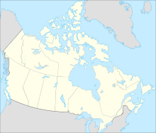
Colomac Airport IATA: none – ICAO: none – TC LID: CFY8Summary Airport type Private Operator DIAND (Contaminated Sites Office) Location Colomac Mine Elevation AMSL 1,073 ft / 327 m Coordinates 64°23′06″N 115°07′29″W / 64.385°N 115.12472°WCoordinates: 64°23′06″N 115°07′29″W / 64.385°N 115.12472°W Map Location in the Northwest Territories Runways Direction Length Surface ft m 03/215,1001,554GravelSource: Canada Flight Supplement[1] Colomac Airport
(TC LID: CFY8), was located near Colomac Mine in the Northwest Territories, Canada where caribou may be found on the runway. Prior permission was required to land except in the case of an emergency.References
- ^ Canada Flight Supplement. Effective 0901Z 20 October 2011 to 0901Z 15 December 2011
External links
- Page about this airport on COPA's Places to Fly airport directory
Airports in Canada By name A–B · C–D · E–G · H–K · L–M · N–Q · R–S · T–ZBy location indicator CA · CB · CC · CD · CE · CF · CG · CH · CI · CJ · CK · CL · CM · CN · CO · CP · CR · CS · CT · CV · CW · CY · CZBy province/territory National Airports System Calgary · Charlottetown · Edmonton · Fredericton · Gander · Halifax · Iqaluit · Kelowna · London · Moncton · Montréal-Mirabel · Montréal-Trudeau · Ottawa · Prince George · Québec · Regina · Saint John · St. John's · Saskatoon · Thunder Bay · Toronto · Vancouver · Victoria · Whitehorse · Winnipeg · YellowknifeRelated List of airports by ICAO code: C · List of defunct airports in Canada · List of heliports in Canada · List of international airports in Canada · National Airports System · Operation Yellow RibbonCategories:- Defunct airports in the Northwest Territories
- Northwest Territories airport stubs
Wikimedia Foundation. 2010.

