- Morpeth, New South Wales
-
Morpeth
Maitland, New South Wales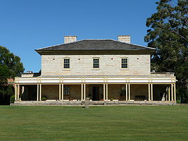
Closebourne (formerly St John's Theological College)Population: 891[1] Note1 • Density: 188/km² (486.9/sq mi) Established: 1821 Postcode: 2321 Coordinates: 32°43′34″S 151°37′54″E / 32.72611°S 151.63167°ECoordinates: 32°43′34″S 151°37′54″E / 32.72611°S 151.63167°E Elevation: 15 m (49 ft) Note2 Area: 4.8 km² (1.9 sq mi) Note3 Time zone: • Summer (DST)
AEST (UTC+10) AEDT (UTC+11)
Location: LGA: City of Maitland[2] Region: Hunter[2] County: Northumberland[3] Parish: Alnwick[3] State District: Maitland[4] Federal Division: Paterson[5] Suburbs around Morpeth: Raworth Phoenix Park Hinton Raworth Morpeth Berry Park Tenambit Chisholm Berry Park Morpeth is a suburb of the City of Maitland Local Government Area (LGA) in the Hunter Region of New South Wales, Australia.[2] It is located on the southern banks of the Hunter River at the border between the City of Maitland and Port Stephens Council LGAs.[6] The major population centre, where almost all residents of the suburb reside, is the historical town of Morpeth which takes its name from Morpeth, Northumberland, near Newcastle upon Tyne, in England.
Contents
History
The town of Morpeth was initially created through the private actions of Lieutenant E.C.Close, who selected a property of 1,000 hectares and developed it as a river port from 1831-1841. The lieutenant built his house, known as Closebourne, on the property. A two-storey Georgian home made of sandstone, the house became an episcopal residence from 1848-1912, which eventually became the nucleus of St John's Theological College on Morpeth Road.
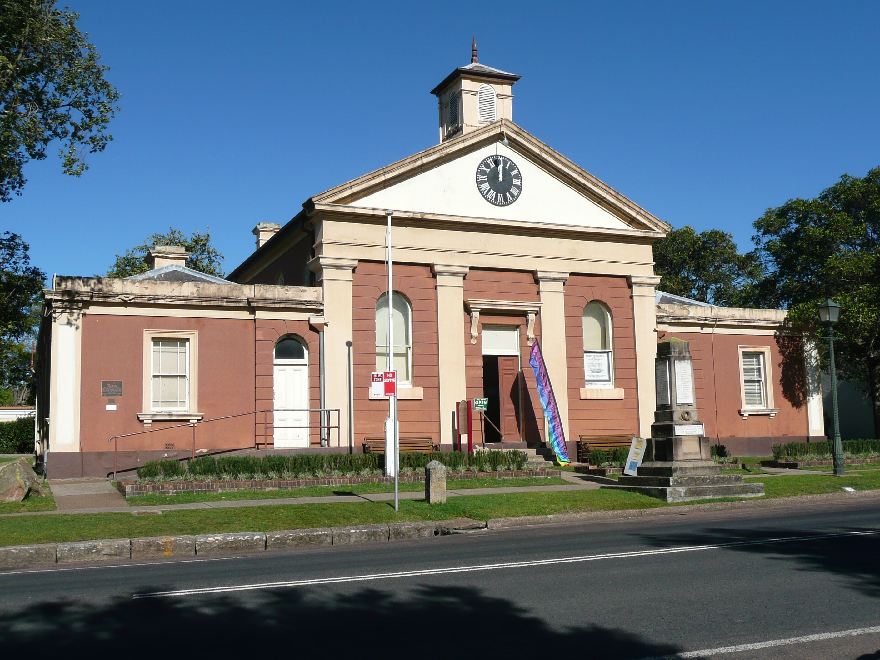
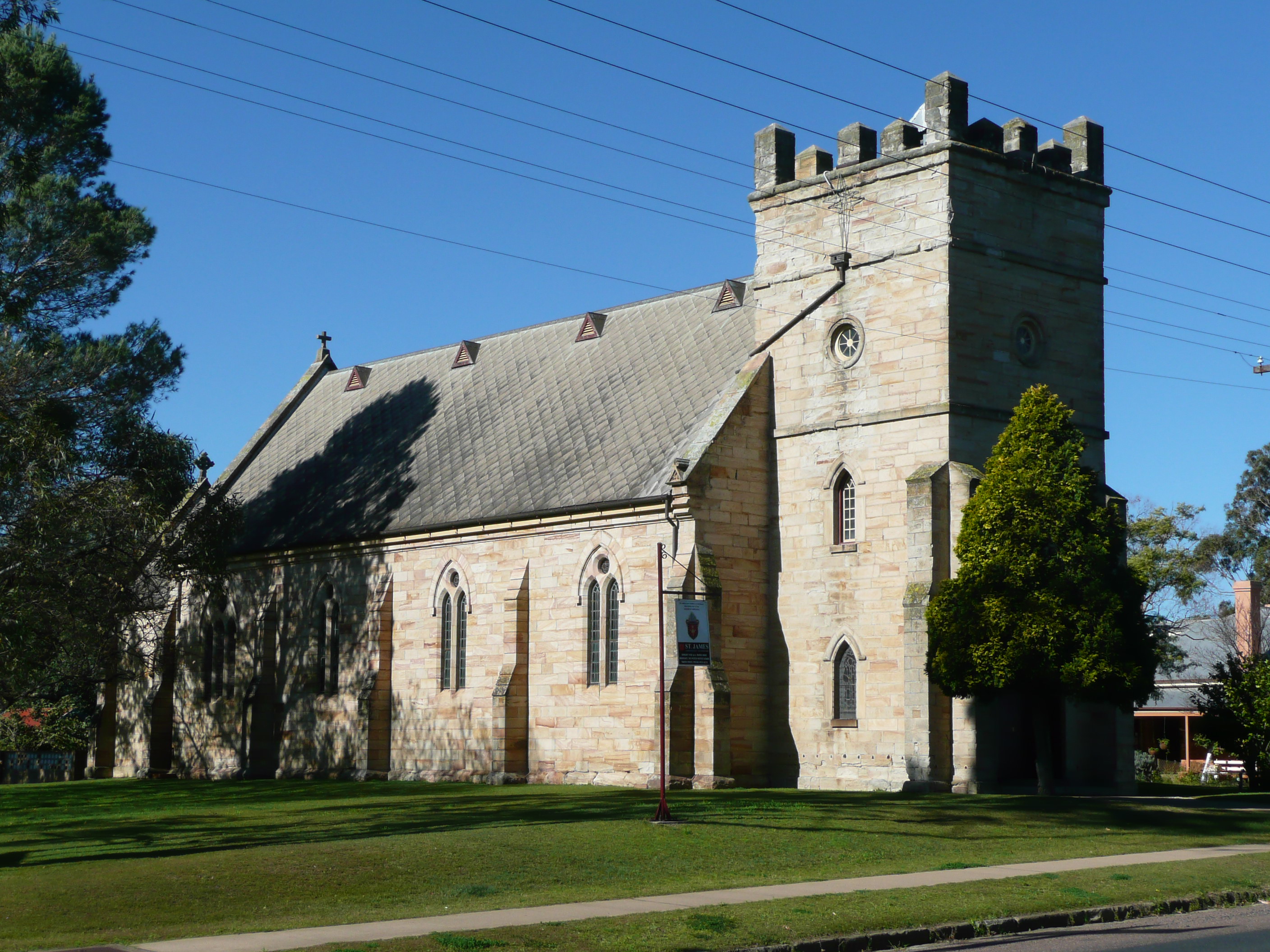
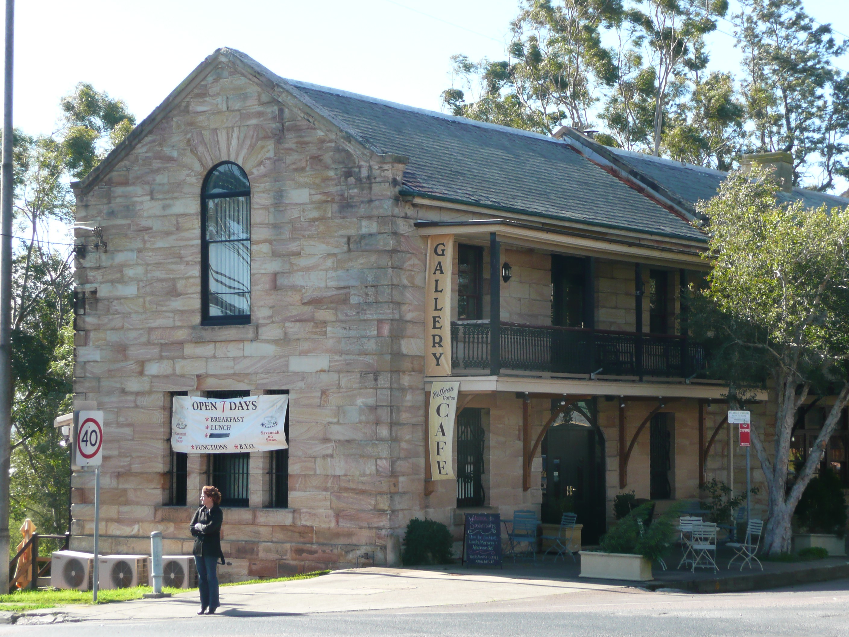
The river port grew steadily throughout the 1830s; St James's Church, Tank Street, was built from 1837 to 1840. It was partly designed by John Horbury Hunt and now has a Local Government Heritage listing. A major merchant at this time was James Taylor, who built a bond store circa 1850, located near the bridge and now heritage-listed. The town continued to expand. Morpeth Court House was built circa 1861 in a Greek Revival style; the police station followed in 1879. The construction of the Great Northern Railway in 1857, bypassing Morpeth, meant that Newcastle developed as the regional port. Morpeth became less significant commercially, but still survived as a township with its own history and heritage.
The town today is a popular tourist destination due to its many historical buildings and river bank setting.[7] The following buildings are listed on the Register of the National Estate:[8]
- Closebourne, Morpeth Road
- Former Bond Stores, Swan Street
- Morpeth Public Library (formerly Court House),Swan Street
- Police Station, High and George Streets
- Former Morpeth Railway Station
Gallery
-
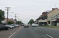
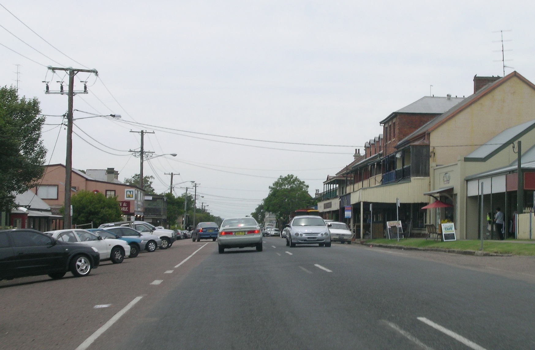
Main street of Morpeth
-
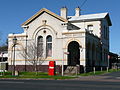
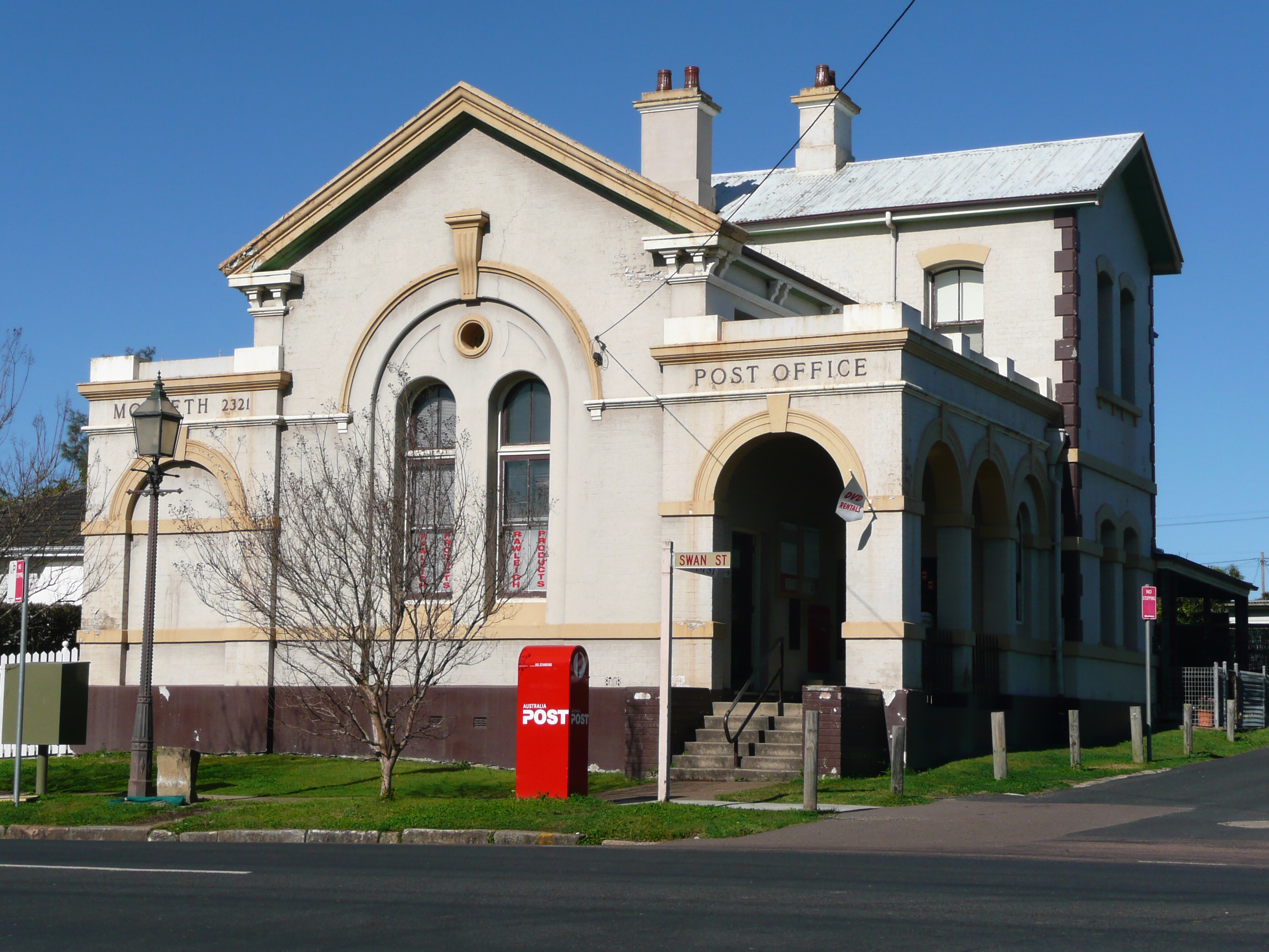
Morpeth Post Office, Swan Street
-
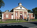
Old Court House, Swan Street
-
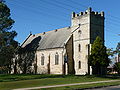
St James's Church (1840), Tank Street
-
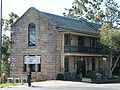
Morpeth Bond Stores, Swan Street
Notes
- ^ The Australian Bureau of Statistics Census Collection District of Morpeth only includes the township. It excludes persons living on rural properties close to the township in the remainder of the suburb. This means that the actual population of Morpeth is slightly higher than shown.
- ^ Average elevation of the suburb as shown on 1:100000 map 9232 NEWCASTLE.
- ^ Area calculation is based on 1:100000 map 9232 NEWCASTLE.
References
- ^ Australian Bureau of Statistics (25 October 2007). "Morpeth (State Suburb)". 2006 Census QuickStats. http://www.censusdata.abs.gov.au/ABSNavigation/prenav/LocationSearch?collection=Census&period=2006&areacode=SSC18159&producttype=QuickStats&breadcrumb=PL&action=401. Retrieved 2009-01-03. Map
- ^ a b c "Suburb Search - Local Council Boundaries - Hunter (HT) - Maitland City Council". New South Wales Department of Local Government. http://www.dlg.nsw.gov.au/dlg/dlghome/dlg_Regions.asp?regiontype=2&slacode=5050®ion=HT. Retrieved 2009-01-03.
- ^ a b "Geographical Names Register Extract: Morpeth". Geographical Names Register (GNR) of NSW. Geographical Names Board of New South Wales. http://www.gnb.nsw.gov.au/name_search/extract?id=anwGwpsyGH. Retrieved 2009-01-03.
- ^ "Maitland". New South Wales Electoral Commission. 24 March 2007. http://www.elections.nsw.gov.au/state_government_elections/electoral_districts/all_districts_/maitland. Retrieved 2009-01-03.
- ^ "Paterson". Australian Electoral Commission. 19 October 2007. http://www.aec.gov.au/profiles/p/paterson.htm. Retrieved 2009-01-03.
- ^ "Morpeth". Land and Property Management Authority - Spatial Information eXchange. New South Wales Land and Property Management Authority. http://imagery.maps.nsw.gov.au/?role=mysuburb&search=suburb&suburb=Morpeth. Retrieved 2009-01-03.
- ^ "Morpeth - New South Wales - Australia - Travel". The Age. 8 February 2004. http://www.theage.com.au/news/New-South-Wales/Morpeth/2005/02/17/1108500197681.html. Retrieved 2009-01-03.
"Morpeth". Australian Explorer. http://www.australianexplorer.com/morpeth.htm. Retrieved 2009-01-03. - ^ The Heritage of Australia, Macmillan Company, 1981, p.2/202
Towns, suburbs and localities of the City of Maitland | Hunter Region | New South Wales Towns, suburbs
& localitiesAberglasslyn • Allandale • Anambah • Ashtonfield • Berry Park • Bishops Bridge • Bolwarra • Bolwarra Heights • Buchanan • Chisholm • Dalwood • Duckenfield • East Maitland • Farley • Gillieston Heights • Gosforth • Greenhills • Greta • Harpers Hill • Hillsborough • Horseshoe Bend • Lambs Valley • Largs • Lochinvar • Lorn • Louth Park • Luskintyre • Maitland • Maitland North • Maitland Vale • Melville • Metford • Millers Forest • Mindaribba • Morpeth • Mount Dee • Oakhampton • Oakhampton Heights • Oswald • Phoenix Park • Pitnacree • Raworth • Rosebrook • Rutherford • South Maitland • Telarah • Tenambit • Thornton • Tocal • Windella • Windermere • Woodberry • Woodville
Other places &
points of interestHunter River • Maitland Gaol • Paterson River • Walka Water Works
Categories:- Hunter region geography stubs
- Suburbs of Maitland, New South Wales
- Towns in the Hunter Region, New South Wales
- 1821 establishments in Australia

Wikimedia Foundation. 2010.