Oxley, Australian Capital Territory

Oxley, Australian Capital Territory
Oxley
CanberraAustralian Capital Territory
Oxley IBMap-MJC.png
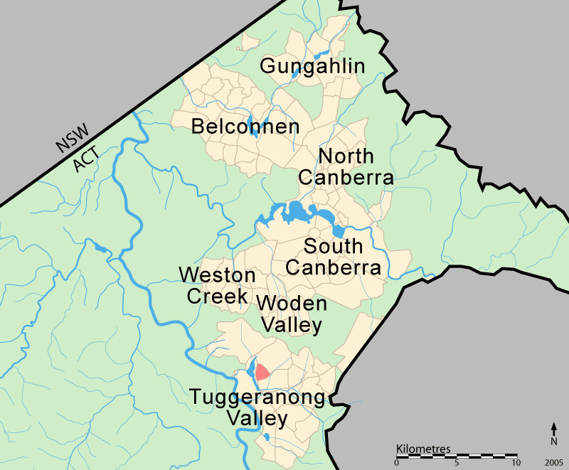
Population: 1,788 (2006 census)[1]
Established: 1985
Gazetted: 22 March 1982
Postcode: 2903
District: Tuggeranong
Assembly Electorate: Brindabella
Federal Division: Canberra
Suburbs around Oxley:
Greenway Wanniassa Wanniassa
Wanniassa Oxley Greenway
Greenway Monash Monash

Oxley (postcode 2903) is the smallest suburb in Canberra. It is located in the district of Tuggeranong. The suburb is named after the explorer John Joseph William Molesworth Oxley (1783 to 1828), who explored parts of New South Wales.[2] It was gazetted on 22 March 1982[2] and first settled in 1985. Streets are named after social reformers[2] and the suburb has an area of 1.08 km².

It is next to the suburbs of Greenway, Wanniassa and Monash and is bounded by Drakeford Drive, Taverner Street and Erindale Drive.

Geology

Deakin Volcanics green grey, purple and cream rhyolite occurs over most of the suburb and Deakin Volcanics green grey and purple rhyodacite is found in the far south east corner. These rocks are from 414 mya in the Silurian period.[3]

References

  1. ^ Australian Bureau of Statistics (25 October 2007). "Oxley (State Suburb)". 2006 Census QuickStats. http://www.censusdata.abs.gov.au/ABSNavigation/prenav/LocationSearch?collection=Census&period=2006&areacode=SSC81386&producttype=QuickStats&breadcrumb=PL&action=401. Retrieved 2009-05-24. 
  2. ^ a b c Canberra's suburb and street names : origins and meanings. Department of the Environment, Land and Planning. 1992. p. 98. ISBN 1 86331 128 9. 
  3. ^ Henderson G A M and Matveev G, Geology of Canberra, Queanbeyan and Environs 1:50000 1980.

Coordinates: 35°24′22″S 149°04′48″E / 35.406°S 149.080°E / -35.406; 149.080


Wikimedia Foundation. 2010.

Игры ⚽ Нужно решить контрольную?

Look at other dictionaries:

  • Wanniassa, Australian Capital Territory — Infobox Australian Place | type = suburb name = Wanniassa state = Australian Capital Territory city = Canberra caption = lga = Tuggeranong postcode = 2903 est = 1975 propval = AU$327,000 (2005) [http://allhomes.com.au/c/ah?a=uisu i=798] pop =… …   Wikipedia

  • Monash, Australian Capital Territory — Monash Canberra, Australian Capital Territory Population: 5,549 (2006 cen …   Wikipedia

  • Greenway, Australian Capital Territory — Infobox Australian Place | type = suburb name = Greenway city = Canberra state = Australian Capital Territory lga = Tuggeranong ACTgov = Brindabella fedgov = Canberra est = 1988 postcode = 2900 pop = 968 (2001 census) propval = $418,000 (2005)… …   Wikipedia

  • Oxley — may refer to: Organisations Oxley High School is a school located in Tamworth, NSW, Australia Oxley College, for disambiguation of the colleges People Cameron Oxley, Australian solicitor David Oxley, English actor Harrison Oxley, English organist …   Wikipedia

  • Oxley — steht für: Den Familiennamen folgender Personen: John Oxley (1785 1828), australischer Entdecker Michael Oxley (* 1944), US amerikanischer Politiker Tony Oxley (* 1938), britischer Schlagzeuger Folgende Orte: Oxley (Arkansas) Oxley… …   Deutsch Wikipedia

  • John Oxley — This article is about the person. For the Australian pilot ship, see John Oxley (ship) .John Joseph William Molesworth Oxley (1783/1785? – 26 May 1828) was an explorer and surveyor of Australia in the early period of English colonisation.October… …   Wikipedia

  • John Oxley — en: The Explorers of Australia and their Life Work , Ernest Favenc, 1908 Nacimiento 1783 5 Farnsfield, Nottinghamshire …   Wikipedia Español

  • Timeline of Australian history — This is a timeline of Australian history.BC*c. 68,000 BC 40,000 BC: Aboriginal tribes thought to have arrived in Australia.1600s*1606 (March): The Duke of York s ship Duyfken , under Captain Willem Janszoon, explores the western coast of Cape… …   Wikipedia

  • Divisions of the Australian House of Representatives — The Australian House of Representatives is elected from 150 single member districts called Divisions. They are also commonly known as electorates or seats. The British term constituencies is rarely used. Contents 1 Apportionment 2 Naming 3 List… …   Wikipedia

  • Jervis Bay Territory — closeup map. The Jervis Bay Territory is a territory of the Commonwealth of Australia. It was surrendered by the state of New South Wales to the Commonwealth Government in 1915[1][2] …   Wikipedia

Share the article and excerpts

Direct link
Do a right-click on the link above
and select “Copy Link”