- Moor Park, Hertfordshire
-
Coordinates: 51°37′47″N 0°25′53″W / 51.6298°N 0.4315°W
Moor Park 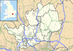
 Moor Park
Moor Park shown within HertfordshirePopulation 2,046 [1] OS grid reference TQ085935 District London Borough of Hillingdon Shire county Hertfordshire Region East Country England Sovereign state United Kingdom Post town NORTHWOOD/RUISLIP Postcode district HA6 Dialling code 01923 Police Hertfordshire Fire Hertfordshire Ambulance East of England EU Parliament East of England List of places: UK • England • Hertfordshire Moor Park Estate (North Ruislip Estate) is a private residential estate in north-west London. The area borders Northwood, London and is part of the affluent suburb of Ruislip. It takes its name from Moor Park, a country house which was originally built in 1678–9 for James, Duke of Monmouth, and was reconstructed in the Palladian style circa 1720 by Giacomo Leoni. The house and grounds are now occupied by Moor Park Golf Club.
The estate consists of around 6 square miles (16 km2) of gated, Private roads; extending from Ruislip Woods through to Northwood, and finishing at Merchant Taylors' School. It is built on what used to be an area of Ruislip Moor, which is where the name Moor Park originates. The majority of the area lies in the London postcode HA6 OR HA4.
The surrounding neighbourhood consists mostly of upscale houses, some dating back to the original 1930s developments. Moor Park has large Muslim, Jewish and Asian communities, and many homeowers commute to London via Moor Park tube station on the Metropolitan Line of the London Underground.
External links
 Media related to Moor Park, Hertfordshire at Wikimedia Commons
- http://www.timesonline.co.uk/article/0,,2087-2426773.html - 2006 Times article on influx of wealthy Asian families to the neighbourhood
Section 13: London Outer Orbital Path Section 14: Harefield Moor Park Hatch End Categories:- Three Rivers (district)
- Villages in Hertfordshire
- London Loop

Wikimedia Foundation. 2010.