- Spencer's Island, Nova Scotia
Infobox Settlement
official_name = Pagename
other_name =
native_name =
nickname =
settlement_type = Village
motto =
imagesize =
image_caption =
flag_size =
image_
seal_size =
image_shield =
shield_size =
city_logo =
citylogo_size =
mapsize =
map_caption =
mapsize1 =
map_caption1 =
image_dot_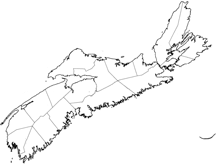
dot_mapsize = 250px
dot_map_caption =Location of Pagename
dot_x =61 |dot_y =82
pushpin_
pushpin_label_position =
pushpin_map_caption =
pushpin_mapsize =
subdivision_type = Country
subdivision_name = CAN
subdivision_type1 = Province
subdivision_name1 = NS
subdivision_type2 = Municipality
subdivision_name2 = Cumberland County
subdivision_type3 =
subdivision_name3 =
subdivision_type4 =
subdivision_name4 =
government_footnotes =
government_type =
leader_title =
leader_name =
leader_title1 =
leader_name1 =
leader_title2 =
leader_name2 =
leader_title3 =
leader_name3 =
leader_title4 =
leader_name4 =
established_title =
established_date =
established_title2 =
established_date2 =
established_title3 =
established_date3 =
area_magnitude =
unit_pref =
area_footnotes =
area_total_km2 =
area_land_km2 =
area_water_km2 =
area_total_sq_mi =
area_land_sq_mi =
area_water_sq_mi =
area_water_percent =
area_urban_km2 =
area_urban_sq_mi =
area_metro_km2 =
area_metro_sq_mi =
population_as_of =
population_footnotes =
population_note =
population_total =
population_density_km2 =
population_density_sq_mi =
population_metro =
population_density_metro_km2 =
population_density_metro_sq_mi =
population_urban =
population_density_urban_km2 =
population_density_urban_sq_mi =
population_blank1_title =
population_blank1 =
population_density_blank1_km2 =
population_density_blank1_sq_mi =
timezone = AST
utc_offset = -4
timezone_DST =
utc_offset_DST =
latd=45 |latm=21 |lats=18 |latNS=N
longd=64 |longm=42|longs=57 |longEW=W
elevation_footnotes =
elevation_m =
elevation_ft =
postal_code_type = Postal code
postal_code = B
area_code = 902
blank_name =Telephone Exchange
blank_info =254
blank1_name =
blank1_info =
website =
footnotes =
Spencer's Island is a rural community in Cumberland County,Part of a series about Places in Nova Scotia Nova Scotia located at the western end of Greville Bay on theBay of Fundy . The community is named after a small island of the same name located offshore from nearby Cape Spencer. According to legend, the island, cape and community trace their name to a man named Spencer who is buried on the island. However the name more likely comes from Lord Spencer, a British statesman at the time the community was settled.Spencers Island was used seasonally by the
Mi'kmaq who called it Wochuk, meaning small kettle island. The first recorded settlement was by the Spicer families in 1778. Spencer's Island became an important shipbuilding centre during the latter days of theAge of Sail . The first large vessel from its shipyards was the "Amazon" built in 1861 and later to become famous as the ill-fated "Mary Celeste ". Many larger vessels followed including the full-rigged ship "Glooscap" in 1891, the largest ship built in Cumberland County.The community is located at 45º21'16"N, 64º42'54"W, with the community of Advocate Harbour to the west and the community of Port Greville and village of Parrsboro to the east.
The community of Spencer's Island contains a historic lighthouse dating to 1904, a beach, campground and cafe.The Lighthouse has recently been granted permission by the Canadian Coast Guard to turn the light back on, and is open to the public with pictures of the ship building and ship building artifacts on display. A plaque in the lighthouse recognizes Stanley Spicer, a noted local historian who helped save the lighthouses and wrote many books on the history and shipping of the Bay of Fundy. A picnic park is located beside the lighthouse and a public boat ramp has also been re-built for small craft to be launched from mid-tide to high tide. Public bathrooms are available from June-September.
External links
* [http://www.gov.ns.ca/nsarm/cap/places/page.asp?ID=638 Nova Scotia Archives: Paces Names of Nova Scotia]
* [http://www.tides.info/?command=view&location=Spencer+Island%2C+Nova+Scotia tides.info: Spencer's Island]
* [http://maps.google.com/maps?ll=45.359865,-64.709473&spn=0.055346,.120515&t=h&hl=en Google map of Spencer's Island]
* [http://oldshipyardbeachcampground.com Park]References
Geographic Location (8-way)
Centre = Pagename
North =
Northeast =

Wikimedia Foundation. 2010.