- Cospaia
-
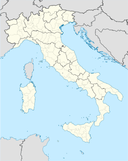
Cospaia — Frazione — Location of Cospaia in Italy Coordinates: 43°33′34″N 12°10′15″E / 43.55944°N 12.17083°ECoordinates: 43°33′34″N 12°10′15″E / 43.55944°N 12.17083°E Country  Italy
ItalyRegion Umbria Province Perugia Comune San Giustino Elevation 357 m (1,171 ft) Time zone CET (UTC+1) - Summer (DST) CEST (UTC+2) Postal code 06016 Dialing code 075 Cospaia Republic
Repubblica di CospaiaMicrostate ← 
1440–1826  →
→
 →
→Flag
Motto
Perpetua et firma libertasCapital Not specified Language(s) Italian Religion Roman Catholic Government Republic Historical era Early Modern - Established 1440 - Partitioned May 25, 1826 Area 3.3 km2 (1 sq mi) Cospaia was a small former republic in Italy. It unexpectedly gained independence in 1440 after Pope Eugene IV, embroiled in a struggle with the Council of Basel, made a sale of territory to the Republic of Florence. By error a small strip of land went unmentioned in the sale treaty, and its inhabitants promptly declared themselves independent. An early centre in Italy for tobacco production, Cospaia eventually deteriorated into a mere smugglers' state, so Tuscany and the Papal States divided the republic between them in 1826.
Today the former republic is a hamlet near the town of San Giustino in the Province of Perugia.
See also
References
- Ascani, Angelo (1963). Cospaia: storia inedita della singolare Repubblica. Tuscany: Città di Castello.
- Natali, Filippo (1892). La stato libero di Cospaia: nell'alta Valle del Tevere (1440-1826). Umbertide: stab. tip. Tiberino.
External links
- Thayer's Gazetteer
- La storia ritrovata: La Repubblica di Cospaia (Italian)
- Cospaia: storia della repubblica più piccola al mondo (Italian)
- Flag of Cospaia Republic
Categories:- Former republics
- Former countries on the Italian Peninsula
- States and territories established in 1440
- States and territories disestablished in 1826
- 1826 disestablishments
- Frazioni of the Province of Perugia
- Tuscany
- Micronations in Italy
- Italian history stubs
- Umbria geography stubs
Wikimedia Foundation. 2010.


