- Ovar Municipality
-
Ovar — Municipality — 
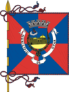
Flag
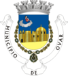
Coat of armsLocation in Portugal Coordinates: 40°52′N 8°38′W / 40.867°N 8.633°WCoordinates: 40°52′N 8°38′W / 40.867°N 8.633°W Country  Portugal
Region Centro Subregion Baixo Vouga District/A.R. Aveiro Government - Mayor Manuel Oliveira (PS) Area - Total 147.4 km2 (56.9 sq mi) Population - Total 56,296 - Density 385/km2 (997.1/sq mi) Parishes (no.) 8 Municipal holiday Saint Christopher
July 25Website http://www.cm-ovar.pt Ovar Municipality (Portuguese pronunciation: [oˈvaɾ] or [ɔˈvaɾ]) is a municipality in Aveiro District, Baixo Vouga Subregion in Portugal. It has a total area of 147.4 km² and a total population of 56,296 inhabitants, and 42,582 electors (2006). The city of Ovar itself has a population of 16,849.[1]
The municipality is composed of 8 parishes and includes two cities:Ovar (approx. 17,000 inhabitants) & Esmoriz (about 12,000 residents).
The present Mayor is Manuel Alves Oliveira, elected by the Socialist Party.
The municipal holiday is July 25.
Contents
Demographics
Population of Ovar Municipality (1801 – 2008) 1801 1849 1900 1930 1960 1981 1991 2001 2008 10 822 10 075 25 605 29 970 35 320 45 378 49 659 55 198 57 983 Cities and towns
There are two cities and three towns in the municipality.
Parishes
- Arada
- Cortegaça
- Esmoriz
- Maceda
- Ovar
- São João
- São Vicente de Pereira
- Válega
References
- ^ UMA POPULAÇÃO QUE SE URBANIZA, Uma avaliação recente - Cidades, 2004 Nuno Pires Soares, Instituto Geográfico Português (Geographic Institute of Portugal)
External links
Ágeda · Albergaria-a-Velha · Anadia · Arouca · Aveiro · Castelo de Paiva · Espinho · Estarreja · Ílhavo · Mealhada · Murtosa · Oliveira de Azeméis · Oliveira do Bairro · Ovar · Santa Maria da Feira · São João da Madeira · Sever do Vouga · Vagos · Vale de Cambra Categories:
- Cities in Portugal
- Municipalities of Portugal
- Ovar
Wikimedia Foundation. 2010.

