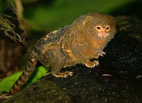
- Otishi National Park
-
Otishi National Park IUCN Category II (National Park)
Pygmy MarmosetLocation  Peru
Peru
Junín Region (84,5%), Junín Province and Satipo Province, Río Tambo District;
Cusco Region (15,5%), La Convención Province, Echarate DistrictArea 305,973.05 ha Established January 1, 2003 (D.S. Nº 003-2003-AG)) The Otishi National Park (Spanish: Parque Nacional Otishi) is a protected area in Peru located in the Junín Region (84,5%), Junín Province and Satipo Province, Río Tambo District and in the Cusco Region (15,5%), La Convención Province, Echarate District. It protects Southwest Amazon moist forests at lower elevations and Peruvian Yungas at higher elevations.[1]
References
- ^ Olson, D. M, E. Dinerstein, et al (2001). "Terrestrial Ecoregions of the World: A New Map of Life on Earth". BioScience 51 (11): 933–938. doi:10.1641/0006-3568(2001)051[0933:TEOTWA]2.0.CO;2. http://gis.wwfus.org/wildfinder/.
See also
External links
- Otishi National Park (Spanish)
Protected areas of Peru National Parks Alto Purús · Bahuaja-Sonene · Cerros de Amotape · Cordillera Azul · Cutervo · Huascaran · Ichigkat muja - Cordillera del Condor · Manú · Otishi · Abiseo River · Tingo María · Yanachaga-ChemillénNational Sanctuaries Historical Sanctuaries National Reserves Allpahuayo-Mishana · Calipuy · Junin · Lachay · Pacaya-Samiria · Pampa Galeras – Barbara D’Achille · Paracas · Salinas and Aguada Blanca · Tambopata · Titicaca · TumbesWildlife Refuge Landscape Reserves Communal Reserves National Forests Protection Forests Alto Mayo · Adjacent to the Nuevo Imperial Canal Intake · Pagaibamba · Pui–Pui · Puquio Santa Rosa · San Matías–San CarlosHunting enclosed lands Reserved Zones Algarrobal El Moro · Aymara Lupaca · Batán Grande · Chancaybaños · Cordillera de Colán · Cordillera Huayhuash · Güeppí · Pampa Hermosa · Pucacuro · Santiago-Comaina · Tambopata–Candamo · Tumbes
This article related to a protected area in South America is a stub. You can help Wikipedia by expanding it.
