Ostrander Lake (Michigan)

Ostrander Lake (Michigan)
Ostrander Lake
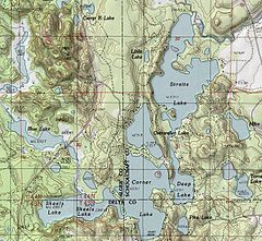
A topographic map of the Corner-Straits Chain area showing Ostrander Lake
Location Alger, Schoolcraft, and Delta counties
Coordinates 46°10′00″N 86°36′46″W / 46.1666667°N 86.61278°W / 46.1666667; -86.61278Coordinates: 46°10′00″N 86°36′46″W / 46.1666667°N 86.61278°W / 46.1666667; -86.61278
Basin countries United States
Surface area 54.2 acres (21.9 ha)[1]
Shore length1 about 1.4 miles (2.3 km)[1]
Surface elevation 761 ft (232 m)
1 Shore length is not a well-defined measure.
Ostrander Lake is located in Michigan
{{{alt}}}
Ostrander Lake

Ostrander Lake is a 54.2-acre (21.9 ha) lake that is located near the tri-county corner of Delta County, Michigan, Alger and Schoolcraft countries in the Hiawatha National Forest.[1] The chain consists of Skeels Lake, Corner Lake, Deep Lake, and Straits Lake. Other nearby lakes include Hugaboom Lake, Blue Lake, Ironjaw Lake, the Corner-Straits Chain of lakes, Toms Lake and Round Lake.

References

  1. ^ a b c "OSTRANDER_LAKE_LYMAN_LAKE.PDF". U.S.D.A. Forest Service and the Michigan DNR. http://www.dnr.state.mi.us/SPATIALDATALIBRARY/PDF_MAPS/INLAND_LAKE_MAPS/SCHOOLCRAFT/OSTRANDER_LAKE_LYMAN_LAKE.PDF. Retrieved 2008-12-07. 

Wikimedia Foundation. 2010.

Игры ⚽ Поможем сделать НИР

Look at other dictionaries:

  • Ostrander Lake — For the Lake in Michigan s Upper Peninsula see: Ostrander Lake (Michigan) Ostrander Lake August 2005 Location Yosemite National Park, Mariposa County, Califor …   Wikipedia

  • Ostrander — may refer to: People John Ostrander Places United States Ostrander, California Ostrander, Minnesota Ostrander, Ohio Ostrander, Wisconsin, an unincorporated community Ostrander Lake, in Yellowstone National Park Ostrander Lake (Michigan) …   Wikipedia

  • Arenac County, Michigan — Infobox U.S. County county = Arenac County state = Michigan map size = 200 founded = 1883 seat = Standish | area total sq mi =681 area water sq mi =314 area percentage = 46.12% census yr = 2000 pop = 17269 density km2 =18 web =… …   Wikipedia

  • Corner-Straits Chain of lakes — Corner Straight chain of lakes A topographic map of the Corner Straits chain area Location Alger, Schoolcraft, and Delta counties …   Wikipedia

  • Curry Village, California — Not to be confused with Camp Currie. Curry Village   Unincorporated community   Curry Village, Yosemite National Park …   Wikipedia

  • Mariposa Grove — is at the southern entrance to Yosemite G …   Wikipedia

  • Chris Jorgenson Studio — Jorgenson, Chris, Studio U.S. National Register of Historic Places …   Wikipedia

  • Crane Flat Fire Lookout — U.S. National Register of Historic Places …   Wikipedia

  • McCauley and Meyer Barns — U.S. National Register of Historic Places …   Wikipedia

  • McGurk Cabin — U.S. National Register of Historic Places …   Wikipedia

Share the article and excerpts

Direct link
Do a right-click on the link above
and select “Copy Link”