- Osmanabad Airport
-
Osmanabad Airport
ओस्मानाबाद विमानतळIATA: OMN – ICAO: none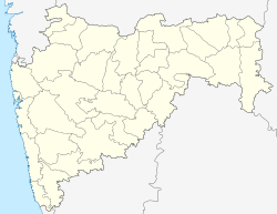
 Osmanabad Airport ओस्मानाबाद विमानतळOsmanabad Airport ओस्मानाबाद विमानतळ (Maharashtra)
Summary Airport type Public Owner Maharashtra Industrial Development Corporation Operator Osmanbad Airport Pvt. Ltd Serves Osmanabad Location Osmanabad, Maharashtra Elevation AMSL 2,260 ft / 689 m Coordinates 18°16′43″N 076°03′12″E / 18.27861°N 76.05333°E Runways Direction Length Surface ft m 04/22 3,966 1,200 Asphalt Osmanabad Airport (IATA: OMN) is a public airport located off NH 211, 10 Kilometres north of the town of Osmanabad, in the Marathwada region of Maharashtra, India
The airfield was built in 1972 but currently does not see any air traffic apart from visits from the odd state government aircraft.
Structure
Osmanabad airport has one runway oriented 04/22, 1,200 metres in length with a 10 metre wide parallel taxiway running along its entire length on the north side. It has an apron measuring 60 metres by 80 metres connected to the South-west end of the Runway by means of a taxi-way. MIDC is currently constructing a Terminal building next to the apron at a cost of Rs. 89 Lacs.[1]
Future Plans
Reliance Airport Developers, who won a bid in 2009 to run five airports,[2] [3] Osmanabad, Nanded, Baramati, Yavatmal and Latur on a 95-year lease, plans to use this airport for Aviation Training.[1]
References
- ^ a b "Aviation Academy proposed at Osmanabad Airport". National Web Network India. 08 Jan 2011. http://osmanabad.nwn.in/2011/01/08/aviation-academy-praposed-at-osmanabad-airport/. Retrieved 20 September 2011.
- ^ "Reliance Airport gets five projects on lease". Times of India. 06 Aug 2009. http://articles.timesofindia.indiatimes.com/2009-08-06/india-business/28178331_1_greenfield-airport-reliance-airport-developers-midc. Retrieved 19 September 2011.
- ^ "MIDC-run airports set for makeover". Indian Express. 1 July 2008. http://www.expressindia.com/latest-news/midcrun-airports-set-for-makeover/329583/. Retrieved 19 September 2011.
Categories:- Airports in Maharashtra
- Osmanabad district

Wikimedia Foundation. 2010.