- Oppdal Airport, Fagerhaug
-
Oppdal Airport, Fagerhaug
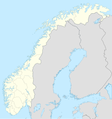
Oppdal flyplass, FagerhaugIATA: none – ICAO: ENOP Location of airport in Norway Summary Airport type Public Serves Oppdal, Norway Location Fagerhaug Elevation AMSL 1,830 ft / 558 m Coordinates 62°38′59″N 009°50′48″E / 62.64972°N 9.84667°E Runways Direction Length Surface m ft 07/25 936 3,071 Asphalt Source: DAFIF[1] Fagerhaug Airport (Norwegian: Oppdal flyplass, Fagerhaug) (ICAO: ENOP) is an airport serving Oppdal, in Sør-Trøndelag county, Norway. It is located at Fagerhaug, about 10 kilometres (6.2 mi) northeast of the municipal center of Oppdal, along the European route E6 highway.
Facilities
The airport resides at an elevation of 1,830 feet (558 m) above mean sea level. It has one runway designated 07/25 with an asphalt surface measuring 936 by 18 metres (3,071 × 59 ft).[1]
The runway is planned to be lengthend by 400 metres (1,300 ft).[2]
References
- ^ a b "Airport information for ENOP". DAFIF. http://www.worldaerodata.com/wad.cgi?airport=ENOP. Retrieved 2011-02-07.
- ^ Bygg.no
External links
- Oppdal, Fagerhaug at norskeflyplasser.no (Norwegian)
- Midt-Norsk Fly-og Luftsportsenter AS (Norwegian)
- Røkke bygger flyplass på Oppdal (Norwegian)
Categories:- Airports in Sør-Trøndelag
- Oppdal
Wikimedia Foundation. 2010.

