- OpenSeaMap
-
OpenSeaMap 
URL openseamap.org Slogan The Free Nautical Chart Commercial? No Registration only required for contributors Available language(s) English, German, French, Italian, Spanish, Russian Owner Community Created by members of the OpenSeaMap and OpenStreetMap community Launched 2009 OpenSeaMap is a software project collecting freely usable nautical information and geospatial data to create a worldwide nautical chart. This chart is available on the OpenSeaMap website, and can also be downloaded for use as an electronic chart for offline applications.
The project is part of OpenStreetMap. OpenSeaMap uses the same database, and complements the spatial data with nautical information. Such data may be used in accordance with Creative Commons Attribution-ShareAlike 2.0 license. This ensures integration into printed materials, websites and applications is possible, without being limited by restrictive licenses, or having to pay fees. The naming of OpenSeaMap as a data source is required for data sharing.
Contents
History
The idea for the project was born at an OpenStreetMap developer conference in autumn 2008 at the Linux Hotel in Essen, Germany. A group of boaters and programmers decided to extend the coverage of OpenStreetMap to the seas and fresh water bodies. From the start the project has been worldwide and multilingual. By the end of 2009, the design and architecture of the project had been created, and a sample harbor "Warnemünde" was created to serve as an example chart. Since autumn 2009, a dedicated server has been available and the project is engaged in several collaborations with other free projects and organizations. In January 2010 OpenSeaMap was given a stand at boot Düsseldorf, Europe's largest boat show, allowing volunteers to present the project to a large audience of specialists for the first time.
Contents of the chart
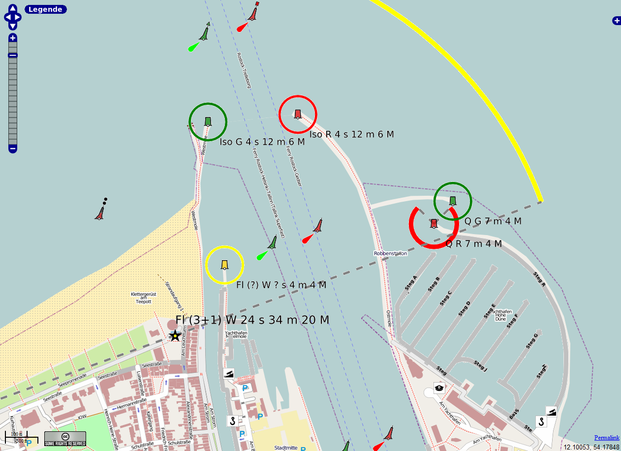
Charts will show lighthouses, lateral buoy, cardinal marks and other navigational aids. In the ports, facilities will be mapped (port wall, pier, walkways, docks, fueling stations, loading cranes, access roads, railway lines, ferry lines). Similarly, public authorities, shipbuilders and repairers, as well as sanitation and utility facilities will be displayed. The navigational attributes correspond to the international standard IHO S-57.
Water depths are not yet covered, because the database is not designed for three-dimensional coordinates. However, the plan is to eventually integrate a bathymetric model to describe the seabed.
The data are presented in multiple levels with OpenLayers on the base map of OpenStreetMap. The base map contains all the possible objects from OpenStreetmap.[1] OpenSeaMap includes additional layers such as aids to navigation, ports and temporary racing events.
Applications
The chart is for planning sailing and boat trips. It will also be useful as a guide for tourists. It is not intended to replace official charts.
- Online Map
- The map is available to any computer with an internet connection from the website OpenSeaMap.org. This map is updated daily.
- Offline Map
- The map can also be loaded on local data storage and can be used on any PC without internet access. This map will also permit use on other devices, such as GPS devices from Garmin and Lowrance, phones, and PDAs. The off-map is regularly updated, usually every week.
- Navigation
- With certain navigation programs, it is possible to display the current position directly on the chart via a connected GPS device, tracking a vessel's movement. An NMEA interface can run an autopilot and thus control the ship. Also, the display of AIS signals on the chart is possible. Appropriate navigation tools from the open source area are SeaClear and OpenCPN.
Internationalization
The site is translated into six languages: English, German, French, Italian, Spanish and Russian. The tools and the legends are available with a German, English and French interface. On the map the place names are always written in local language and script. The geographical coverage is worldwide. Depending on the region and the active cartographers, the coverage varies but is growing daily.
Timeliness
Data is stored in the database as soon as it has been entered, and is immediately available worldwide. Base map data is visible on the map after a few minutes. Navigational data is currently (2010) visible on the chart about two days after it has been entered.
Editing Tools
 Online Editor
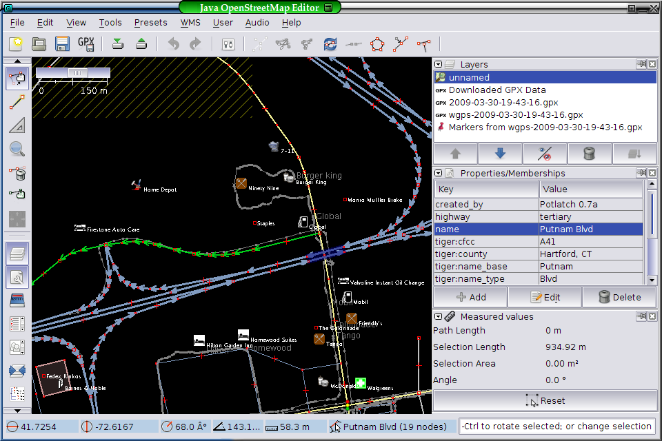
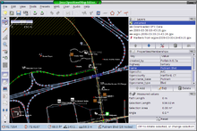 JOSM Editor
There are two programs available for editing data:
- OpenSeaMap online editor for beacon
- The online editor [2] was designed specifically for OpenSeaMap. It provides the user with a GUI for entering data without having to be familiar with the underlying schema. It runs on any standard web browser.
- Offline Editor JOSM with navigational enhancements
- JOSM is the default editor for OpenStreetMap. It has been extended for use on navigational charts with a plugin. It is written in Java and runs on multiple desktop platforms [3]
To edit you must register with a verified email address. Registration is free and will encourage high data quality. Read access does not require registration.
Other programs can access the XML-RPC interface to the data on the server in order to read and write OpenSeaMap data.
Harbor Pilots
On the map are the world port, marina and anchorage. Via a pop-up window these are linked with a port guide containing detailed port information. This guide is organized as a Wiki and is shaped by the users. Included is the free wikiproject "SkipperGuide" [4]. 5000 ports are accessible worldwide, including detailed descriptions of 600 marinas.
Weather information
 Air pressure
In worldwide weather charts there are shown weather data like wind speed, air pressure (isobars), etc, each actualised two to three times per day, and with weather forecast up to three days.
For each harbour there is a Meteogram with detailed wind forecasts and weather informations for eight days. Available weather data for wind direction, wind speed, air temperature, air pressure, relative humidity, cloudiness, precipitation. From this worldwide available data the captains can predict the marine weather.
Batymetric data
 Batymetric data
Worldwide the depth between 100 and 10'000 m are showed in a 23 steps blue colour scale together with deep shading. In higher zoom levels there are also shown deep lines. The data is given by a cooperation with GEBCO and its bathymetric GEBCO_08-database.
Another project cooperating with OpenSeaMap that uses crowdsourcing to generate marine data is TeamSurv [1]. TeamSurv concentrates on bathymetric charts. Its members record both position data from the GPS, and depth information from their depth sounder, and once uploaded to the server the depth data is corrected for tides and other factors to reduce it to chart datum.
Wikipedia articles on the map
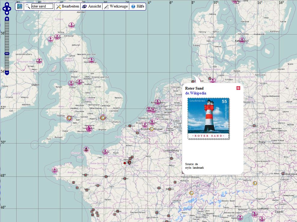
 OpenSeaMap and Wikipedia
By "View Wikipedia-Links" OpenSeaMap displays all georeferenced Wikipedia articles worldwide as Icon. Until now 1.7 Mio. georeferenced articles are shown, in 41 languages, 260’000 in German and 740’000 in English (9.2011). By mouseover a popup is opened with title of the article and an informative picture. By click you will get the responding Wikipedia-article.
References
- ^ map elements "Map Features "
- ^ OpenSeaMap Online Editor for beacon
- ^ JOSM Editor
- ^ port manual "SkipperGuide"
External links
Categories:- Collaborative mapping
- Creative Commons-licensed works
- Open content projects
- OpenStreetMap maps
- Internet properties established in 2009
- Web mapping
- Web Map Services
- Wiki communities
- Maps
- 2009 establishments
- Free websites
- Geographic information systems
- Crowdsourcing
- Navigation


Wikimedia Foundation. 2010.